Pakistan Map
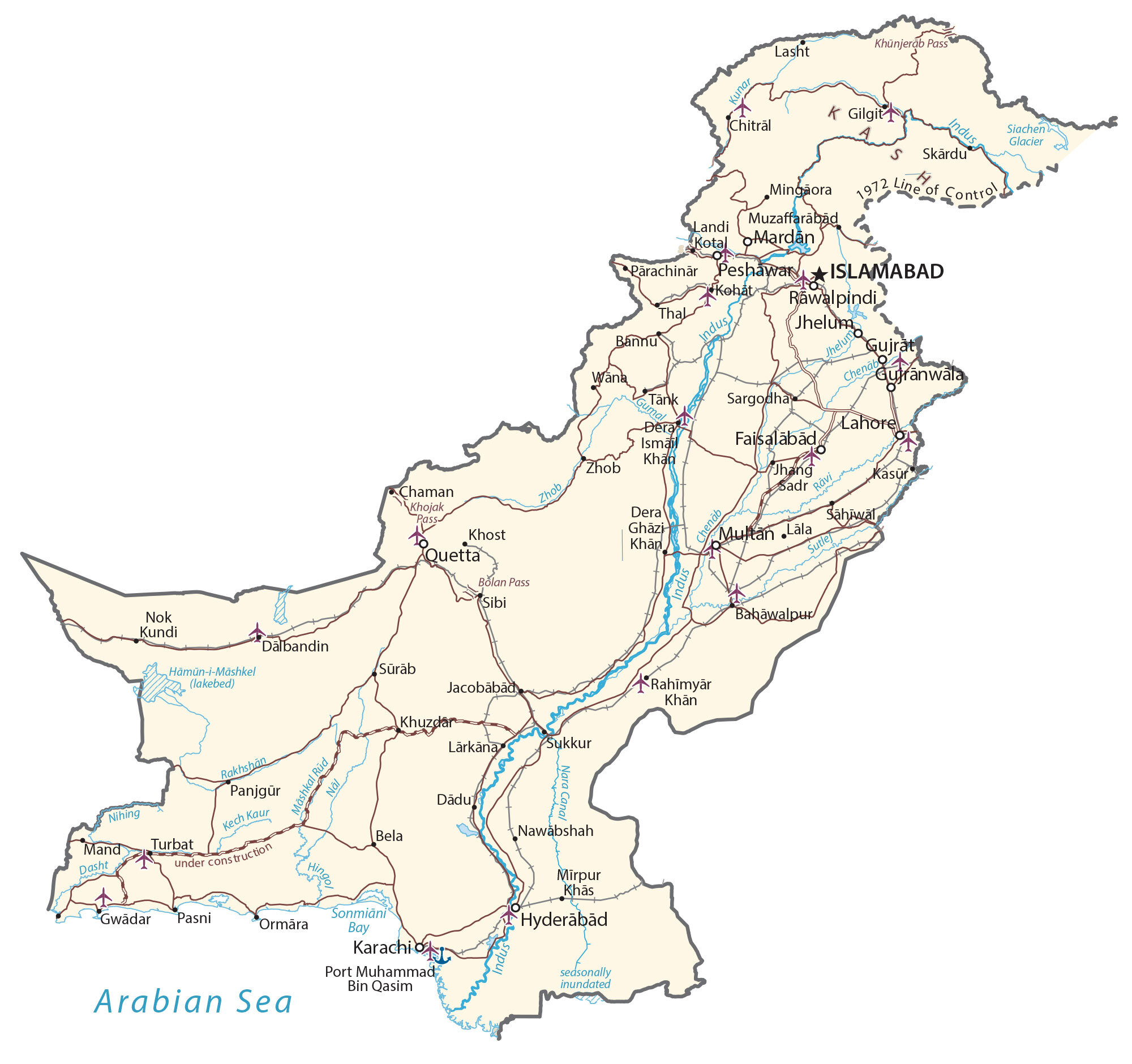
This Pakistan map displays major cities, towns, roads, rivers, and provinces. Satellite imagery and an elevation map show everything from the Himalayas to the Indus River plain.

You are free to use our Pakistan map for educational and commercial uses. Attribution is required. How to attribute?
About the map
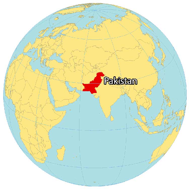
Pakistan is located in Southern Asia, along the Arabian Sea. It borders the Middle Eastern countries of Iran to the west and Afghanistan to the northwest. Additionally, it’s next to India to the east and China to the northeast, which are both a part of Asia.
Pakistan is the fifth most populous country. Also, it’s known for K2, which is the second-highest mountain in the world. Islamabad is the capital of Pakistan. But Karachi is the largest city.
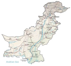
SATELLITE IMAGERY
Pakistan Satellite Map
The geography of Pakistan is diverse, with a range of different landscapes and features. The landscape of Pakistan includes the Indus River plain in the east, the Punjab plain in the southeast, the Sindh desert in the south, the Balochistan plateau in the southwest, and the Hindu Kush and Pamir mountain ranges in the north and northwest.

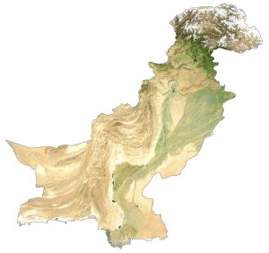
PHYSICAL MAP
Pakistan Physical Map
Pakistan has three major regions – the Northern Highlands, the Indus River Plain, and the Balochistan Plateau. First, the northern highlands contain the Himalayas along its border with China.
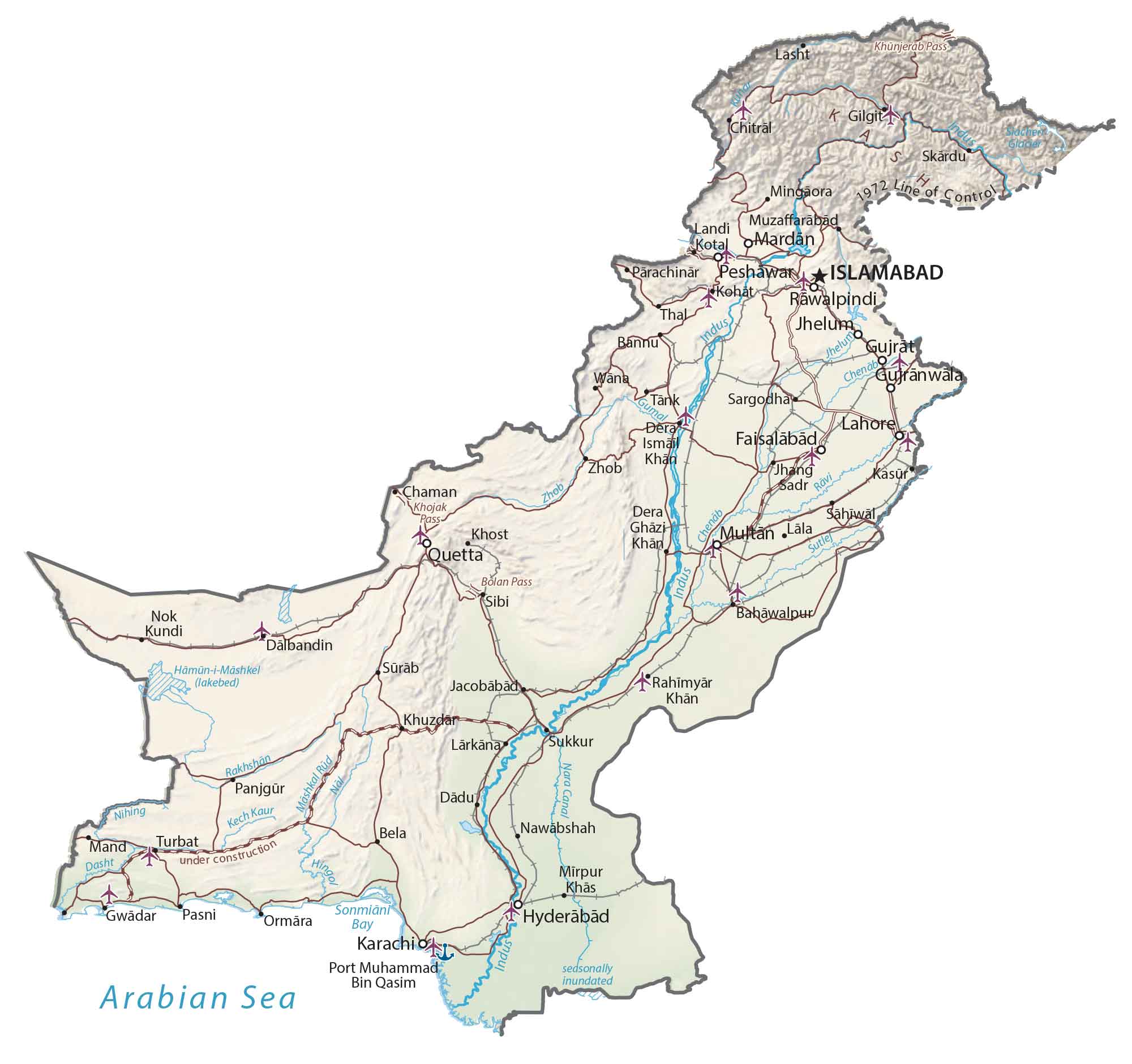
At 8,610 m (28,250 ft), K2 is Pakistan’s highest mountain and the world’s second-largest mountain. The interior of Pakistan is characterized by the low-lying relief of the Punjab Plain and Indus Valley. Finally, both the Sulaiman Range and Balochistan Plateau lie in the southwestern region of Pakistan.
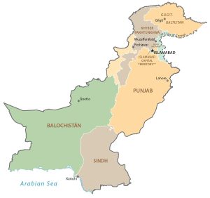
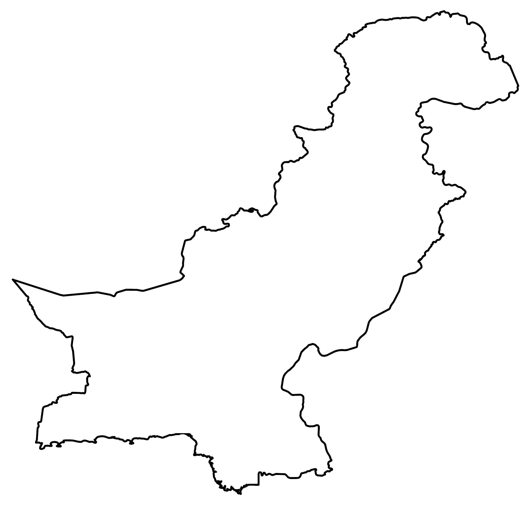
POLITICAL MAP
Pakistan Provincial Map
Provinces are the first-level administrative unit in Pakistan that are divided geographically and administratively. Currently, there are 4 four provinces and one federal territory. The provinces of Pakistan include Balochistan, Punjab, Sindh, and Khyber Pakhtunkhwa. Whereas the federally administered unit is the Islamabad Capital Territory.

Capital City
Islamabad
Major cities
Faisalabad
Hyderābād
Karachi
Lahore
Multan
Quetta
Rawalpindi
Sukkur
Cities, towns and villages
Bahawalpur
Bannu
Bela
Chaman
Chitral
Dadu
Dalbandin
Dera Ghāzi Khan
Gwadar
Jacobābād
Jhang
Khost
Khuzdar
Kohat
Lala
Landi
Lasht
Lārkāna
Mand
Mardan
Mingaora
Mirpur Khās
Muzaffarābād
Nawabshah
Ormāra
Panjgur
Parachinar
Pasni
Peshawar
Sadiqabad
Sargodha
Sibi
Skārdu
Sonmiani Bay
Sūrāb
Tank
Thal
Turbat
Lakes, seas and water features
Arabian Sea
Chenab River
Dasht River
Gumal River
Hingal River
Indus River
Jhelum River
Kech Kaur River
Kunar River
Nara Canal
Nihing River
Rakhshan River
Rāvi River
Samiani Bay
Siachen Glacier
Sutlej River
Zhob River