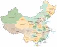
China Map – Cities and Roads
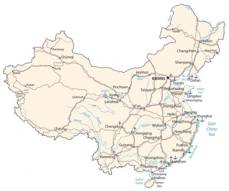
This map of China contains major cities, towns, roads, and rivers. From the Gobi Desert to Mount Everest, this China map collection includes a physical map, satellite imagery, and a provincial map of China.
China map collection
You are free to use our China map for educational and commercial uses. Attribution is required. How to attribute?
About the map
China (People’s Republic of China) is the third-largest landmass among countries, behind Russia and Canada. It’s slightly larger than the United States, which is the fourth largest country in the world.
It’s a rapidly growing economy and is the most populous in the world with over 1.4 billion people. The capital city is Beijing but its largest city is Shanghai on the coast of the East China Sea
It borders Mongolia, Burma (Myanmar), Russia, Kazakhstan, Pakistan, India, Bhutan, Laos, Vietnam, North Korea, Nepal, Afghanistan, Tajikistan, and Kyrgyzstan. Also, China’s coastlines add up to 14,500 km (9,010 mi) along the Yellow Sea, East China Sea, and the South China Sea.
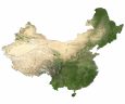
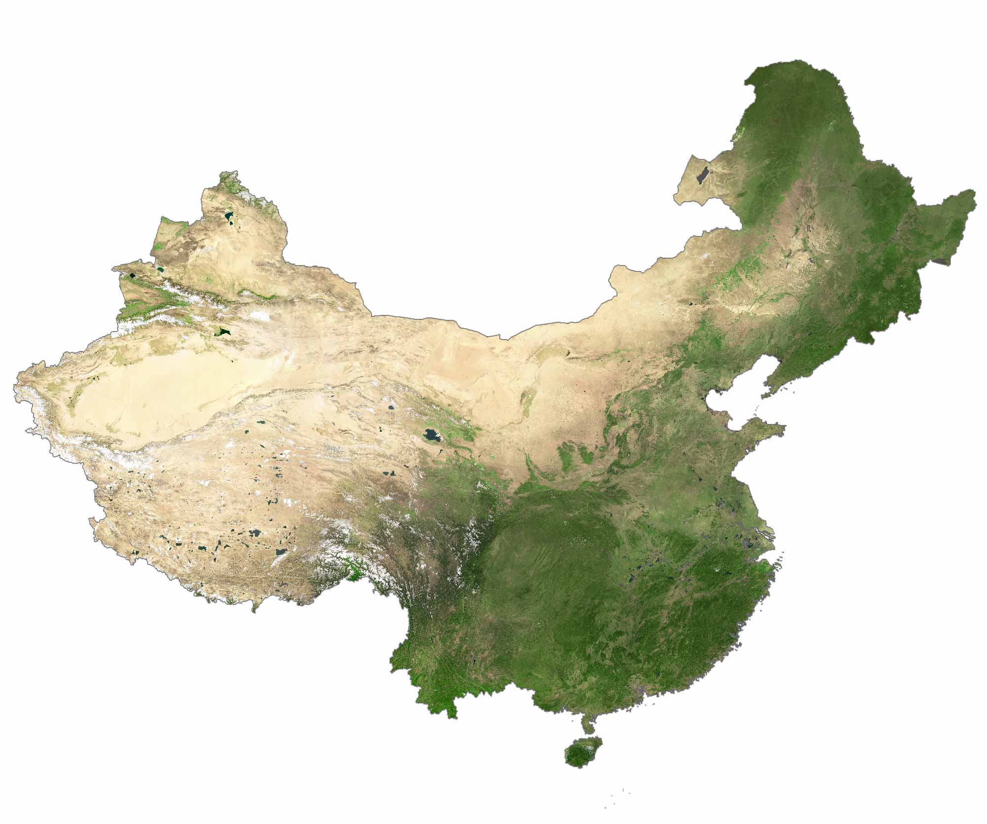
SATELLITE IMAGERY
China Satellite Map
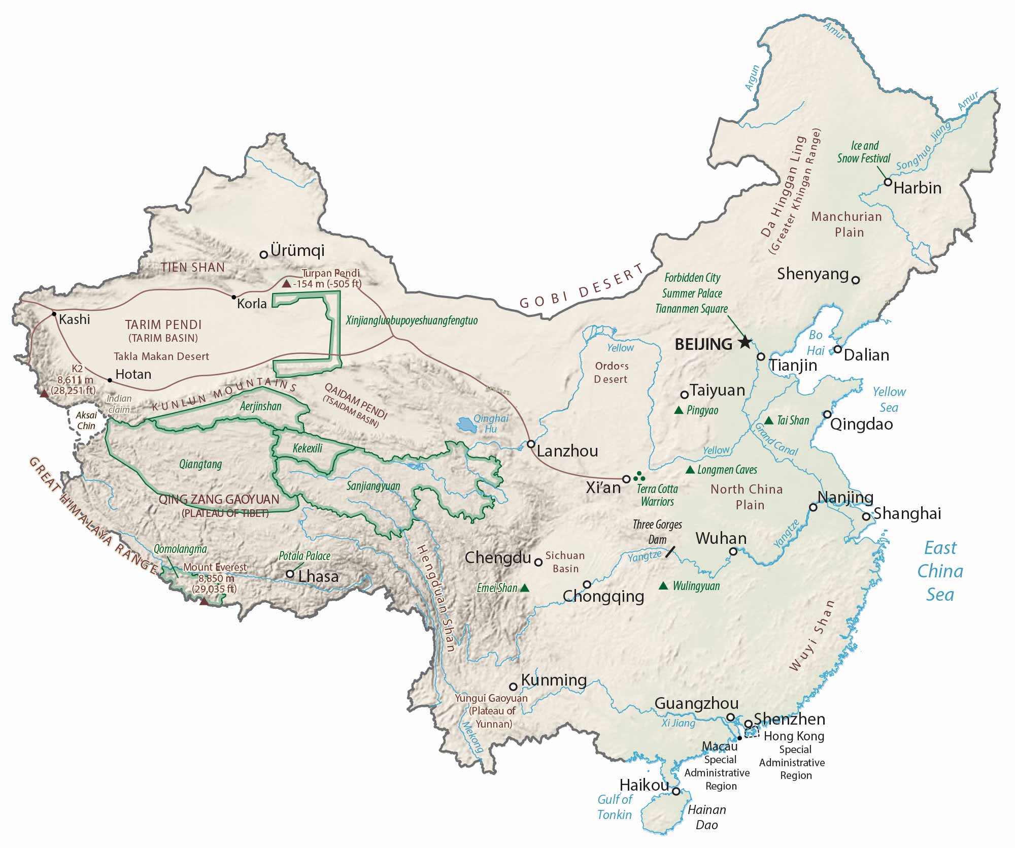
China occupies an area of 9,596,961 square kilometers (3,705,407 sq mi), which makes it smaller than Canada but larger than the United States. Its landscape is diverse with influence from the Himalayas to the southwest and its coastal climate next to the East China Sea.
The north is arid with the Gobi and Taklamakan Deserts. Whereas the south is characterized by wetter conditions and subtropical forests. Forests cover over 20% of China but agricultural land usage is at about 56%.
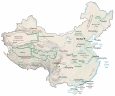
PHYSICAL MAP
China Physical Map
The terrain in China is mostly mountains, high plateaus, and hills. It also consists of deserts in the west, with plains in the eastern part of the country. The highest point in China is Mount Everest, which is also shared with Nepal.
This is the highest mountain peak above sea level in the world at 8,848 meters (29,029 ft) in height. Some of its major mountain chains include Wuyi, Tien, Hengduan, and the Greater Khingan Range.
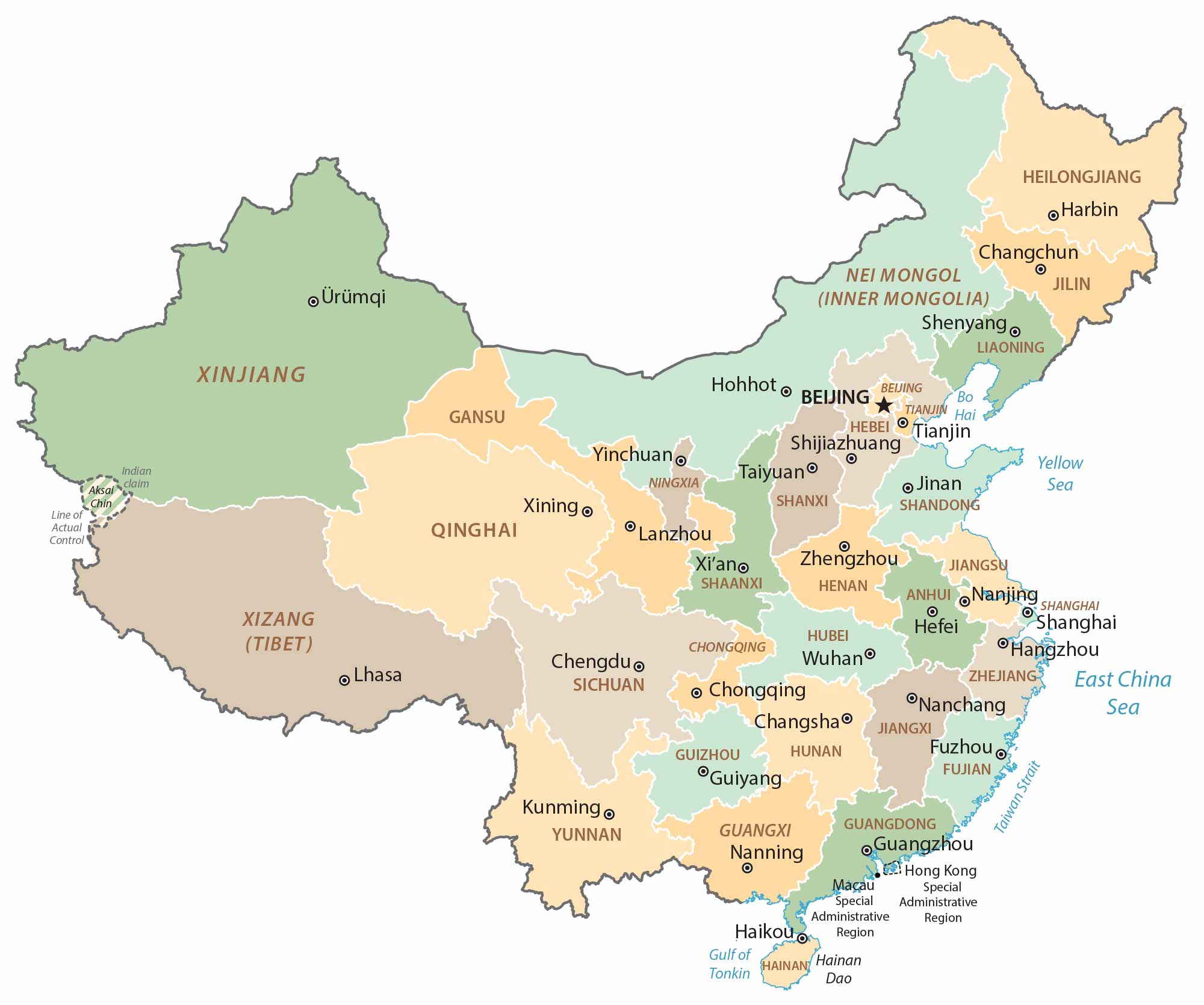
Capital City
Beijing
Major cities
Changchun
Chengdu
Chongqing
Dalian
Fuzhou
Guangzhou
Guiyang
Hangzhou
Harbin
Hefei
Jinan
Kunming
Lanzhou
Nanjing
Nanning
Qingdao
Shanghai
Shenzhen
Shenyang
Shijiazhuang
Taiyuan
Tianjin
Wuhan
Xi’an
Xiamen
Xining
Yinchuan
Zhengzhou
Cities and towns
Hailar
Hotan
Hunchun
Kashi
Korla
Lhasa
Haikou
Golmud
Hohhot
Rivers, seas and water
Gulf of Tonkin
Bohai Sea
Mekong River
Salween River
Argun River
Songhua River
Taiwan Strait
Yellow Sea
Yangtze River
Xi Jiang River
East China Sea
Geographic features
Great Himalaya Range
Manchurian Plain
Greater Khingan Range
Ordos Desert
Hainan Dao Island
Takla Makan Desert
North China Plain
Wuyi Shan Mountain Range
Gobi Desert
Yunnan–Guizhou Plateau
Tian Shan Mountain
Attractions
Forbidden City
Tiananmen Square
Longmen Caves
Ping Yao
Wulingyuan
Potala Palace