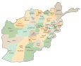
Afghanistan Map – Cities and Roads
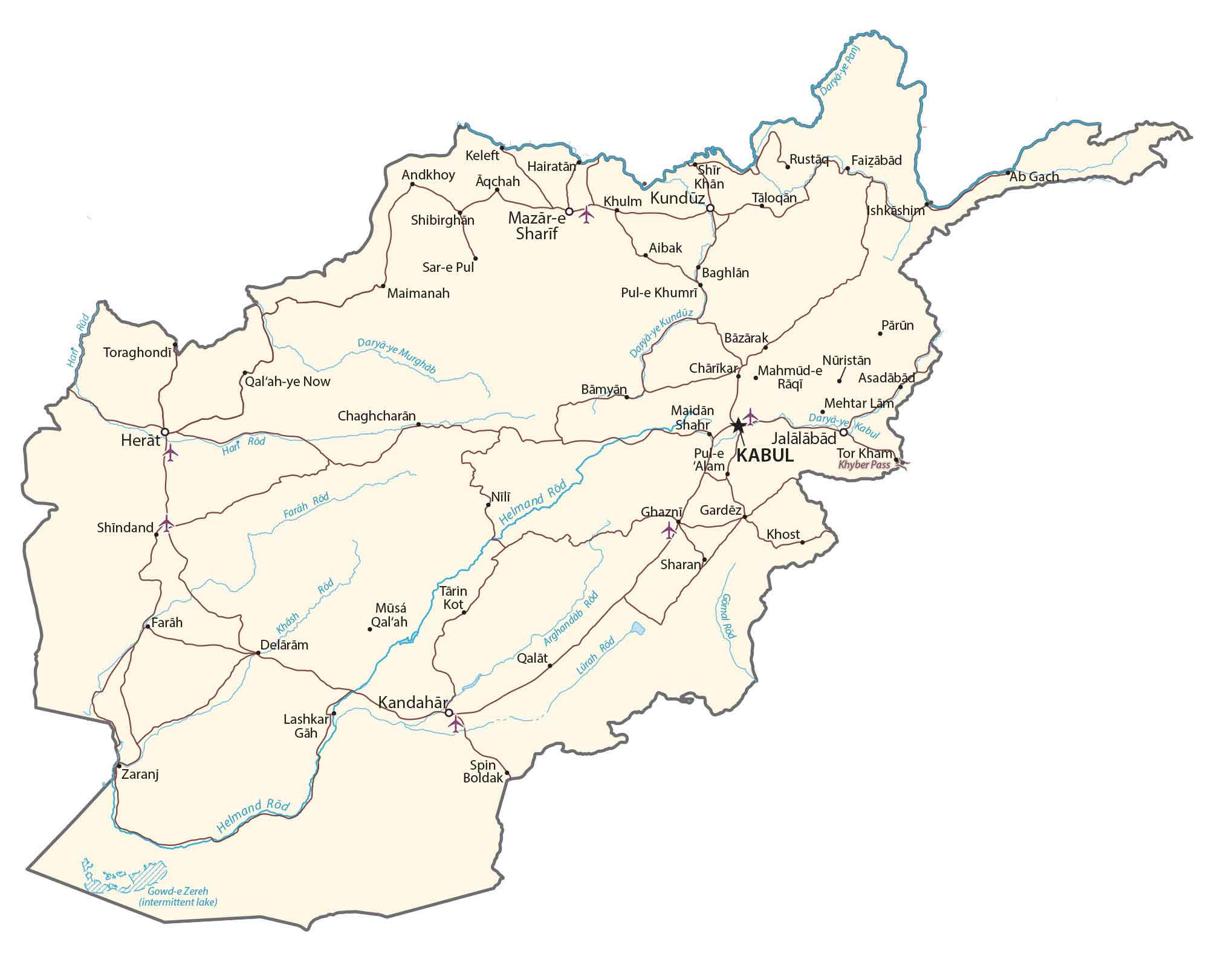
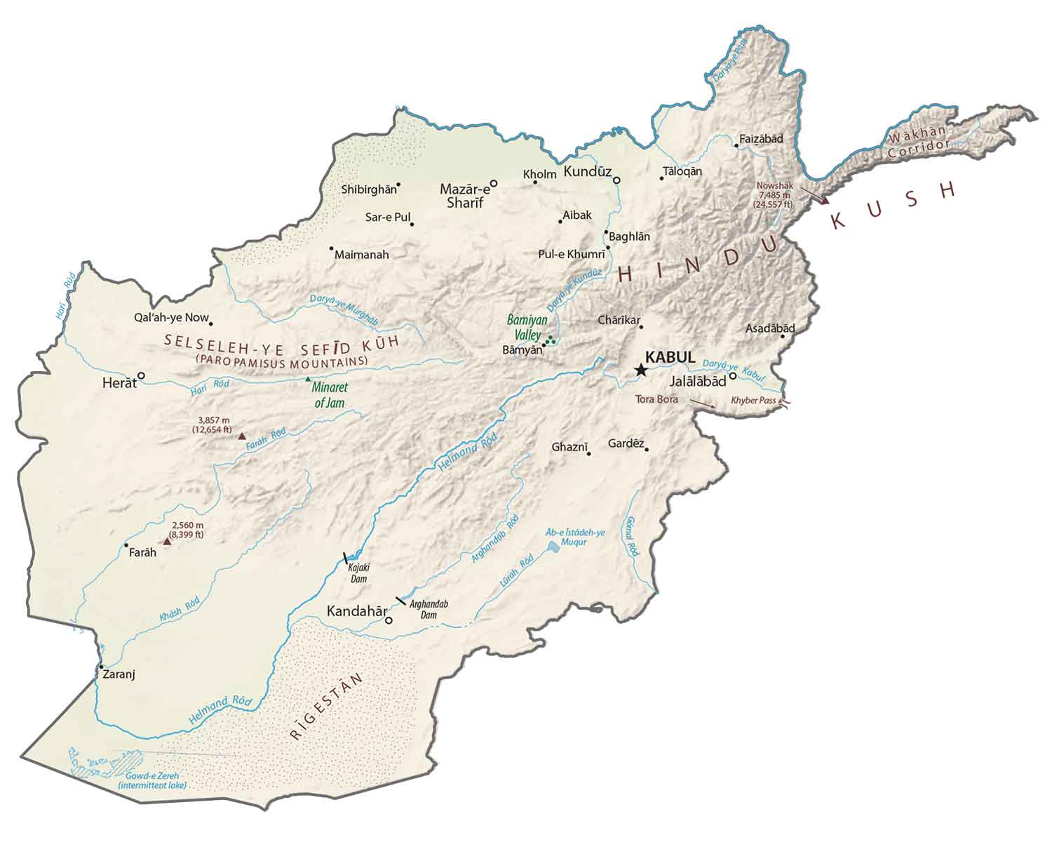
This Afghanistan map displays major cities, towns, roads, and rivers with key features such as the capital city of Kabul and the 800-km stretch Hindu Kush mountain range.
Afghanistan map collection
You are free to use our Afghanistan map for educational and commercial uses. Attribution is required. How to attribute?
About the map
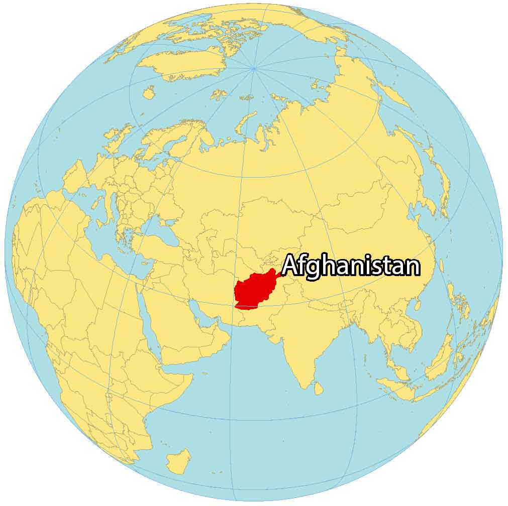
Afghanistan is located in Central Asia and is often recognized as the “Crossroads to Asia”. It’s surrounded by six other countries.
Specifically, it borders Pakistan to the south and Iran to the west. Then, Turkmenistan, Uzbekistan, and Tajikistan are to the north. Finally, China is to the northeast of Afghanistan.
Afghanistan occupies an area of 652,864 square kilometers (252,072 sq mi), which is similar in area to France or the state of Texas. Kabul is the capital city of Afghanistan and is one of the 100 most populous cities in the world.
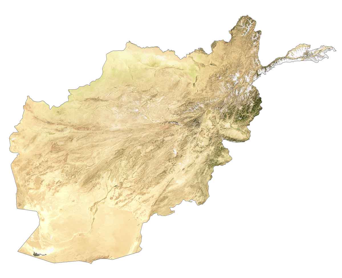
SATELLITE IMAGERY
Afghanistan Satellite Map
The majority of Afghanistan’s terrain is rugged and mountainous. Between the mountains are the valleys where many Afghan people live and produce crops. Despite its vast amount of deserts and dry regions, Afghanistan has various rivers flowing within the country.
For instance, its longest rivers are Helmand, Kabul, and Farah. According to the FAO, forests cover just 2.1% of Afghanistan. Whereas deserts like the Registan Desert cover most of the south.
PHYSICAL MAP
Afghanistan Physical Map
Afghanistan is completely landlocked with various physical geographic regions. But the majority of Afghanistan is mountainous.
For example, the Hindu Kush Mountains dominate the north and central regions. Within the Hindu Kush Range, Noshaq is Afghanistan’s highest peak at 7,492 m (24,580 ft). Further to the northwest, the Paropamisus Mountains stretch westward toward Iran.
Otherwise, the Bamiyan Valley is enclosed between the Hindu Kush Mountain Range. Finally, the Registan Desert is an extremely arid plateau in the south.
POLITICAL MAP
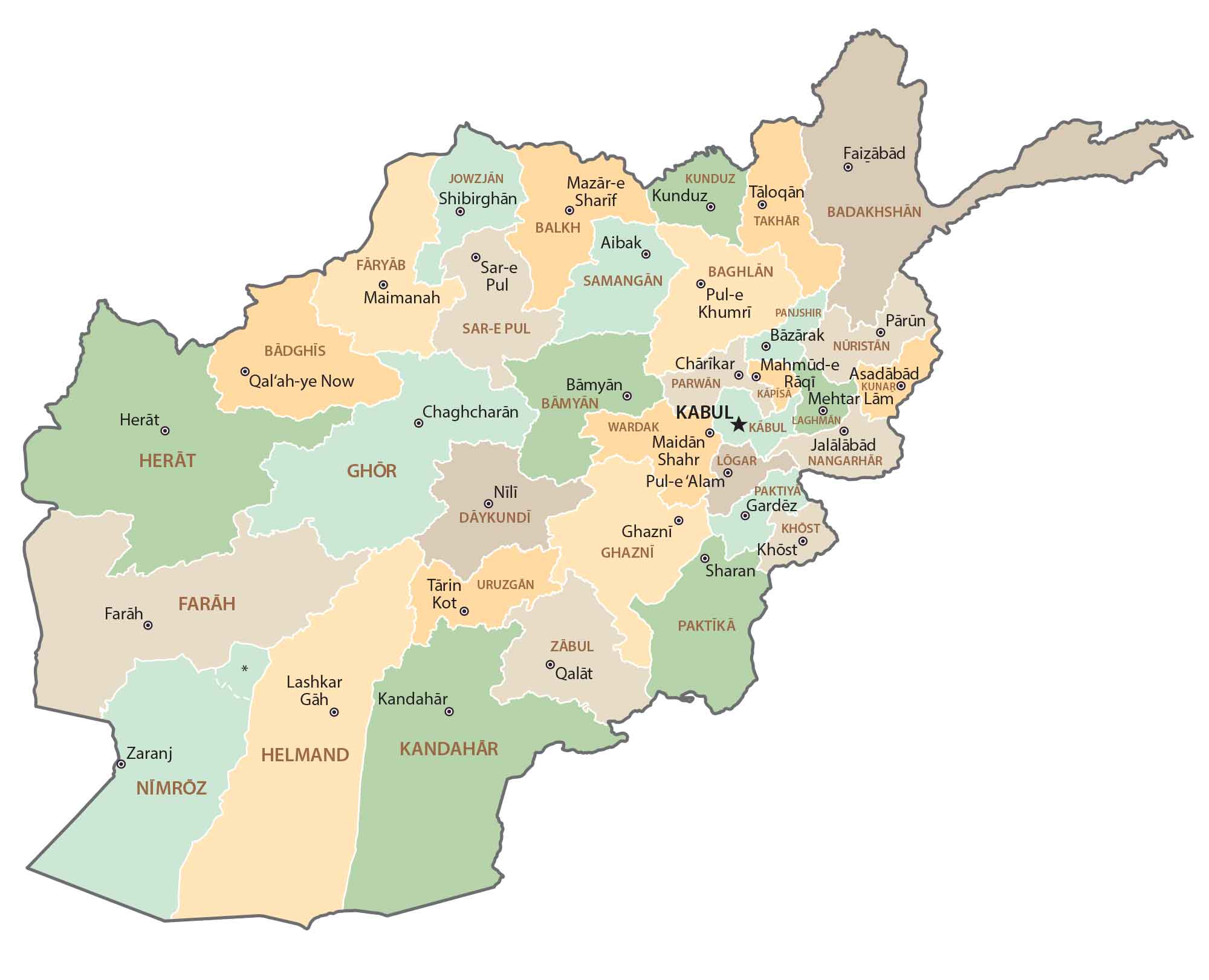
Afghanistan Provincial Map
There are 34 provinces in Afghanistan, which are the first-level administrative unit level of the country. Each province appoints its own governor. Typically, a province contains over 1000 villages or a number of districts. The capital city of Kabul is also a province.
Capital City
Kabul
Major cities and towns
Mazar-e Sharif
Kandahar
Herat
Jalalabad
Kunduz
Lashkar Gah
Taloqan
Pul-e Khumri
Khost
Ghazni
Farah
Nangarhar
Cities and towns
Baghlan
Gardez
Chaghcharan
Sar-e Pul
Charikar
Sheberghan
Puli Khumri
Shindand
Khulm
Maimanah
Qal’ah-ye Now
Shibirghan
Aibak
Asadabad
Maidan Shahr
Zaranj
Ishkashim
Lakes, rivers and creeks
Panj River
Murghab River
Helmand River
Gowd-e Zereh Intermittent Lake
Khash River
Kundu River
Kabul River
Arghandab River
Lurah River
Gomal River
Abe Istada Lake
Physical Geography
Paropamisus Mountains
Hindu Kush
Wakhan Corridor
Rigestan
Minaret of Jam
Bamiyan Valley
Kajaki Dam
Arghandab Dam
Nowshak
Important Sites
Tora Bora
Khyber Pass