Understanding Sonar Technology
Diving deep into sonar technology
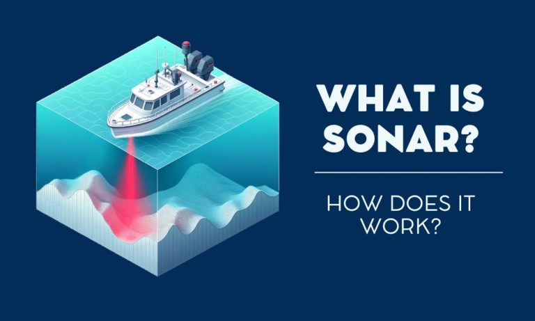
What if we could use sound to explore underwater? Sonar does just that. In simple terms, sonar turns sound waves into a map of the ocean floor. Let’s explore how sonar works and some of its use cases.
How sonar works
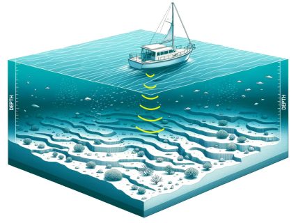
Sonar is an acronym for “Sound Navigation and Ranging“. This technology uses sound waves to explore and map the underwater environment. We call this echo sounding.
First, it starts by emitting sound pulses into the water. When these pulses hit an object, they bounce back as echoes. Finally, we capture these echoes by the sonar system.
By calculating the time it takes for the echoes to return, we can determine the distance to the object. The speed of sound in water is approximately 1,500 meters per second. We use this speed in the calculation of Sonar waves.
Sonar equipment and types
In general, we mount sonar systems on ships and submarines. Drone sonar surveys are also becoming more popular. This technique uses tethered sonar systems, emitting sound waves that penetrate the water.
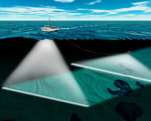
There are two main types of sonar: active and passive.
- Active sonar emits its own signals and listens for echoes
- Passive sonar listens for sounds made by other objects without emitting any sound.
Active sonar is more common. We see it for situations such as obstacle avoidance, depth sounding, and fishing. Whereas passive sonar listens for sounds. This is common for detecting submarines without revealing the listener’s position.
What is sonar used for?
Sonar is like our window to the underwater world. It helps us identify everything from ocean depths to vessel detection and shipwrecks. Here are some examples:
- Submarine navigation and detection: Locate submarines and avoid collisions.
- Ship obstacle avoidance: Detect objects to prevent ship accidents.
- Deep-sea exploration: Explore unreachable ocean depths and discover bathymetric features.
- Fish Finders: Locate schools of fish.
- Underwater archaeology: Find sunken artifacts and shipwrecks.
- Seabed mapping: Chart ocean floor topography.
- Underwater mine detection: Identify and neutralize naval mines.
- Torpedo guidance: Direct torpedoes to targets.
- Marine mammal research: Study marine life behaviors and populations.
- Oceanographic data collection: Gather ocean condition data.
These applications show the importance of sonar technology in maritime research and safety.
Sonar in underwater bathymetry data
When it comes to bathymetry data, Sonar is like our underwater eyes. Two of the most common bathymetric data sources are:
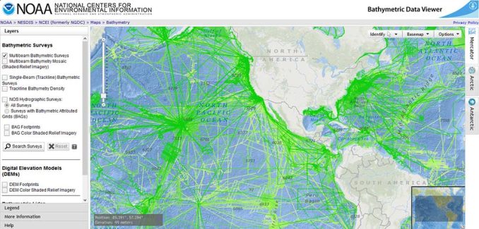
- GEBCO Bathymetry: The GEBCO Grid 2023 is the most recent global elevation grid. Using soundings and satellite-derived gravity data, it provides a resolution of 30 arc-seconds.
- Topobathy 3D: Topobathy 3D integrates topographic and bathymetric data. This dataset shows the Earth’s surface, both land and underwater.
When you explore the oceans through Google Maps, it’s likely bathymetric data from any of these data sources.
How far can sonar detect underwater?
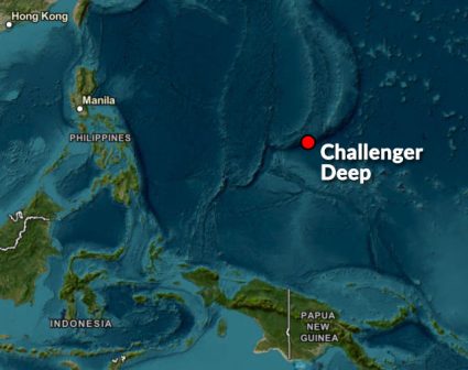
During an expedition from 1872 to 1876, the HMS Challenger was one of the first ocean expeditions in history. While conducting depth soundings, the Challenger expedition stumbled upon the Mariana Trench, Earth’s deepest point.
It initially recorded a depth exceeding 8,200 meters. But subsequent expeditions refined these figures. Further soundings revealed the trench’s lowest point to be around 11,000 meters deep. This finding was honored by naming the deepest part of the ocean after the Challenger.
Even though it did not specifically target the Mariana Trench, the Challenger expedition marked the beginning of mapping the ocean floor. It also laid the groundwork for future soundings in deep-sea environments like the Mariana Trench.
The science of sound
Sonar uses sound to map the ocean floor. While sonar scans the sea, it helps create bathymetric maps.
So, sonar isn’t just about navigation. It’s a tool for science, safety, and understanding our planet better.
Do you want to see bathymetric data? Try out NOAA’s Bathymetry Data Viewer or the GEBCO bathymetry download application.
Do you have any questions? Please let us know in the comment form below.


