How the Public Land Survey System (PLSS) Works
Learn how the Public Land Survey System (PLSS) works, which divides land in the United States into townships, ranges, and sections.
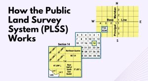
Learn how the Public Land Survey System (PLSS) works, which divides land in the United States into townships, ranges, and sections.
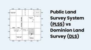
The Dominion Land Survey (DLS) and the Public Land Survey System (PLSS) divide the land to help distribute land and assign land titles.

Geodesy is the field of applied mathematics that studies Earth’s shape, orientation, positions and gravity for the past, present and future.
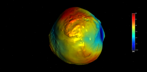
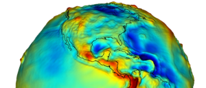
The geoid measures mean sea level and gravity. The GRACE and GOCE satellites are providing the most accurate measurements of the geoid to this date.
A vertical datum is a reference surface of zero elevation to which heights are referred to. Datums are used to measure height and depth from mean sea level.
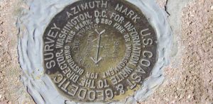
If you’re serious about geocaching, than you’ve probably heard of benchmark hunting. A survey benchmark is a disk in the ground with a latitude & longitude.

The Magnetic North Pole is a point in Northern Canada where the northern lines of attraction enter the Earth. Compass needles point to the magnetic north.
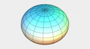
Reference ellipsoids (ex. Clarke Ellipsoid) are smooth, mathematical models of the Earth’s shape. It has a semi-major and minor axis flattened at the poles.

A horizontal datum provides a reference frame for latitude and longitude coordinates on the Earth. A datum is constructed through surveys and triangulation.