Dissolve Tool in GIS
The Dissolve Tool combines adjacent boundaries based on common attribute values – only if neighbor polygons have the same dissolving attribute.
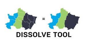
The Dissolve Tool combines adjacent boundaries based on common attribute values – only if neighbor polygons have the same dissolving attribute.
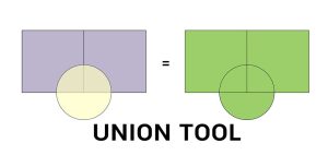
The Union tool combines input data layers into a single composite layer, preserving the boundaries and attributes from all input features.
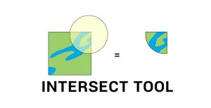
The Intersect Tool in GIS performs a geometric overlap. All features and attributes that overlap will become part of the output feature class.
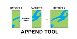
The Append Tool adds data from one or more sources of data and puts it into an existing target dataset, without creating a new dataset.
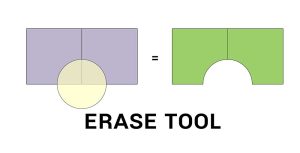
The Erase Tool removes the area that is overlapping with the erasing features. Everything outside the erasing layer ends up in the output.
Unless you’re a data editing jedi, your GIS data may unknowingly have errors like gaps and overlaps. What to do? Fix errors using topology tools in ArcGIS

So you want to geoprocess like a GIS guru, do you? From clipping to buffering, you will learn the basic GIS processing tools along with uses & applications
Follow these quick 5 steps and turn Excel lat long coordinates into spatial data in ArcMap. Set to WGS 1984. Add table. Display XY Data. Export shapefile.