Append Tool in GIS
What Is the Append Tool?
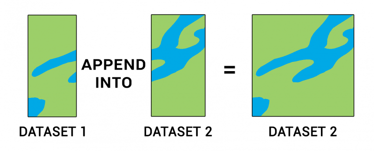
The “Append Tool” adds data from one or more sources and puts it into an existing target dataset. It’s very similar to the Merge tool but appending does not create a new data set.
Instead, it simply takes an existing dataset and combines the source data into this target dataset. This tool allows for any type of feature such as points, lines, polygons, and tables.
In this tutorial, you’ll learn how to use the append tool with a practical example. Plus, we’ll explore field maps, common errors, and troubleshooting.
The append tool combines one or more datasets by adding the features and attributes into an existing target dataset.
Setting a Field Map
When you append the geometry from one feature into an existing one, the Field Map allows you to set which attributes combine into the target.
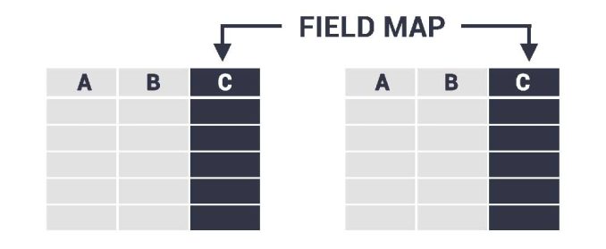
Because your target dataset will have an existing schema, it’s how you control and even force attributes to match the target dataset.
But this also introduces an error common while merging or appending data. When you have two different field types like string and double, you cannot force these two types of fields together.
Common errors and troubleshooting
If you use the Append Tool, you can encounter errors associated with this operation. Here are some of the common errors and how to troubleshoot them.
FIELD VALUES – Appending one or more datasets into an existing target dataset will try to combine any fields with the same name. But if one field is a string and the other is numeric, you may get Error 001156 in ArcGIS. This is also true if the input surpasses the target field length. You can fix this error by assigning your field a new type of field. For string fields, you may have to add more length for characters.
MISSING OUTPUT – If the appending dataset has missing features, this can happen if you accidentally select features before running the tool. To fix this, you can deselect the features from your input dataset and run the process again.
INVALID SHAPE TYPES – You cannot append different types of geometry. If you still want to append the data, you can try to convert from points, lines, or polygons into a common geometry type.
You can try troubleshooting 999999 errors in ArcGIS, which is a generic error code. The error code 999998 is an operating system error. Often, you can fix this error by removing background processing in your geoprocessing options.

What are some examples of using the Append Tool?
The most prominent usage of the append tool is when you have a larger dataset and you just want to keep adding data to it.
For example:
Keep in mind that it’s always good practice to perform quality control on your results. For data entry, collectors have to follow consistent rules with domains and default values.
How to run the Append Tool in ArcGIS and QGIS
If you want to try out this tool, it’s actually very easy to do so in either ArcGIS Pro or QGIS (which is completely free).
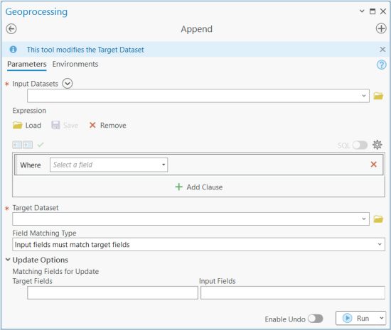
In ArcGIS and ArcGIS Pro, the Append Tool is in the Data Management Toolbox and within the General Toolset. Here’s what the tool looks like in ArcGIS Pro.
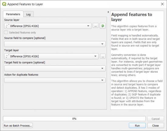
In QGIS 3, it’s also very easy to find and use. You can find this tool as a plugin as Append Features to Layer.
The main difference is how you can dynamically match fields from the input to the target dataset in the field map.
Summary: The Append Tool
The append tool is similar to the merge tool. But when you append data, it adds it to an existing dataset.
But merging takes two or more existing data sets and combines them creating a new data set.
What are some ways that you use the append tool? What errors have you encountered? Do you have any questions? Please let us know with a comment below.


