Map of Tulsa, Oklahoma

Map of Tulsa
Use this Tulsa map collection to help navigate you through the city. It includes a road map, things to do, a reference map, and an interactive map of the surrounding area.
The City of Tulsa is located in the state of Oklahoma, which is known for being filled with beautiful nature. The city itself is located in the northeastern part of the state and has a population of around 405,000 people.
Tulsa is known for its arts, food, and its history in the oil industry. Find out more about the wonderful city of Tulsa, Oklahoma by checking out these maps of Tulsa. First, let’s start with this interactive map.
Jump To: Interactive Map | Printable Road Map | 10 Things to Do | Reference Map
Tulsa map collection
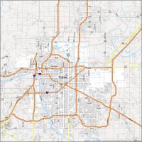

Interactive Map of Tulsa
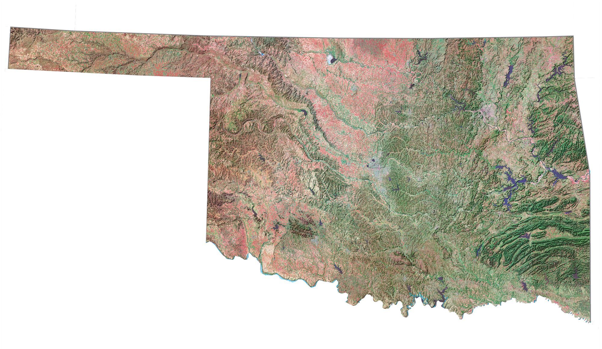
Tulsa Oklahoma is a great place to visit and explore. It’s the second-most populous city after Oklahoma City. The Arkansas River meanders through Tulsa, where several parks have been established along the river banks. Lake Yahola is the largest reservoir within the city.
This map will help you find your way around the city and discover all of the hidden treasures. This interactive map includes the best landmarks, restaurants, hotels, activities, and attractions in Tulsa, Oklahoma. Tour the city by zooming and panning around to find your favorite spots.
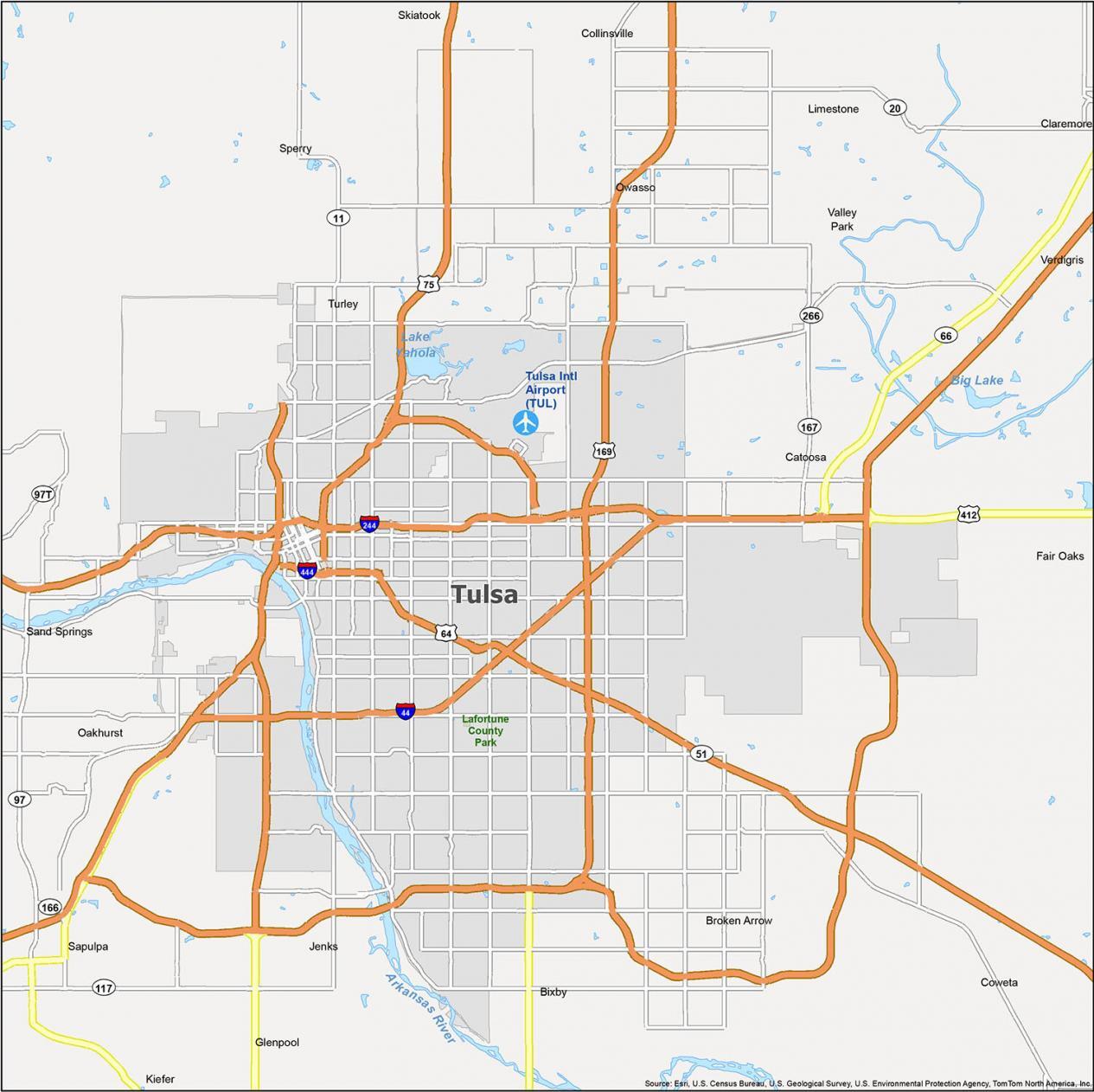
Tulsa Road Map
Find your way around Tulsa, Oklahoma with the help of this comprehensive map. This Tulsa road map will help you explore Tulsa without getting lost. With interstates, highways, and major roads, it is a true guide to the sights and sounds that Tulsa offers.
Download and print it today because it’s the perfect companion for any traveler. But if you plan on traveling outside the city, then check out our Oklahoma road map for highway information in the state.
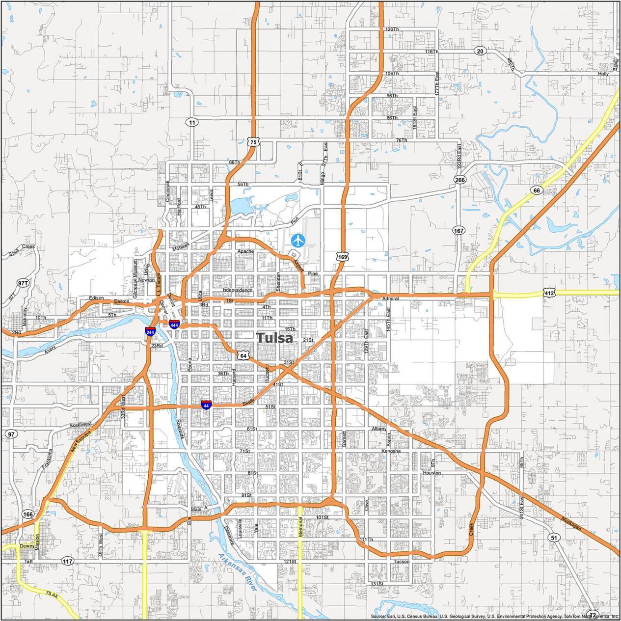
Interstate Highways: I-44, I-244, I-444
US Highways: 11, 51, 64, 75, 169, 266, 412, Creek Tpke
Parkways: L.L. Tisdale Pky, Riverside Pky
Major Roads: 13th E Ave, 25th West Ave, 26th St, 36th St, 46th St, 71st St, 75th East Ave, Airport Blvd, Airport Rd, Apache St, Gilcrease Museum Rd, Kenosha St, Memorial Dr, Peoria Ave, Port Rd
10 Things To Do in Tulsa
This map is a must-have for any Tulsan looking to explore the city. With details on everything from museums to monuments, to parks, this map has everything you need to get to know the city like a pro. With this map, you will be able to find all of the places that you want to visit.
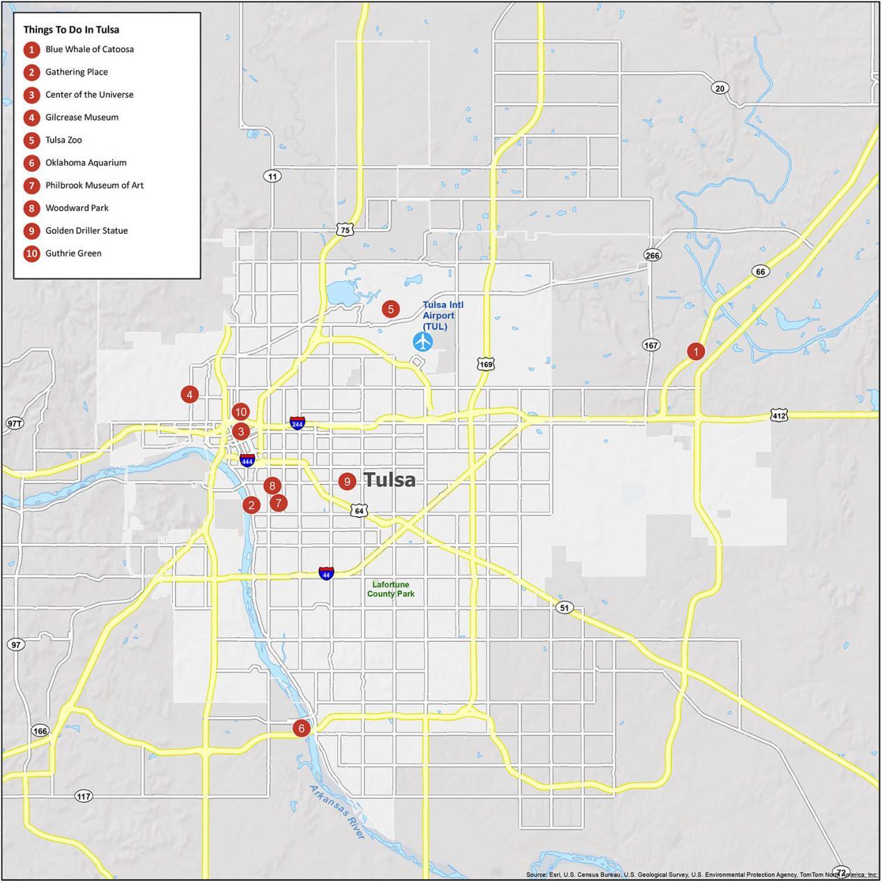
If you ever travel to Tulsa, we recommend these 10 things to do.
- Blue Whale of Catoosa
- Gathering Place
- Center of the Universe
- Gilcrease Museum
- Tulsa Zoo
- Oklahoma Aquarium
- Philbrook Museum of Art
- Woodward Park
- Golden Driller Statue
- Guthrie Green
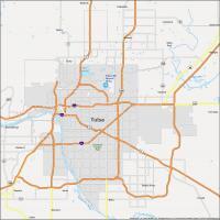
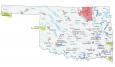
Tulsa Reference Map
Make the most of your time in Tulsa with this reference map. It’s a great resource for exploring Tulsa Oklahoma. It has detailed information about lakes, rivers, and populated areas. It is easy to use and you can customize it to suit your needs. Explore Tulsa and the surrounding areas with this map.
Airports: Tulsa International Airport (TUL)
Cities: Bixby, Broken Arrow, Catoosa, Claremore, Collinsville, Coweta, Glenpool, Jenks, Owasso, Sand Springs, Sapulpa, Skiatook, Tulsa
Towns: Fair Oaks, Kiefer, Sperry, Valley Park, Verdigris
Census-designated place (CDP): Limestone, Oakhurst, Turley

How do I get a map to a location?
Which location are you looking for?
I am looking for a map of the Forest Hills area of Tulsa OK before it was built up, or just the beginning of planning and the building of the mansions. I am flexible on years but am thinking of 1920 to 1970. I am looking for photos of construction as well as maps of the area. Thank you.
You can try out some of our historical imagery viewers – https://gisgeography.com/free-historical-imagery-viewers/
Tulsa is not located in northwest oklahoma!!
Thanks, fixed it