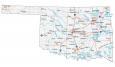
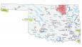
Map of Oklahoma – Cities and Roads

About the map
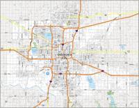
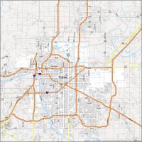
This Oklahoma map contains cities, roads, rivers, and lakes. For example, it features Oklahoma City, Tulsa, and Norman, which are some of the major cities shown on this map of Oklahoma.
Oklahoma is nicknamed the “Sooner State” because it references settlers who claimed better land. These folks were called “Sooners” and the nickname just stuck since then.
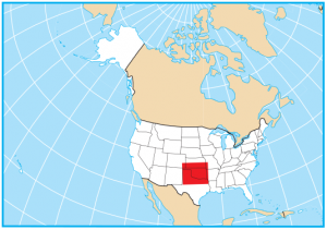
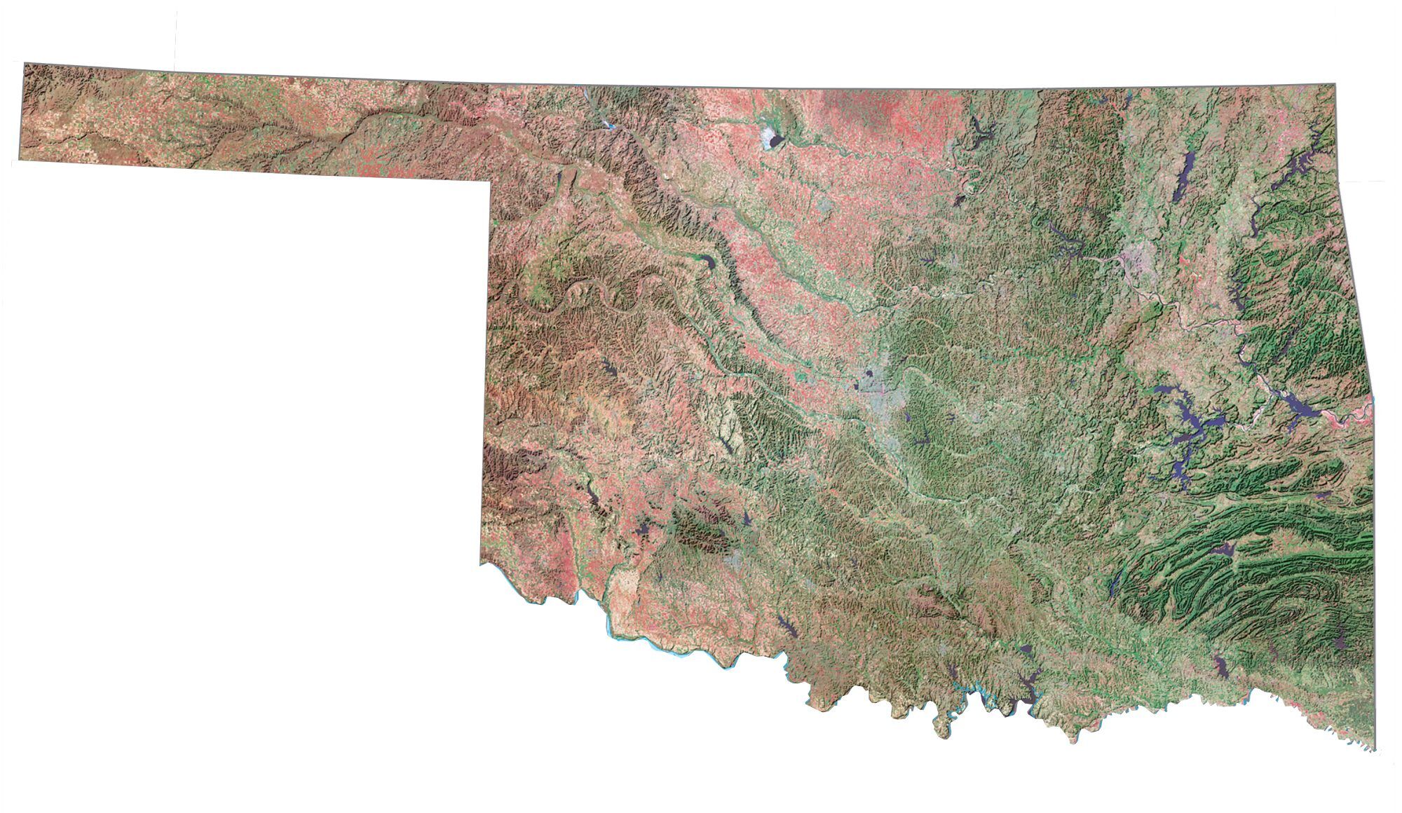
The state of Oklahoma is completely landlocked. It borders Kansas, Colorado, New Mexico, Texas, Arkansas, and Missouri. It’s located in the heart of tornado alley, an area in the Great Plains that gets hit hard by tornadoes. But Oklahoma is worse than all mid-west states, hitting records for most tornadoes each year.
Oklahoma map collection
You are free to use our map of Oklahoma for educational and commercial uses. Attribution is required. How to attribute?
State capital
Oklahoma City
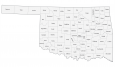
Major cities and towns
Oklahoma City
Tulsa
Norman
Bartlesville
Broken Arrow
Edmond
Enid
Lawton
Moore
Muskogee
Ponca City
Shawnee
Stillwater
Ada
Altus
Alva
Anadarko
Antlers
Ardmore
Atoka
Blackwell
Boise City
Chickasha
Claremore
Clinton
Cushing
Duncan
Durant
El Reno
Elk City
Eufaula
Frederick
Guthrie
Guymon
Henryetta
Hobart
Holdenville
Hugo
Idabel
McAlester
Miami
Okmulgee
Pauls Valley
Pawhuska
Perry
Poteau
Pryor
Sapulpa
Seiling
Shattuck
Tahlequah
Woodward
Vinita
Madill
Seminole
Buffalo
Grove
Coalgate
Sulphur
Waurika
Sayre
Watonga
Interstate highways
Interstate-35 (I-35)
Interstate-40 (I-40)
Interstate-44 (I-44)
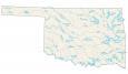
Lakes, rivers and creeks
North Canadian River
Cimarron River
Canadian River
Washita River
Red River
Arkansas River
Lake Texoma
Eufaula Lake
Robert S Kerr Reservoir
Oologah Lake
Lake O’ The Cherokees
Hugo Lake
Little River
Broken Bow Lake
Landmarks in Oklahoma
Wichita Mountains
Arbuckle Mountains
Ouachita Mountains
Black Mesa