5 Free Historical Imagery Viewers to Leap Back in the Past
Do you want to leap backward in time and see how the world has changed?
Thanks to these historical imagery viewers, we can now take a leap back in time without needing a time machine.
The past comes alive through these historical maps to explore vintage imagery for nearly anywhere on Earth.
Let’s get started on how to view historical imagery.
1. Google Earth Pro
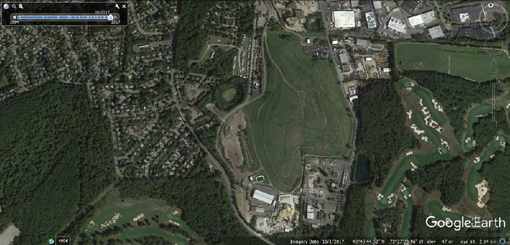
Not only is Google a world leader in geocoded addressing, but you can leap to the past with its historical time slider.
From historical satellite to aerial photography, Google Earth Pro puts the whole world in your hands.
First, zoom into your area of interest. Click the time slider icon. Now, visit your neighborhood in the past. You’ll know which years are available based on the thumbnails.
2. Esri’s Wayback Living Atlas
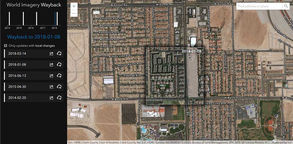
Recently, Esri has released its newest addition to the Living Atlas of the World. Basically, this collection of Earth curates essential geographic information that impacts people’s daily lives.
For example, this includes items such as weather, traffic, elevation, demographics, oceans, and urban systems.
As part of their enormous collection of maps, Esri’s Wayback Living Atlas lets users browse historical imagery back in time.
Still, in the introductory phase, their collection of imagery is growing and evolving into a must-have platform for map historians.
READ MORE: The Living Atlas of the World by Esri
3. USGS LandLook
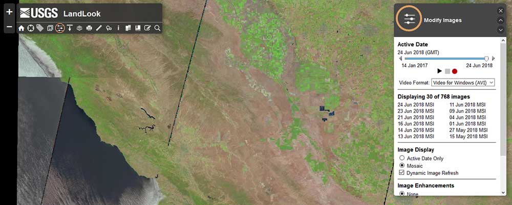
For rapid viewing of Sentinel-2 and Landsat imagery, the USGS Land Look spans back to 1999.
- First, load your images by filtering the days, years, cloud cover, and sensors.
- Next, you can play a video displaying each scene in your time span.
- Finally, if you want to export your scenes as PNG, GeoTIFF, or JPG, you can select the “export” tool.
Overall, USGS Land Look is ideal for searching historical imagery that is part of the Sentinel-2 and Landsat archives.
Alternatively, if you want to dig into USGS’s giant collection of about 7 million scanned historical images, take a trip to the USGS Earth Explorer. To get started, we put together this step-by-step USGS Earth Explorer tutorial. Instead of satellite imagery, your search criteria would be “Aerial Imagery”. Some of my favorites are NAIP, DOQ, and the mosaics.
4. NASA Worldview
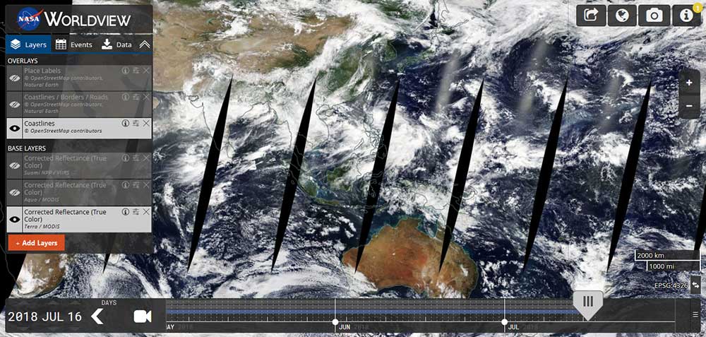
NASA’s Worldview has 600 global, full-resolution satellite imagery layers.
Albeit, they’re coarser than the others on this list. But essentially, they show the entire Earth as it looks “right now”. Actually, it’s updated within three hours of observation.
So you’re probably asking: this isn’t historical imagery, is it?
Instead of using the current date (which is the default), you can step back in time by adjusting the time slider. Unlike the cloudless imagery we are accustomed to, this is the true view of our planet.
5. Planet Labs
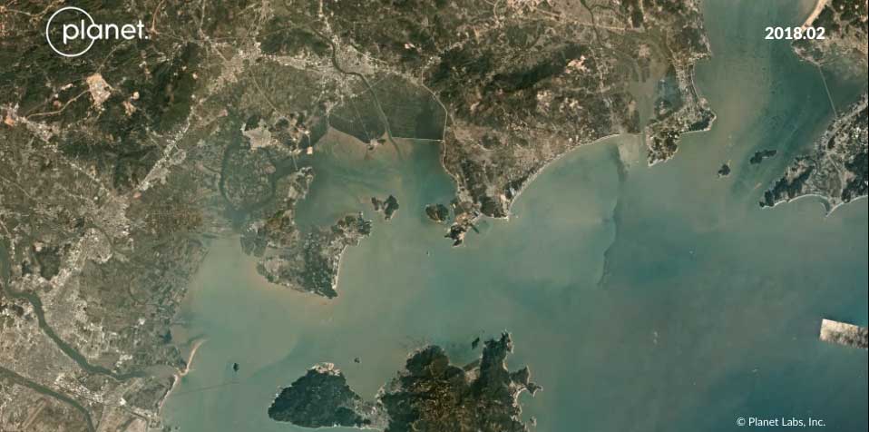
Here are a couple of cool facts about Planet:
- They are a team of ex-NASA scientists who built their business embracing low-cost, lightweight, microsatellites in space.
- They are the largest collector of Earth imagery with a constellation of 450+ satellites in orbit at this time.
- Planet has a “freemium” service that dates back to 2009 giving you historical context on your areas of interest.
Planet’s fleet of satellites is ideal for monitoring anything on Earth. For example, Planet Stories allows users to use space imagery and tell their own stories anywhere.
Aerial Orthoimagery for Historical Context
When you want a historical context for an area of interest, there are several options to help you get started.
Google Earth is a mobile and desktop application with an enormous collection of historical imagery for free.
Esri’s Wayback Living Atlas provides an online platform. It’s free and it’s growing for historical images. Lastly, it’s becoming more ubiquitous to the average user.
Finally, USGS, NASA, and Planet’s constellation of satellites provide an alternative means to view the history of Earth. Also, you can try your luck with our list of free drone imagery as well.
Looking for more satellite imagery?
Find more free satellite imagery with the resources below.
- 15 Free Satellite Imagery Data Sources
- Satellite Maps To See Earth in New Ways
- 5 Live Satellite Maps to See Earth in Real-Time
- Satellite Image of Earth – Blue Marble (NASA)
- Aerial Imagery and Photography Sources
Got anything else? We’d love to hear from you in our comments section below.


I’m looking of old pictures of Stafford road wallington in perticular the chaser
looking for a before and after bombed area the fishhook area of south Vietnam and Cambodian border before and after april 24 1969 thank you
One option is the CORONA satellite (1960-1972). This imagery has been made open source and you can find it on the USGS Earth Explorer website. Unfortunately, Landsat is not an option as it was first launched in 1972.
Looking for an aerial photo of Rome from 1995. Would anyone know where I could find/purchase one?
Thanks!
You will probably have to time travel to the past and fly up into the sky riding on a dinosaur because planes did not exist back then.
Hello all,
I am looking for a way to go back to prehistoric Era to the 1400’s both in the US and abroad.
What would be best suited for me?
Satellites didn’t exist in 1400 Jay.
All of these are great options, you left out one of my favorites though!
https://www.historicaerials.com/viewer also happens to have an array of old satellites, as well as what I am guess is plane photography being they have alot of images that go back pretty far! Check it out!
How can I purchase these map images?
Is it possible to get historical imagery for World War 2 locations? I would like to see what present day sites looked like back then.
Hi Greg. Sorry. I am not sure of that. I think that would be a really interesting idea.
The only reconnaissance satellite that I can think of that’s open today is the CORONA satellite, which was used for surveillance of the Soviet Union (USSR) starting in 1959.
Of course, this isn’t the same period as World War II. However, it may also be of interest to you. This data is openly available at USGS Earth Explorer. Here’s a tutorial how to download the imagery – USGS Earth Explorer: Download Free Imagery
I am trying to look up historical images from Charlotte 1960-present.
What is the best way to do this?
I assume you mean Charlotte, NC. historicaerials.com goes back to 1956 and google earth 1984
I am looking for a satellite image of a beach on a specific date in 2017. What would be the best programme to use for this?
Hi Mary. I think your best option would be looking through the company “Planet” satellite imagery archive. It’s the largest constellation of micro-satellites orbiting the Earth. It captures the “Earth Daily” and 2017 would fit in the timeframe that Planet’s constellation has been active.
Unfortunately, there might be a cost to this. Previously, they might have had free trials available. They still might because I haven’t checked recently… But it’s worth a shot. Here’s a link – https://www.planet.com/products/planet-imagery/
I am looking for information on Franklin Village Youngtown 7249 Tasmania
Hi, I’m wondering if anyone know of anyone knows of any images for 121 celia st from the late 1940’s?
You’d likely have to talk to your state, provincial or local authority to see what is available. That would be tough to find.
Please I need a platform where I can get an imagery of 1960 to 1970 for Port Harcourt UTM ZONE 32 .
Great resource
Have you checked out historicaerials.com? It’s free to browse, you don’t have to subscribe to use the free viewer.
HI, This is Tony. I found a way once to go back as far as the 1950s but I am having a real hard time finding the website I used. It used aerial photos
Hi my name is Winston Vaughan I am looking for old aerial maps of Chalkhill Road & Barnhill road at Wembley Park from the 1940s to 1970s do you have any please? or what aerial maps website I need to go?
Kind regards
This is a great resource,
Thanks