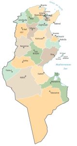
Tunisia Map – Cities and Roads
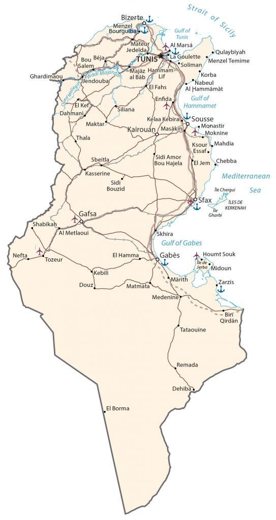
This Tunisia map displays major cities, towns, roads, and rivers. It includes key features such as the Sahara Desert, the Atlas Mountains, and the Mediterranean coastline.
Tunisia map collection
You are free to use our Tunisia map for educational and commercial uses. Attribution is required. How to attribute?
About the map
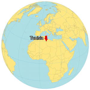
Tunisia is a country in Northern Africa, next to the Mediterranean Sea. Additionally, it contains Africa’s northernmost point at Cape Angela. Tunis is the capital and largest city of Tunisia. Other major cities are Sfax, Sousse, and Kairouan.
Tunisia borders just two countries. While Algeria is situated to the west, Libya is located to the east. Tunisia is known for its historical ruins, mosques, Mediterranean coastline beaches, Atlas Mountains, and the Sahara Desert.
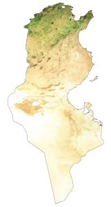
SATELLITE IMAGERY
Tunisia Satellite Map
Tunisia occupies an area of 163,610 square kilometers (63,170 sq mi). In comparison, it’s smaller than Senegal but larger than Malawi. The country lies between 30° and 38°N latitudes so its climate is hot. Although the Sahara Desert is a dry central plain, its climate varies because of its large north-south extent.
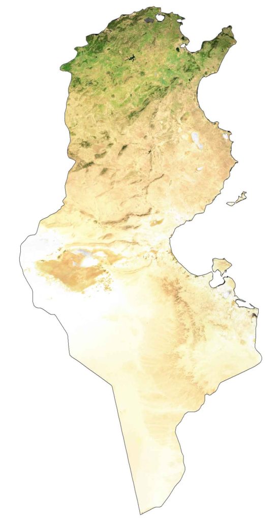
Tunisia’s coastline is 1,148 kilometers (713 mi) long across the Mediterranean Sea. While the Medjerda River is the longest in Tunisia at 450 kilometers (280 mi), Chott el Jerid is the largest salt lake in Tunisia.
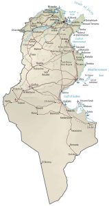
PHYSICAL MAP
Tunisia Physical Map
Tunisia had a diverse mix of terrain including plains, deserts, low rolling hills, and mountains. The largest desert in the world, the Sahara, extends into the southern part of Tunisia and covers the region in sandy dunes.

Whereas northwestern Tunisia contains the Aures Mountains, which are an extension of the Atlas Mountains. At 1,544 meters (5,066 ft), Mount Ash-Sha’nabi (Jebel ech Chambi) is the highest peak in Tunisia.
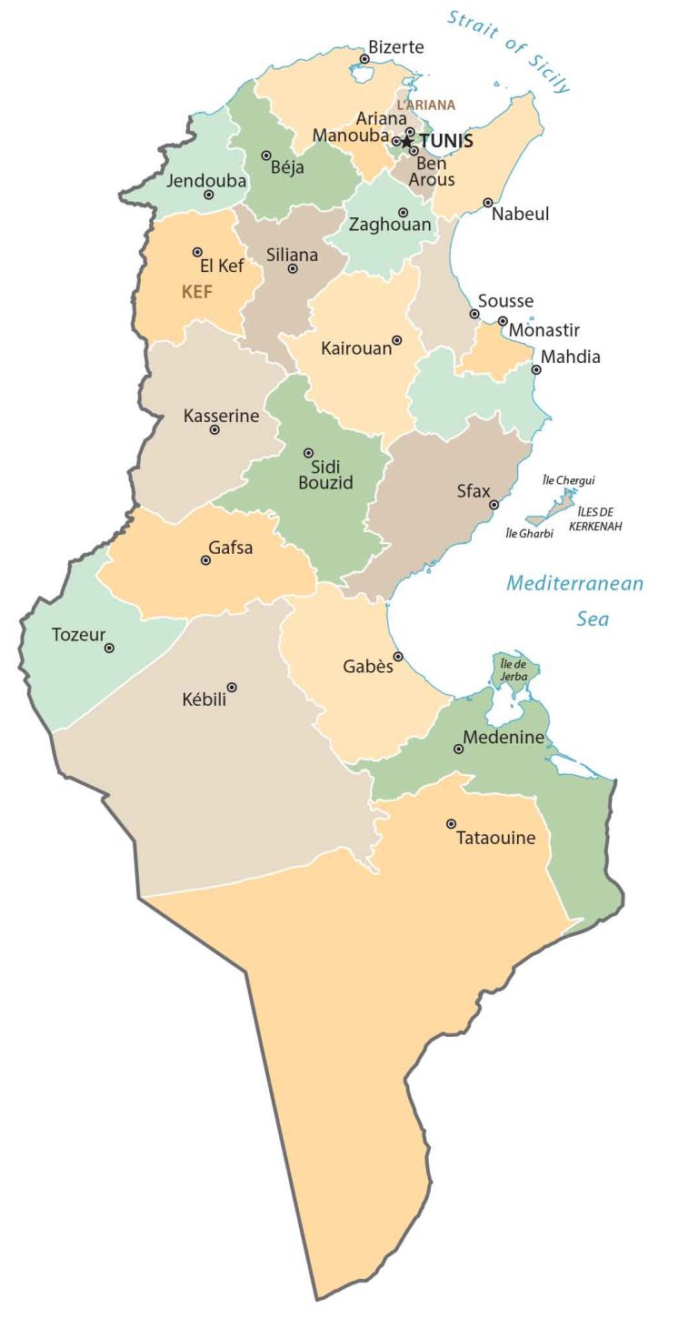
POLITICAL MAP
Tunisia Governorates Map
Governorates are the first-level administrative units in Tunisia that are divided geographically and administratively. Currently, there are 24 governorates in Tunisia. Then, its second-level administrative unit is districts.
Capital City
Tunis
Major cities
Bizerte
Gabès
Gafsa
Kairouan
Kasserine
Monastir
Sfax
Sousse
Cities, towns and villages
Al Hammamat
Al Marsá
Al Metlaoui
Bou Béja
Chebba
Dahmani
Dehiba
Douz
El Fahs
El Hamma
El Jem
El Kef
Enfida
Ghardimaou
Houmt Souk
Jedeïda
Jendouba
Kelaa Kebira
Korba
Ksour Essaf
La Goulette
Lif
Mahdia
Marith
Matmata
Mateur
Medenine
Maktar
Majaz Al Bab
Menzel Bourguiba
Menzel Temime
Moknine
Nefta
Nabeul
Qulaybiyah
Remada
Salem
Shabikah
Sidi Amor Bou Hajela
Sidi Bouzid
Siliana
Skhira
Soliman
Sbeitla
Tataouine
Thala
Tozeur
Zarzis
Gulf, seas and straits
Gulf of Gabes
Gulf of Hammamet
Gulf of Tunis
Mediterranean Sea
Strait of Sicily
Wadi Majardah
Islands
Île Chergui
Île de Jerba
Île Gharbi
Îles de Kerkenah