Map of Libya
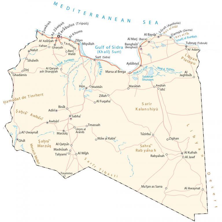
This map of Libya contains the major cities, towns, and roads. It includes an elevation and satellite map to see its two most prominent features – the Sahara Desert and the Mediterranean Sea.
Libya map collection
You are free to use our Libya map for educational and commercial uses. Attribution is required. How to attribute?
About the map
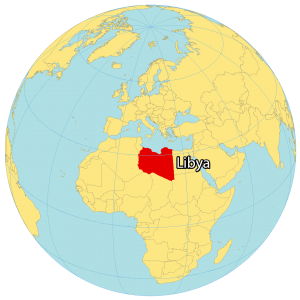
Libya is a large African country in Northern Africa. It borders Egypt to the east, Sudan to the southeast, Chad to the south, Niger to the southwest, Algeria to the west, and Tunisia to the northwest.
Most of Libya’s population is concentrated along its 1,770-kilometer long coastline with the Mediterranean Sea, including its capital of Tripoli.
A total of 6.78 million people reside in Libya with closer to half living in Tripoli and its surrounding area. Libya is known for its oil reserves, deserts, and ancient history.
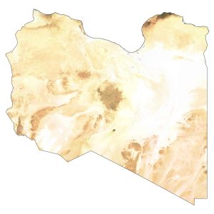
SATELLITE IMAGERY
Libya Satellite Map
Altogether, Libya occupies a total area of 1,759,541 square kilometers (679,363 sq mi). This makes it the fourth largest country in Africa and the 16th largest in the world. Its two most prominent geographic features are the Sahara Desert and the Mediterranean coast.
Just 1% of Libya is arable land and it has virtually no forest cover. The country lies between 20°N and 33°N latitude with a warm desert climate mostly throughout.

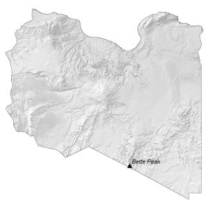
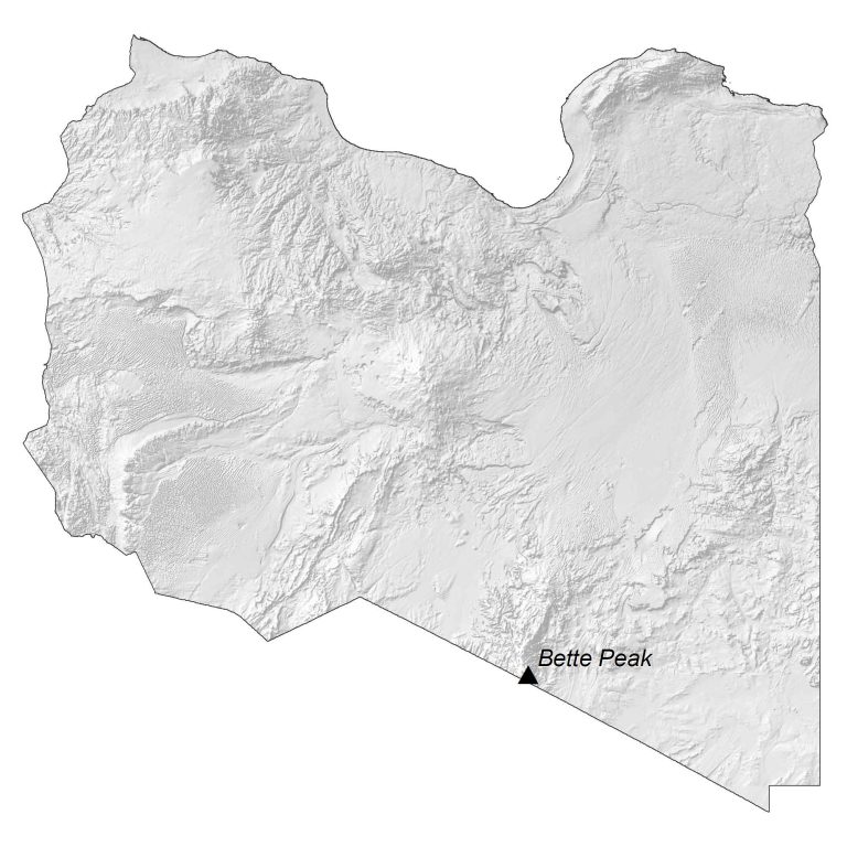
PHYSICAL MAP
Libya Elevation Map
Libya is mostly barren and dominated by the Sahara Desert. It has flat undulating plains with some plateaus and depressions. Its most prominent mountain range is the Tibesti Mountains, which extend from Chad to the south of Libya.
Within this mountain range, it contains Bette Peak (Bikku Bitti). At 2,266 meters (7,434 ft), it’s the highest peak in Libya. Whereas its lowest point is Sabkhat Ghuzayyil at -47 m below sea level.
Capital City
Tripoli (Tarabulus)
Major cities and towns
Ajdabiya
Al Bayda
Banghazi
Misratah
Sabha
Tobruk
Cities, towns and villages
Adiri
Al Aziziyah
Al Marj
Al Adam
Al Fuqaha
Al Qatrun
Al Wigh
Awbari
Awjilah
Bani Walid
Birak
Darnah (Derna)
Dirj
Ghadamis
Gharyan
Ghat
Hun
Jālu
Khums
Maradah
Marzuq
Nalut
Ra’s al Hilal
Ra’s at Tin
Sinawin
Sidra
Tarhunah
Tazirbu
Waw al Kabir
Zawiyah
Zillah
Zliten
Lakes, rivers and creeks
Gulf of Sidra
Mediterranean Sea
Khalij al Bumbah
Sabkhat Shunayn
Wadi al Farigh
Wadi al Hamim
Wadi Tilal
Wadi Zamzam
Landforms and geography
Hamadat de Tinrhert
Libyan Desert
Libyan Plateau
Mesach Mellet
Sarir Kalanshiyu
Sahra Awbarī
Sahra Rabyanah
Sarir Tibasti


Thank you for your great efforts. It is a great map with reasonable resolution.