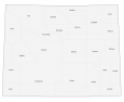
Yellowstone National Park Map
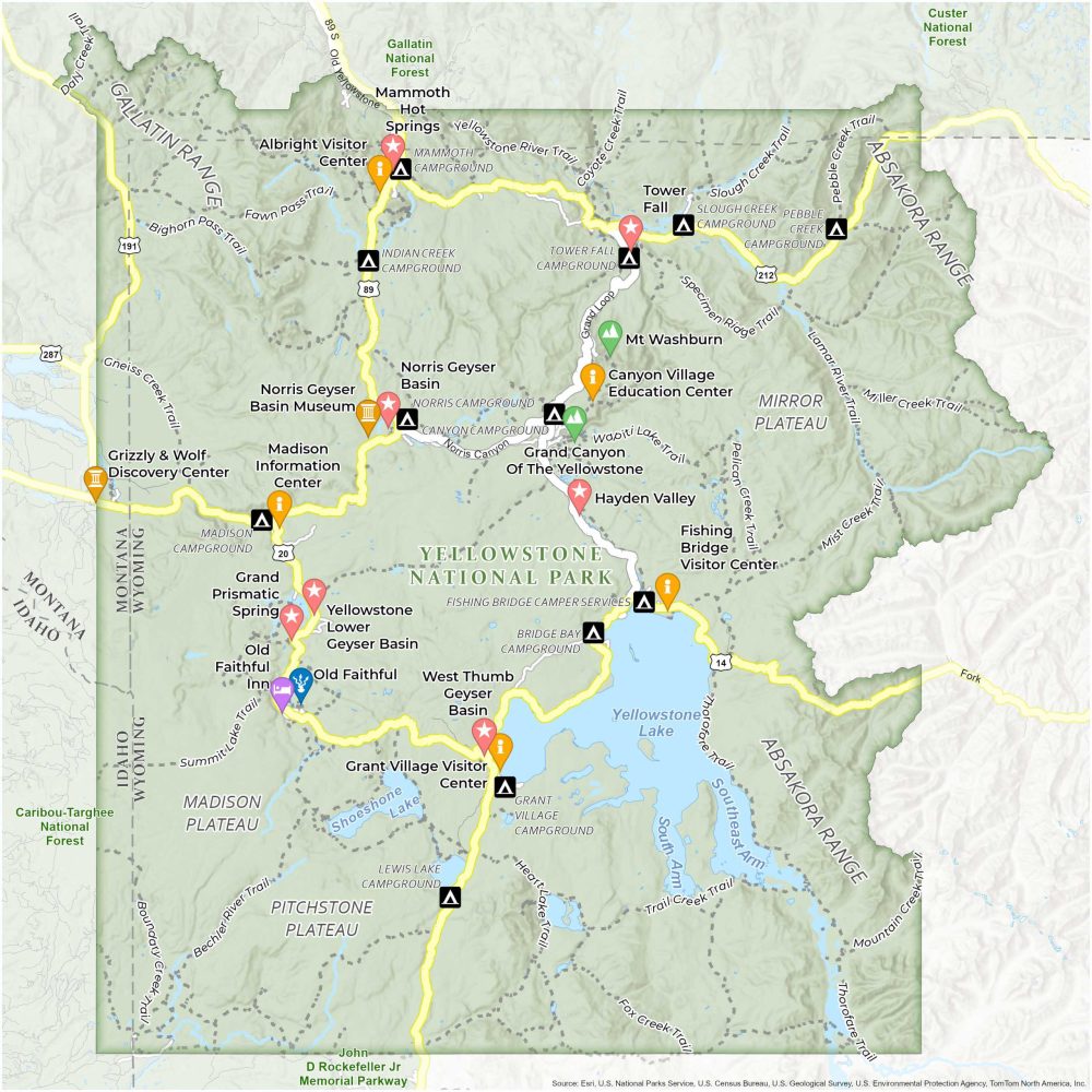
About the map
Download our map of America’s first national park. It’s our new map of Yellowstone National Park. From iconic geysers to its scenic trails and campgrounds, find it all in this Yellowstone National Park Map.
Think of Yellowstone National Park as a giant outdoor museum. Its natural wonders include geothermal features like geysers, hot springs, and mudpots. The park is famous for Old Faithful, an iconic geyser that erupts every 30 to 120 minutes.
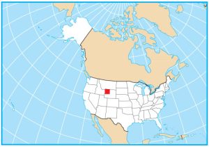
But Yellowstone is more than “Old Faithful”. Visitors compare Yellowstone to the Serengeti of Africa. Yellowstone spans over 2.2 million acres in Wyoming and Montana. It features forests, rivers, mountains, and grasslands with bison, elk, deer, bears, wolves, and mountain lions.
You are free to use our Yellowstone National Park map for educational and commercial uses. Attribution is required. How to attribute?
Top Things to Do
- Old Faithful Geyser – The most famous geyser in the park, known for its regular eruptions.
- Grand Prismatic Spring – The largest hot spring in the United States, known for its striking colors.
- Yellowstone Grand Canyon – Offers stunning views, particularly from Artist Point and Lookout Point.
- Mammoth Hot Springs – A complex of hot springs on a hill of travertine.
- Norris Geyser Basin – The park’s oldest and most dynamic thermal area.
- Yellowstone Lake – One of the largest high-elevation lakes in North America, offering beautiful vistas and boating opportunities.
- Lower Geyser Basin – Features a variety of geothermal phenomena, including Fountain Paint Pot.
- Tower Fall – A beautiful waterfall accessible via a short walk.
- Hayden Valley – A prime spot for viewing wildlife like bison, elk, and sometimes bears.
- Thumb Geyser – A small, colorful geyser that features scenic lake views.
Discovery and Visitor Centers
Albright Visitor Center
Canyon Village Education Center
Fishing Bridge Visitor Center
Grant Village Visitor Center
Grizzly & Wolf Discovery Center
Campgrounds
Mammoth Campground
Indian Creek Campground
Slough Creek Campground
Pebble Creek Campground
Norris Campground
Canyon Campground
Madison Campground
Bridge Bay Campground
Grant Village Campground
Lewis Lake Campground
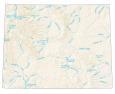
Trails
Yellowstone River Trail
Lamar River Trail
Summit Lake Trail
Slough Creek Trail
Bechler River Trail
Fawn Pass Trail
Coyote Creek Trail
Wapiti Lake Trail
Pebble Creek Trail
Specimen Ridge Trail
Bighorn Pass Trail
Heart Lake Trail
Fox Creek Trail
Mist Creek Trail
Miller Creek Trail
Pelican Creek Trail
Gneiss Creek Trail
Mountain Creek Trail
Thorofare Trail
Trail Creek Trail
Boundary Creek Trail
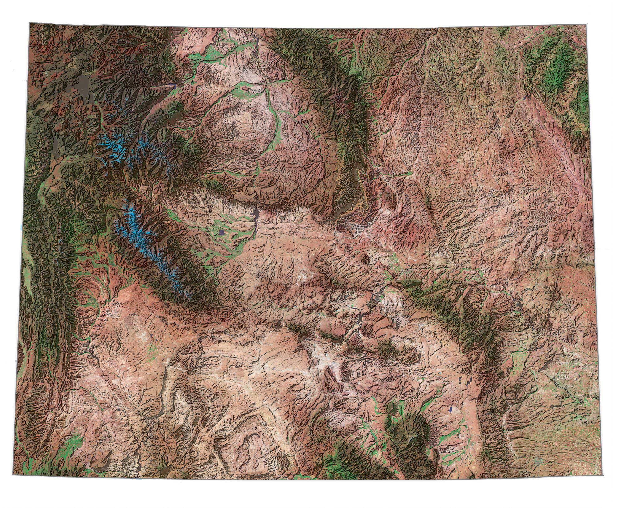
Landforms/Physical Regions
Madison Plateau
Pitchstone Plateau
Gallatin Range
Mirror Plateau
Absakora Range
Gallatin National Forest
Custer National Forest
Caribou-Targhee National Forest
Highways and Major Roads
US Highway 20
US Route 89
Highway 14
Highway 212
Grand Loop
Norris Canyon Road
Old Yellowstone Hwy
References
- Yellowstone National Park (National Park Service)
- USGS Yellowstone National Park Map
- Topographic Maps of Yellowstone NP (USGS)
You’re amazing! Love the map. We’ll use it to see the sights.
Please send me a paper map of Yellowstone with sights on it.