Bangladesh Map
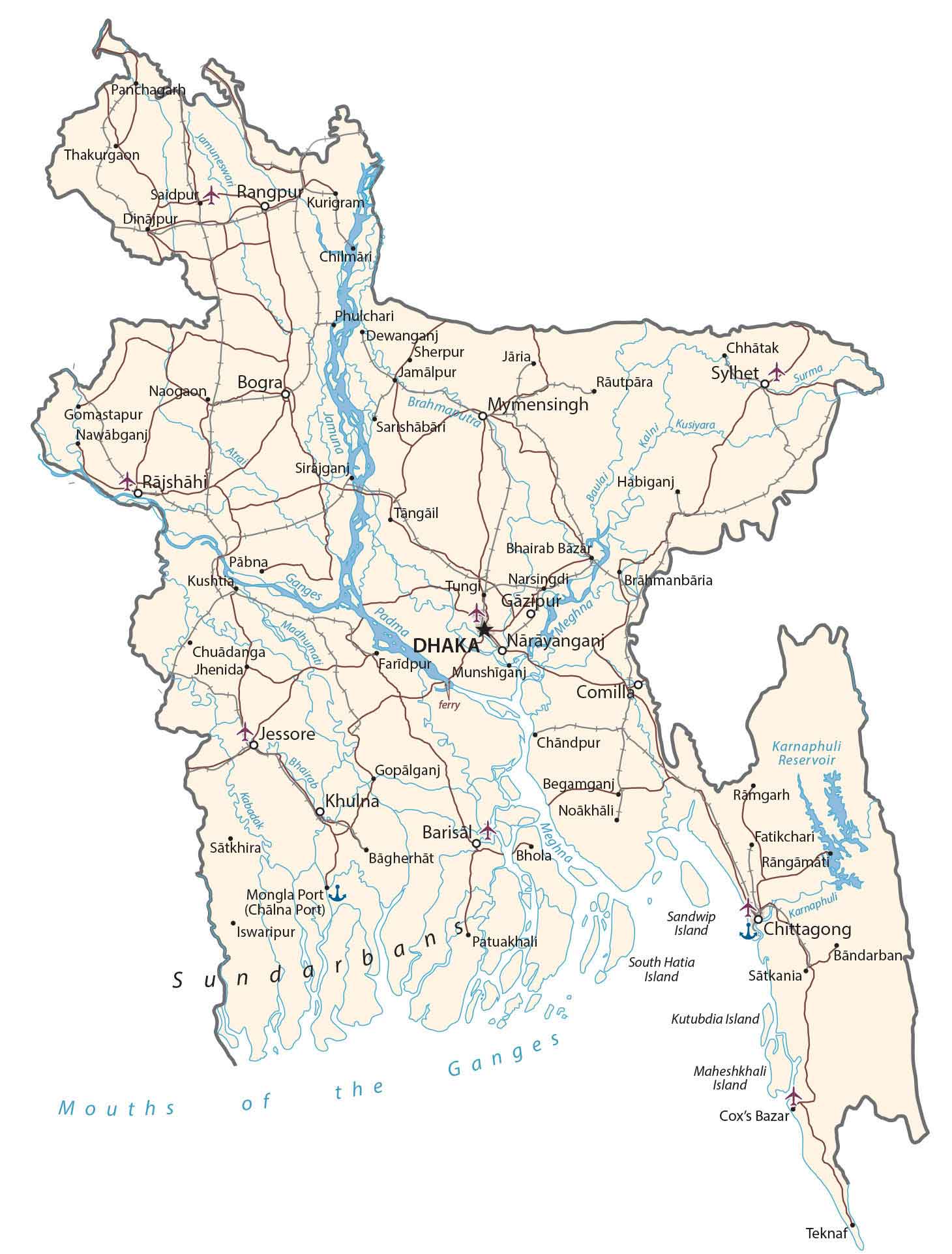
This map of Bangladesh displays major cities, towns, roads, and rivers. It includes a terrain map that shows the transboundary Ganges River. Finally, the divisions of Bangladesh are included in an administrative map.
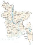
Bangladesh map collection

You are free to use our Bangladesh map for educational and commercial uses. Attribution is required. How to attribute?
About the map
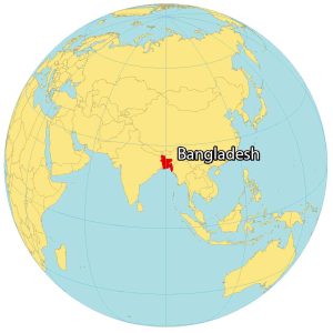
Bangladesh is a country located in Southern Asia. It’s situated along the Bay of Bengal and borders just 2 countries. First, Bangladesh shares a border with Myanmar to the southeast. Whereas India wraps around Bangladesh from west to east.
Bangladesh stands out as one of the most densely populated countries in the world. It occupies an area of 148,560 square kilometers (57,360 sq mi) and is the eighth-most populous country in the world. The capital of Bangladesh is Dhaka, which is also the largest city in the country.
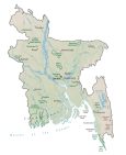
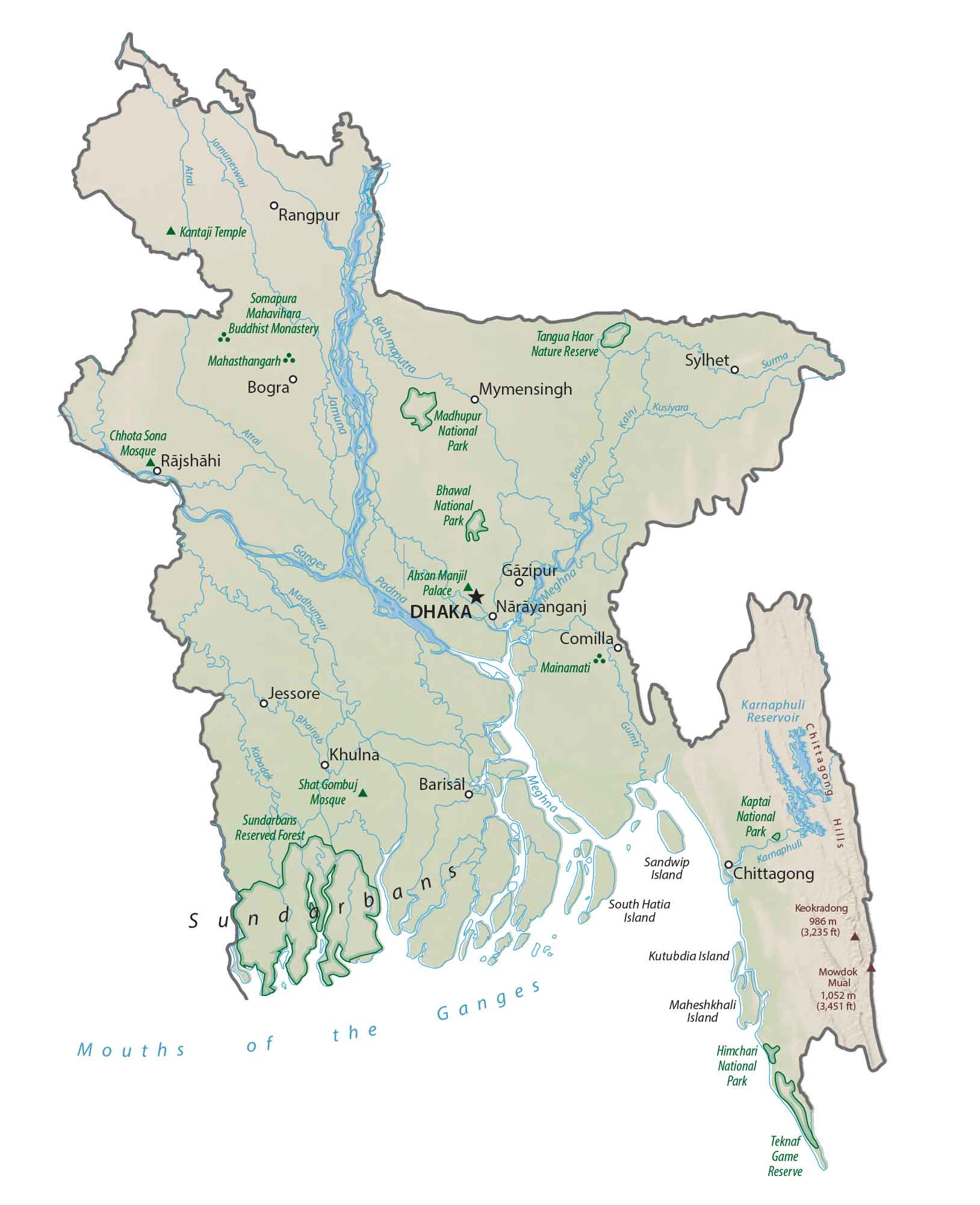
PHYSICAL MAP
Bangladesh Physical Map
The terrain of Bangladesh is mostly flat plains. Then, it transitions to hills to the Chittagong Hills in the southeast. This holds Bangladesh’s highest peak, Keokradong, at 986 meters (3,235 ft) near the border of India.
A major, transboundary river that flows from the Himalayas south through Bangladesh is the Ganges River. As it flows south to the Mouths of the Ganges, it forms the Sundarbans mangrove. Specifically, it’s at the confluence of the Ganges, Brahmaputra, and Meghna Rivers, which exits into the Bay of Bengal. Several major settlements are built near the deltas of rivers in Bangladesh.
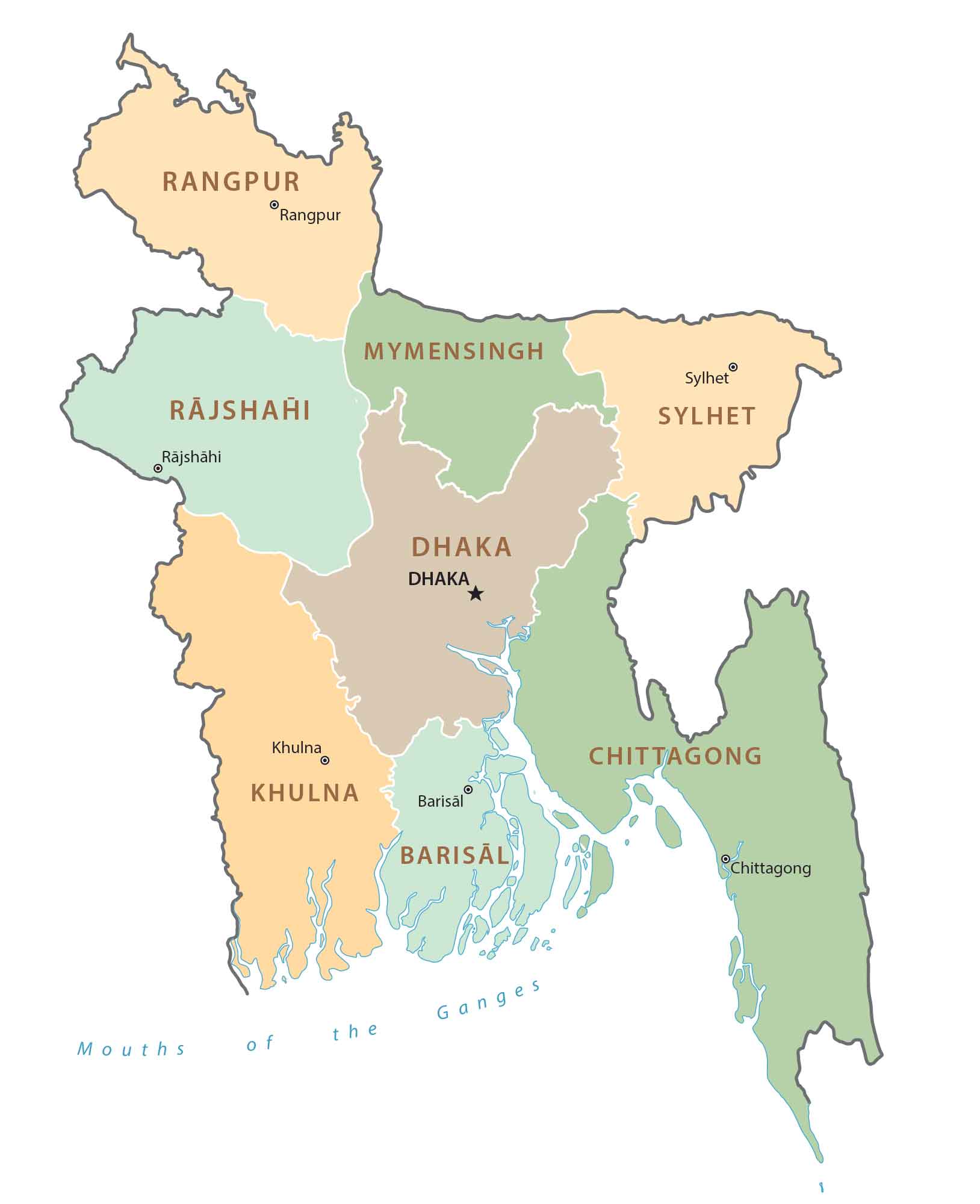
POLITICAL MAP
Bangladesh Divisions Map
There are 8 major administrative divisions in Bangladesh. Then, each division is divided into districts. Each division is named after a major city within its jurisdiction and serves as the administrative capital. The 8 divisions of Bangladesh are Barishal, Chattogram, Dhaka, Khulna, Rajshahi, Rangpur, Mymensingh, and Sylhet.
Capital City
Dhaka
Major cities and towns
Gazipur
Sylhet
Rangpur
Mymensingh
Rajshahi
Jessore
Khulna
Comilla
Cities and towns
Panchagarh
Thakurgaon
Saidpur
Dinajpur
Kurigram
Bogra
Naogaon
Gomastapur
Nawabganj
Chilmari
Chhatak
Surma
Kusiyara
Phulchari
Dewanganj
Sherpur
Jaria
Rautpara
Jamalpur
Sarishābāri
Sirajganj
Habiganj
Tangail
Pabna
Kushtia
Chuadanga
Narsingdi
Meghna
Narayanganj
Faridpur
Munshiganj
Brahmanbaria
Bhairab
Chandpur
Gopalganj
Kabadak
Begamganj
Noakhali
Ramgarh
Satkhira
Barisal
Bagherhat
Bhola
Fatikchari
Rangamati
Patuakhali
Karnaphuli
Chittagong
Bandarban
Satkania
Teknaf
Reservoirs and rivers
Mouths of the Ganges
Ganges River
Meghna River
Karnaphuli Reservoir
Karnaphuli River
Padma River
Bhairab River
Atrai River
Jamuneswar River
Brahmaputra River
Kalni River
Baulai River
Islands
Kutubdia Island
Maheshkhali Island
South Hatia Island
Sandwip Island
Other Places of Interest
Mongla Port (Chalna Port)
Sundarbans