Unsigned Integer vs Signed Integer for Raster Data
Unsigned integer rasters are non-negative numbers. Signed integers can store negative values. IMG, TIFF & GRID formats are acceptable for signed integer

Unsigned integer rasters are non-negative numbers. Signed integers can store negative values. IMG, TIFF & GRID formats are acceptable for signed integer

Does it feel like a big challenge to find LiDAR data sources? Master the art of attaining LiDAR at no cost with this list of 6 free LiDAR data sources.
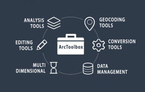
ArcToolbox is a collection of GIS tools for analyzing, editing and converting data. Each toolbox has a unique set of specialized tools for spatial analysis.
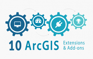
The best way to boost your capabilities in ArcGIS is through extensions and add-ons. And there is a massive, growing list even from 3rd party providers.
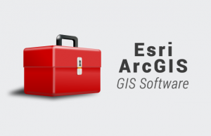
In this ArcGIS review, we rank it based on analysis, cartography, editing and data management capabilities. See our full review and find out where it ranks.
ArcGIS is geospatial software to view, edit, manage and analyze geographic data and patterns. Esri develops ArcGIS for mapping on desktop, mobile and web.
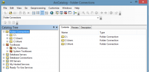
ArcCatalog is like a library for your GIS data. Like any good library, you can collect, store and manage your content. It’s where you write metadata too.
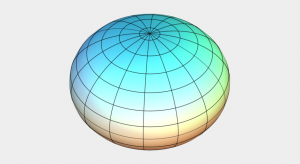
Reference ellipsoids (ex. Clarke Ellipsoid) are smooth, mathematical models of the Earth’s shape. It has a semi-major and minor axis flattened at the poles.
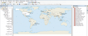
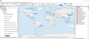
This is an overview how to use ArcGIS Desktop (ArcMap). We teach you the user interface, toolbars, licenses, menu bars, extensions, windows and more!
Ever wonder where your food comes from? Feast your eyes on these amazing agriculture maps and learn what the future of agriculture holds.