ArcGIS Review: Is ArcMap the Best GIS Software?
ArcGIS is the most inventive GIS software in the market today. In this ArcGIS review, we’re going to explore the following.
What are some of the pros and cons of ArcGIS? How is ArcGIS different from other GIS software? If you don’t use it already, should you consider using it? Let’s get started below.
Pros/Cons of ArcGIS Desktop
Here are some of the advantages and disadvantages of using ArcGIS Desktop compared to other GIS software applications.
PROS
CONS
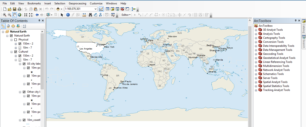
ArcMap Overview
ArcMap is primarily a desktop mapping application that allows users to create, view, analyze, and manipulate geographic data in the form of maps. It provides tools for displaying and working with spatial data, performing spatial analysis, and producing high-quality cartographic outputs.
Some of the key features and capabilities of ArcMap include:
- Map Creation: Users can create maps by adding layers of various geographic data types, such as shapefiles, raster images, and feature classes.
- Data Visualization: ArcMap allows users to symbolize and visualize data through various styles, colors, and labels. It supports both quantitative and qualitative data representation.
- Spatial Analysis: The software provides tools for performing spatial analyses, such as overlay operations, proximity analysis, network analysis, and terrain modeling.
- Geoprocessing: ArcMap includes a wide range of geoprocessing tools that enable users to manipulate and analyze geographic data. These tools can be used to perform tasks like buffer creation, spatial joins, and data conversion.
- Cartography: ArcMap offers advanced cartographic tools for designing and creating aesthetically pleasing maps suitable for various purposes, including presentation and publication.
- Layout Design: Users can create map layouts by arranging map elements such as legends, scale bars, titles, and north arrows. This is useful for generating final map outputs for printing or digital sharing.
- Data Editing: ArcMap provides tools for editing geographic data, allowing users to add, modify, and delete features in vector datasets.
- Integration with Data Sources: ArcMap supports various data formats and can connect to various data sources, including databases, web services, and other GIS software.
- Spatial Database Management: ArcMap can be used to manage and query spatial databases, enabling users to store, organize, and retrieve spatial data efficiently.
Strengths and Weaknesses
ArcMap, along with Esri’s ArcGIS suite, has been a dominant player in the GIS industry for many years due to its comprehensive set of features, wide user base, and extensive support network.
Here are some of its major advantages and disadvantages:
PROS
Scalability
ArcGIS is like a Swiss Army knife in GIS software. The best part? You can extend it to fit your organization’s needs. By using ArcGIS extensions and add-ons, it’s the complete package for all GIS uses.
Geoprocessing
The foundation for geoprocessing in ArcGIS is rock-solid. It’s quick with loads of documentation. Despite the occasional error, the extensive range of tools in ArcToolbox is a key highlight.
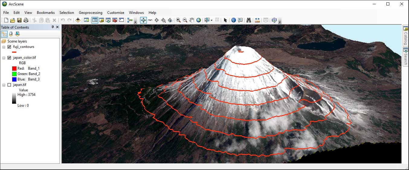
Cartography
You can build powerful maps in ArcGIS. Not only for print. But you can construct maps in 3D and online too. If you don’t have any cartographic skills, ArcGIS has an endless supply of symbology to pick from.
Data
Without data, you don’t have mapping. In ArcGIS, there’s no shortage of data. All you have to do is perform a quick search in ArcGIS Online. This massive data warehouse returns thousands of GIS data sets. In fact, it’s so good that we ranked it #1 in our list of free GIS data sets.
Editing
When you edit data, you can customize it and call it your own. Editing data is easy in ArcGIS. The editing toolbox doesn’t only provide tools to build data. But it also gives you tools for snapping and ensuring quality with topology.
CONS
Interoperability
Consuming specific data types can be difficult in ArcGIS. Over the years, interoperability has improved. But it still lacks capabilities in consuming all data types and GIS formats.
Licenses
ArcGIS has different license levels. Each license provides availability to certain tools. ArcInfo is the highest license available. But if you only have a basic license, you can’t use the entire suite of tools.
Cost
By adding extensions, you add extra capabilities to ArcGIS. But unfortunately, it all comes at a high cost. Despite getting an excellent suite of tools, it’s costly for some organizations.
Ideal for Both Beginners and Seasoned Professionals
Esri ArcMap is a versatile and essential tool in the field of geographic information systems (GIS), providing users with a comprehensive platform for creating, analyzing, and visualizing spatial data.
With its intuitive interface and user-friendly design, ArcMap caters to both beginners and seasoned GIS professionals, making it an invaluable asset for a wide range of applications.
The ability to create visually appealing maps and customize their appearance is another strong suit of ArcMap. Users can easily tailor map layouts, symbology, and labeling to suit their specific requirements, resulting in compelling visualizations that effectively communicate data insights.
One of the standout features of ArcMap is its flexibility in handling various data formats, from shapefiles and raster images to more complex geodatabases. This allows users to seamlessly integrate and manage diverse datasets, ensuring that data interoperability is not a barrier.
Spatial Analysis and Workflows
The array of tools available in ArcMap covers an extensive range of spatial analysis and manipulation tasks, enabling users to perform everything from basic map-making to advanced geoprocessing workflows.
The toolsets cater to different needs, including cartography, data editing, spatial statistics, and modeling, which makes ArcMap a solid companion for projects of varying complexities.
However, it’s worth noting that ArcMap’s interface, while familiar to long-time users, may appear slightly dated compared to newer GIS software offerings. Additionally, the transition towards Esri’s newer software, such as ArcGIS Pro, signals a shift in the company’s focus.
Nonetheless, ArcMap remains a reliable workhorse for many GIS tasks, especially for those who are more comfortable with its traditional interface.
Summary: ArcGIS Review
In this ArcGIS review, we reviewed why ArcGIS has become the industry standard in GIS.
But at the same time, ArcGIS is a big machine with a lot of moving parts.
Experience goes a long way. But since most colleges use it, students graduate with basic knowledge of it.
All things considered, ArcGIS is always well ahead of the curve. We highly recommend it as your GIS software of choice.


I completely agree with Derek. The fact that ESRI has a near monopoly on commercial GIS software shows its signs in the steadily worsening product. If you try QGIS or any other open source software and compare the loading, drawing, and computing times against those of ArcGIS, you’ll be blown away at the difference. In fact, I use(d) arcGIS on corporate machines with immense computational power while on QGIS I’m performing identical operations on my tiny ultrabook in over a 10th of the time it takes on arcGIS. If that isn’t bizarre, I don’t know what is.
Do yourself a favour, skip arcGIS until they decide to put in some effort into their software.
I’ve been using Arcgis for years. It’s gone from BAD to WORSE. Probably the slowest, buggiest, most unreliable piece of software out there. What other software locks itself out of it’s own maps? Corrupts it’s own shapefiles? Takes 10’s of minutes to open a single tiny map? etc…
Arcgis is like playing a bad round of golf everyday. Yeah there are a few moments that play out ok, but most of the time you’ll be cursing at the monitor and wondering how this company is still in business.
Do yourself a favor and use Global Mapper. It does 99% of the same things and it works EVERY TIME.