What is ArcCatalog?
What is ArcCatalog?
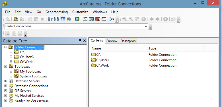
ArcCatalog looks a bit like Windows Explorer. But it doesn’t show all types of files. Instead, it only recognizes GIS formats.
We use it for writing metadata too. It’s through this stand-alone application that writing metadata is simplified.
We’ve already mentioned some key points about ArcCatalog. Today, we’re going to explore this application in more detail. Let’s get started.
ArcCatalog is like a library for your GIS data. Like any good library, you can collect, store and manage your content.
Manage and Organize Data
As mentioned ArcCatalog is like a library for GIS data. But this library only recognizes GIS formats. For example, you can see geodatabases, raster and vector files. But you won’t be able to see PDF files unless you tell it to.
It’s convenient how it re-arranges files into one. For example, there are at least 3 mandatory files that make up a shapefile. In Windows Explorer, you’ll see 3 separate files (SHP, SHX, DBF). But in ArcCatalog, it’s just a single shapefile rolled into one.
ArcCatalog gives you an interface to manage both spatial and non-spatial data. It’s easy to browse for spatial data because of its tree view. The tree view also helps prepare schemas for geodatabases.
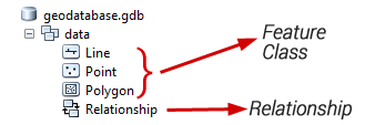
You set up relationships and topology in geodatabases. The easiest way to do this is using the tree view in ArcCatalog. In fact, you won’t be able to view the contents of a geodatabase without ArcCatalog. Here’s what a geodatabase looks like:
Edit Metadata with Convenience
A big part of managing data is creating metadata. Metadata is documentation about data. Creating metadata ensures that essential information about the dataset, such as its source, quality, and usage, is properly documented.
For example, metadata includes:
- When was the data created?
- Who created it?
- How was it made?
If you want to find answers to any of these questions, you can find them in the metadata. Just as long as someone has taken the time to write it. :)
Over the years, various organizations have customized the standards for creating metadata. For example, ISO, FGDC, and INSPIRE are the most common types of metadata. No matter what the metadata standard is, you can set it to your own standard in ArcCatalog.
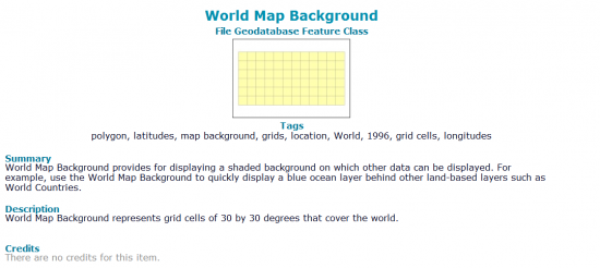
The description tab in ArcCatalog is how you can view, edit, and update metadata. Once you start editing it, this is how you can write metadata. For example, you can include a title, abstract, summary, credits, and lineage.
Preview Data and Geographical Extents
Despite most of the focus in ArcCatalog going to data organization, it also gives basic preview modes. This way, you can see the extent of your data quickly and efficiently.
The preview mode in ArcCatalog isn’t just for seeing the geography of your data. This dual functionality in the preview mode provides you with an overview, allowing you to assess both the spatial and attribute components of your data.
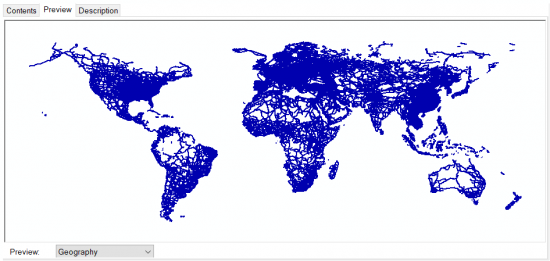
If you want to view your data, you can do this by clicking the preview tab. By selecting the “Geography” preview from the drop-down, this is how you see your features.
But if you want to see your feature records, then select the “Table” from the drop-down. After clicking it, the table will appear in your main window.
Summary: What is ArcCatalog?
ArcCatalog emphasizes storing and manipulating spatial data with a Windows Explorer style.
It recognizes the various formats in GIS. For instance, you can see geodatabases, raster, vector files, and map documents (MXD).
This stand-alone application is also the main way to write metadata through the description tab.
That’s about it for today. Is there anything you want to know about it? Please let us know with a question below.


I’m missing ArcCatalog and wish it came back for Pro