Map of Africa
A map of Africa with countries and labels – It also shows individual countries with outlines for all regions of Africa from north to south.
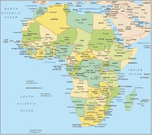
A map of Africa with countries and labels – It also shows individual countries with outlines for all regions of Africa from north to south.
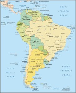
A South America map featuring all countries with labels. This political map shows the geography in a dark blue tone, and white labels.
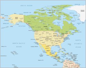
A North America map showing the countries and geography. It includes the Caribbean, Northern, and Central America with each country.
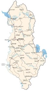
A map of Albania with transportation, cities and water features – Albania is in Southeastern Europe between Greece, Montenegro and Kosovo.
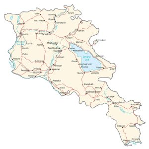
An Armenia map with major cities, roads and waterways. It’s located in the Middle East and borders Azerbaijan, Georgia, Iran and Turkey.
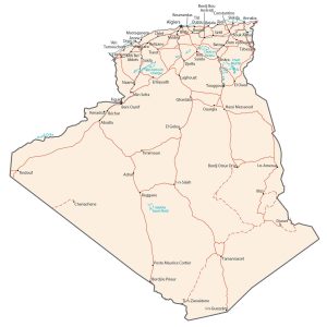
An Algeria map that shows major cities, roads and waterways. Algeria borders the Mediterranean Sea, Morocco and Tunisia in Northern Africa.
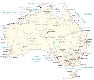
An Australia map featuring major cities, roads and water features – Australia is in Oceania between the Indian Ocean and South Pacific Ocean.
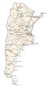
An Argentina Map with cities, transportation and hydrography. Argentina borders the Atlantic Ocean and is located between Chile and Uruguay.
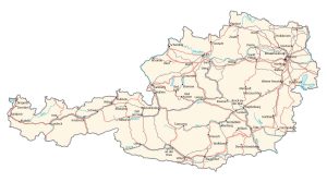
An Austria map with major cities, transportation and water features. Austria is located in Central Europe, north of Italy and Slovenia.
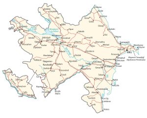
A map of Azerbaijan (physical and reference) located in the Middle East. Azerbaijan is between Iran and Russia, and borders the Caspian Sea.