Location-Allocation in ArcGIS (Site Selection)
Tech-savvy companies are using the location-allocation tool to find optimal location and target market. Here’s an ArcGIS solution to locate your company.
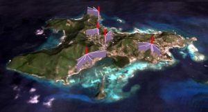
Tech-savvy companies are using the location-allocation tool to find optimal location and target market. Here’s an ArcGIS solution to locate your company.
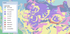
A map legend is used to define features in a map. Point, line and polygon symbols in a legend key is the driving-force to understand what is found in a map.
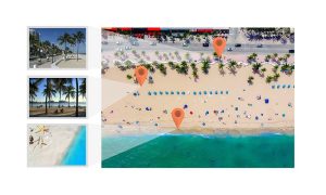
When you take a photo with your GPS on, it stores its physical location where the photo was taken. Geotagging assigns coordinates to photos.
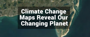
From crop production to melting glaciers, these climate change maps help your grasp a clear understanding of our transforming climate.

There’s a bucket load of free GIS software packages available for you to map the world. Manage, visualize and edit GIS data with open source GIS software.

Map all day. Geoprocess all night. All with open source gvSIG software. gvSIG emerged in 2004. It’s been fine-tuned for close to two decades.

GIS programming often involves a healthy dose of Python, JavaScript, SQL, VB.NET, C++ and HTML. Learn to code and it’s a feather in your cap to a GIS career
Flow direction calculates the direction water will flow in its eight adjacent cells using slope from neighboring cells (in a raster grid cell)
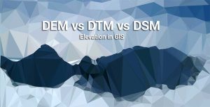
We explore the differences between DEM (bare earth), DSM (natural and built environment) and DTM (vector contours and regularly-spaced points).
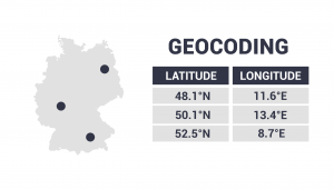
Geocoding takes an address, then translates it to a location on a map. It changes an address to lat long coordinates (latitude and longitude).