Geocoding: Longitude and Latitude by Address
DEFINITION:
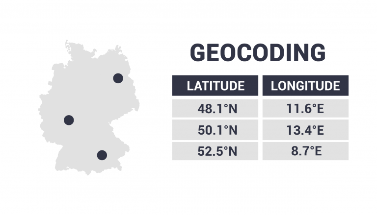
Geocoding is the process of converting a text-based address (like “1600 Amphitheatre Parkway, CA”) into geographic coordinates (like latitude and longitude).
How Does Geocoding Work?
Geocoding takes an address as input and then translates it to a location on a map. In short, it changes an address to latitude and longitude coordinates.
Think about putting an address into Google Maps or using a car navigation system. This is geocoding in action. It’s something that we interact with frequently in everyday life.
Today, we’re going to explain how geocoding works with some practical examples of when we would use geocoding.
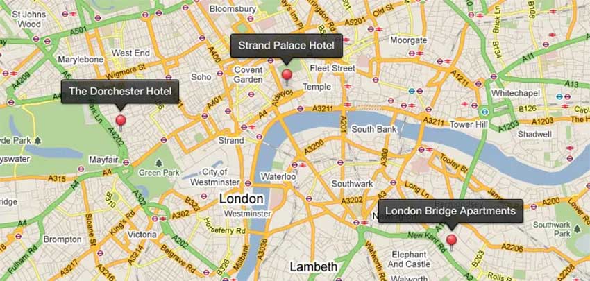
What are Examples of Geocoding?
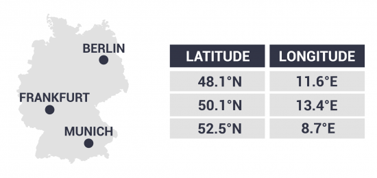
In this simple example, we type in general place names. Then, the geocoder drops the pin in the center of the cities of Berlin, Frankfurt, and Munich.
Depending on the ambiguity of an address, geocoders aim to find the most suitable location. There is a wide range of geocoding services available in use today, so make sure to check out our list of 10 paid and free geocoders.
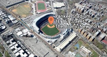
Yankee Stadium
For example, this geocoding example pinpoints Yankee Stadium with the address – 1E 161 St, The Bronx, NY 10451
Fort Lauderdale Beach
In this example, the geocoder drops the pin for Fort Lauderdale Beach in Miami. The marker is less specific because the input is also vague.

How Do We Use Geocoding?
Geocoding is something that we interact with frequently in everyday life. Here are some examples of how we use it:
- Car navigation – After you type in an address, a car navigation system guides you all the way to its final destination. On the dashboard, it drops a location marker giving you every turn within a road network using a routing algorithm.
- Dispatch services – When there’s an emergency, geolocators help guide ambulance, firefighters, and police services. They can even use reverse geocoding to automatically locate the exact coordinates of the user in need of assistance.
- Google Maps – This may be one of the biggest geolocators that we interact with frequently. As you type in any address in Google Maps, it puts a marker on the map with up-to-date aerial and satellite imagery.
What3Words is an alternative to traditional addressing. Instead of a street name and number, What3Words divides the world into 57 trillion 3×3-meter squares. Each square is assigned a random three-word address, making each square completely unique.
What is Reverse Geocoding?
Reverse geocoding is the opposite of traditional geocoding. Instead of taking an address as an input, it starts with a location on a map.
Then, it identifies the address with a street name and number, as well as city, zip code, or postal code.
So reverse geocoding gets an address from latitude and longitude coordinates.
Fun Fact: Null Island consists of the (0, 0) coordinates in the middle of nowhere.


