Belize Map – Cities, Islands and Reefs
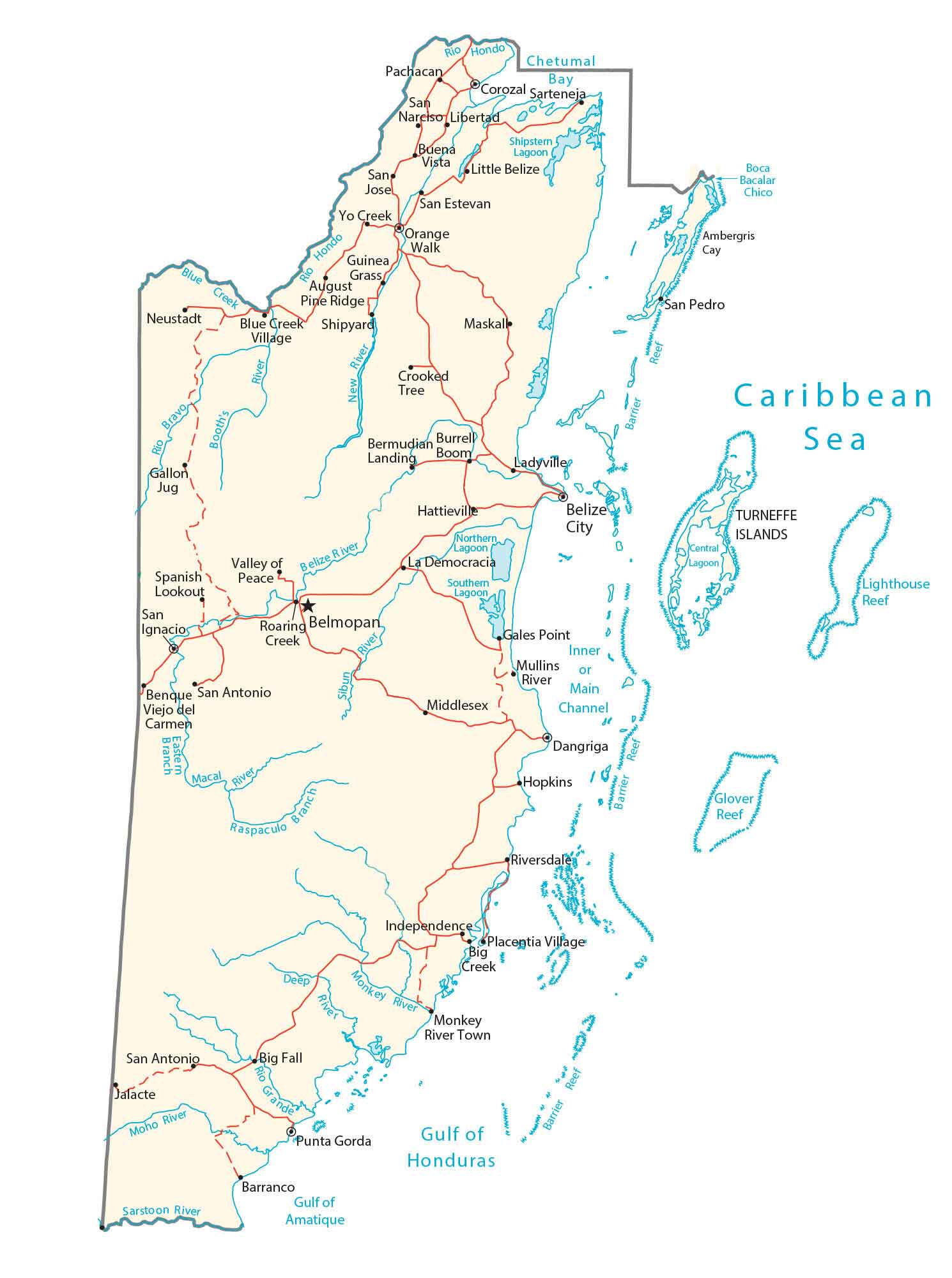
This map of Belize contains major cities, towns, roads, islands, reefs, and rivers. It includes a satellite and physical map to view the topography of Belize and the Belize Barrier Reef.
Belize map collection
You are free to use our Belize map for educational and commercial uses. Attribution is required. How to attribute?
About the map
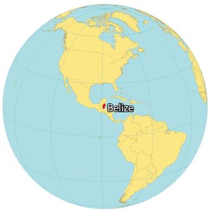
Belize is a country that’s part of Central America, along the Caribbean Sea. It borders just two countries – Guatemala to the southwest and Mexico to the north. Belize is the only country in Central America to not share a coastline along the North Pacific Ocean.
Not only does Belize have the lowest population, but it also has the lowest population density in Central America. The capital city of Belize is Belmopan. But Belize City is the largest in the nation.
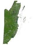
SATELLITE IMAGERY
Belize Satellite Map
Belize occupies an area of 22,970 square kilometers (8,867 sq mi). Although its mainland is about 290 x 110 km in size, it also contains over 450 islands along the east coast. This includes the Belize Barrier Reef which extends toward Mexico, Guatemala, and Honduras. This makes it the longest barrier reef in the Northern and Western Hemispheres.
The Caribbean Sea shorelines are to the east. Whereas dense jungle is characteristic of the western region. This stark contrast between the coastal beauty and the lush wilderness showcases the remarkable diversity of Belize’s natural wonders.

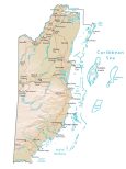
PHYSICAL MAP
Belize Physical Map
The country of Belize is flat, and swampy with a tropical climate. It mostly consists of coastal plains and hilly terrain in the south. At 1,124 m (3,688 ft) in height, Belize’s highest point is Doyle’s Delight in the south.
The major rivers of Belize are the Macal, Moho, and Belize Rivers. Other than the Belize Barrier Reef, its other reefs include the Lighthouse Reef and Glover Reef. According to the FAO, forests cover nearly 80% of Belize, which makes it one of the most heavily forested countries in the world.
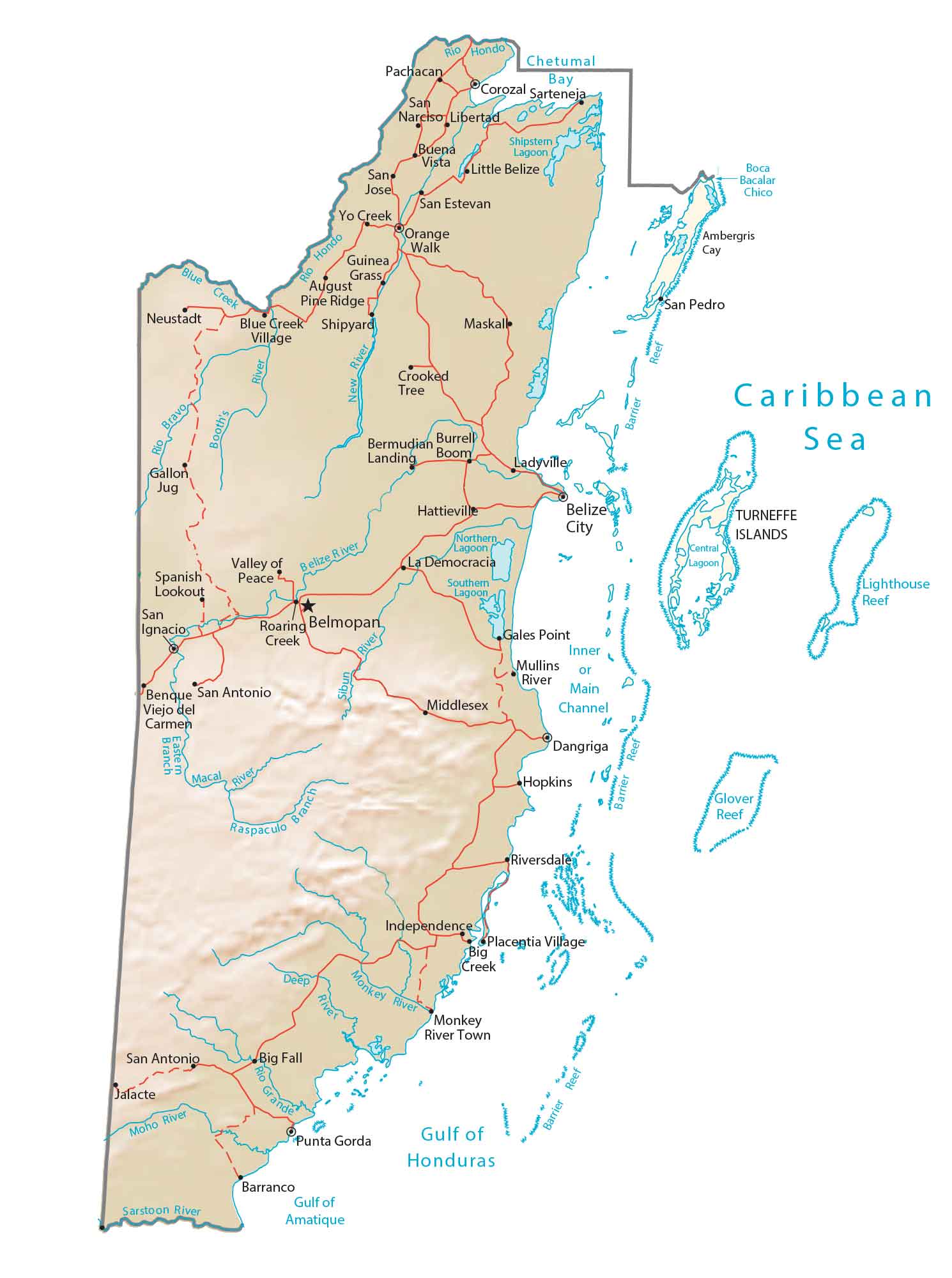
Capital City
Belmopan
Major cities and towns
Belize City
San Ignacio
Corozal
Dangriga
San Pedro
Benque Viejo del Carmen
Punta Gorda
Towns and villages
Neustadt
Gallon Jug
Pachacan
Sarteneja
San Narciso
Buena Vista
Libertad
Little Belize
San Jose
San Estevan
Yo Creek
Orange Walk
Guinea Grass
August Pine Ridge
Blue Creek Village
Shipyard
Crooked Tree
Maskall
Bermudian Landing
Burrell Boom
Ladyville
Hattieville
Spanish Lookout
Valley of Peace
San Antonio
Jalacte
La Democracia
Hopkins
Riversdale
Independence
Monkey River
Placentia Village
Big Creek
Mullins River
Middlesex
Gales Point
Monkey River Town
Big Fall
Barranco
Lakes, rivers and creeks
Blue Creek
Booth’s River
Rio Hondo
Chetumal Bay
Boca Bacalar Chico
Belize River
Roaring Creek
Deep River
Branch Eastern
Moho River
Sarstoon River
Macal River
Raspaculo Branch
Inner or Main Channel
Seas and gulfs
Caribbean Sea
Gulf of Amatique
Gulf of Honduras
Islands, cays and reefs
Ambergris Cay
Turneffe Islands
Glover Reef
Lighthouse Reef
Lagoons
Shipstern Lagoon
Northern Lagoon
Southern Lagoon
Central Lagoon