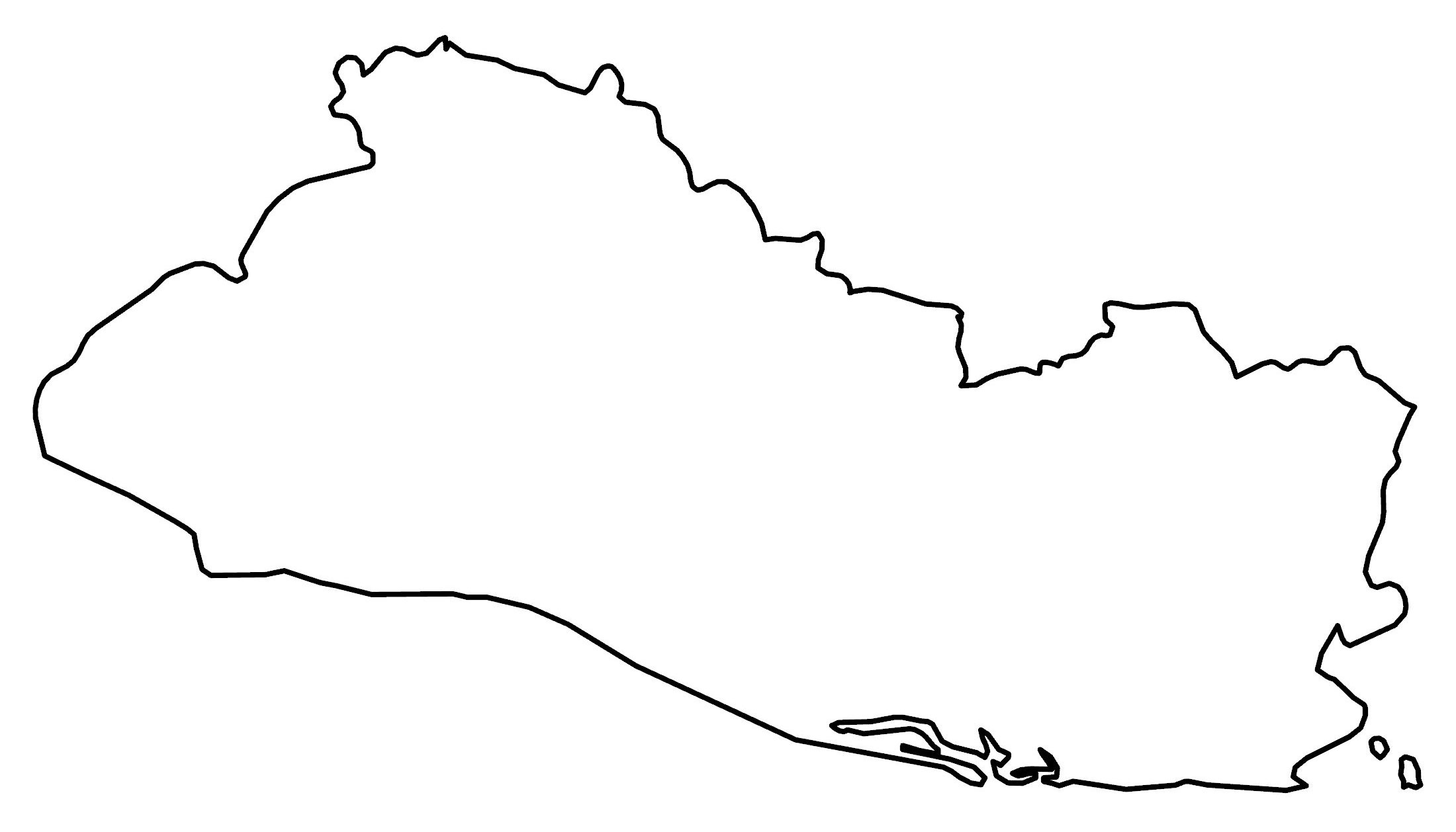
El Salvador Map – Cities and Roads
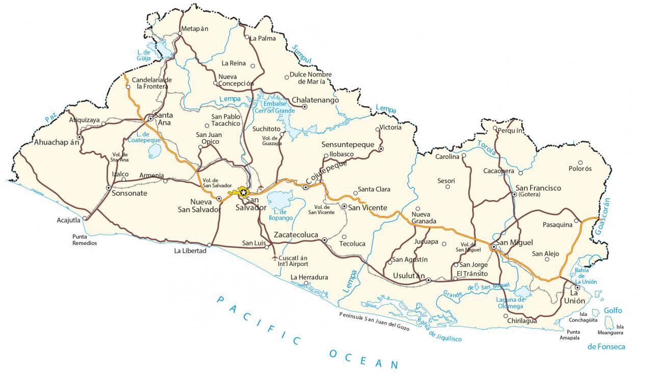
This El Salvador map contains major cities, towns, and roads. Nicknamed the “Land of Volcanoes”, an elevation map and satellite imagery show its volcanic topography and the Sierra Madre Mountains.
El Salvador map collection
You are free to use our El Salvador map for educational and commercial uses. Attribution is required. How to attribute?
About the map
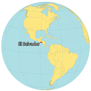
El Salvador is the smallest country in Central America. Unlike any other Central American country, it does not have a Caribbean coastline. Instead, it has roughly 300 kilometers (186 mi) of coastline along the Pacific Ocean and Gulf of Fonseca. Otherwise, it borders Guatemala to the northwest and Honduras to the northeast.
El Salvador is densely populated with nearly 7 million people. San Salvador is the capital and largest city of San Salvador. The country is nicknamed the “land of volcanoes” because every major city has one next to it. Almost every volcano has the same name as the city that it’s closest to.
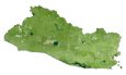
SATELLITE IMAGERY
El Salvador Satellite Map
El Salvador occupies an area of 21,040 square kilometers, which is almost identical in size to Belize. Its longest river is the Lempa River, which flows for 422 kilometers (262 mi). Lake Coatepeque and Ilopango are the two great lakes of El Salvador, both lie on dormant caldera volcanoes.
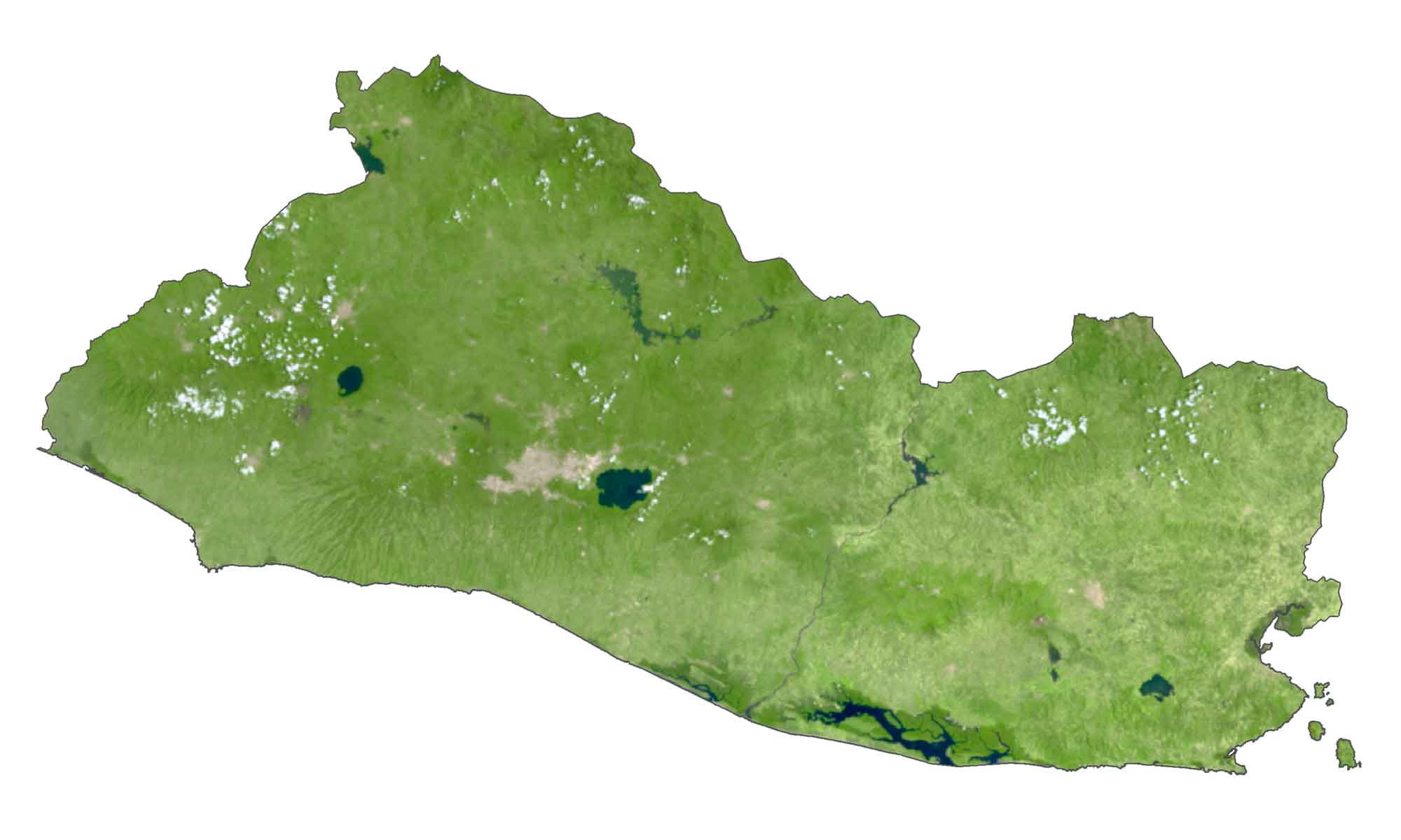
Impossible National Park is a tropical forest and a national park in southwest El Salvador. It contains the Ruta de las Flores, which is like a walk-through story of the history of El Salvador.
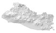
PHYSICAL MAP
El Salvador Elevation Map
There are three geographic regions in El Salvador. First, the Central Plateau consists of about 20 active volcanoes, making up the Sierra Madre Mountains. Secondly, the Pacific coastal belt is characterized by its lowlands and beaches.

Finally, the Lempa River Valley forms the lowlands in the north. The Cocos Plate is a subducting plate where it converges with the Caribbean Plate and is the source of earthquake activity in the territory. Overall, the highest point in El Salvador is Cerro El Pital, at 2,730 meters (8,957 ft).
Capital City
San Salvador
Major cities
Ahuachapán
Chalatenango
Cojutepeque
La Unión
Nueva San Salvador
San Miguel
San Francisco
Santa Ana
Sonsonate
Usulutan
Zacatecoluca
Cities and towns
Acajutla
Armenia
Atiquizaya
Cacaopera
Carolina
Candelaria de la Frontera
Chirilagua
Dulce Nombre de María
El Tránsito
Ilobasco
Izalco
Juguapa
La Herradura
La Libertad
La Palma
La Reina
Metapán
Nueva Concepción
Nueva Granada
Pasaquina
Perquín
Polorós
Punta Remedios
San Agustín
San Alejo
San Jorge
San Juan Opico
San Luis
San Pablo Tacachico
San Vicente
Santa Clara
Sensuntepeque
Sesori
Suchitoto
Tecoluca
Victoria
Lakes, rivers and creeks
Bahía de La Unión
Cerrón Grande Reservoir
Grande San Miguel River
Gulf of Fonseca
Lake Coatepeque
Lake Güija
Lake llopango
Lempa River
Paz River
Sumpul River
Torola River
Pacific Ocean
Laguna de Oldmega
Volcanoes
Guazapa Volcano
San Salvador Volcano
Santa Ana Volcano
San Vincente Volcano
San Miguel Volcano
Other features
Cuscatlán Int’l Airport
Península San Juan del Gozo