Bhutan Map – Cities and Roads
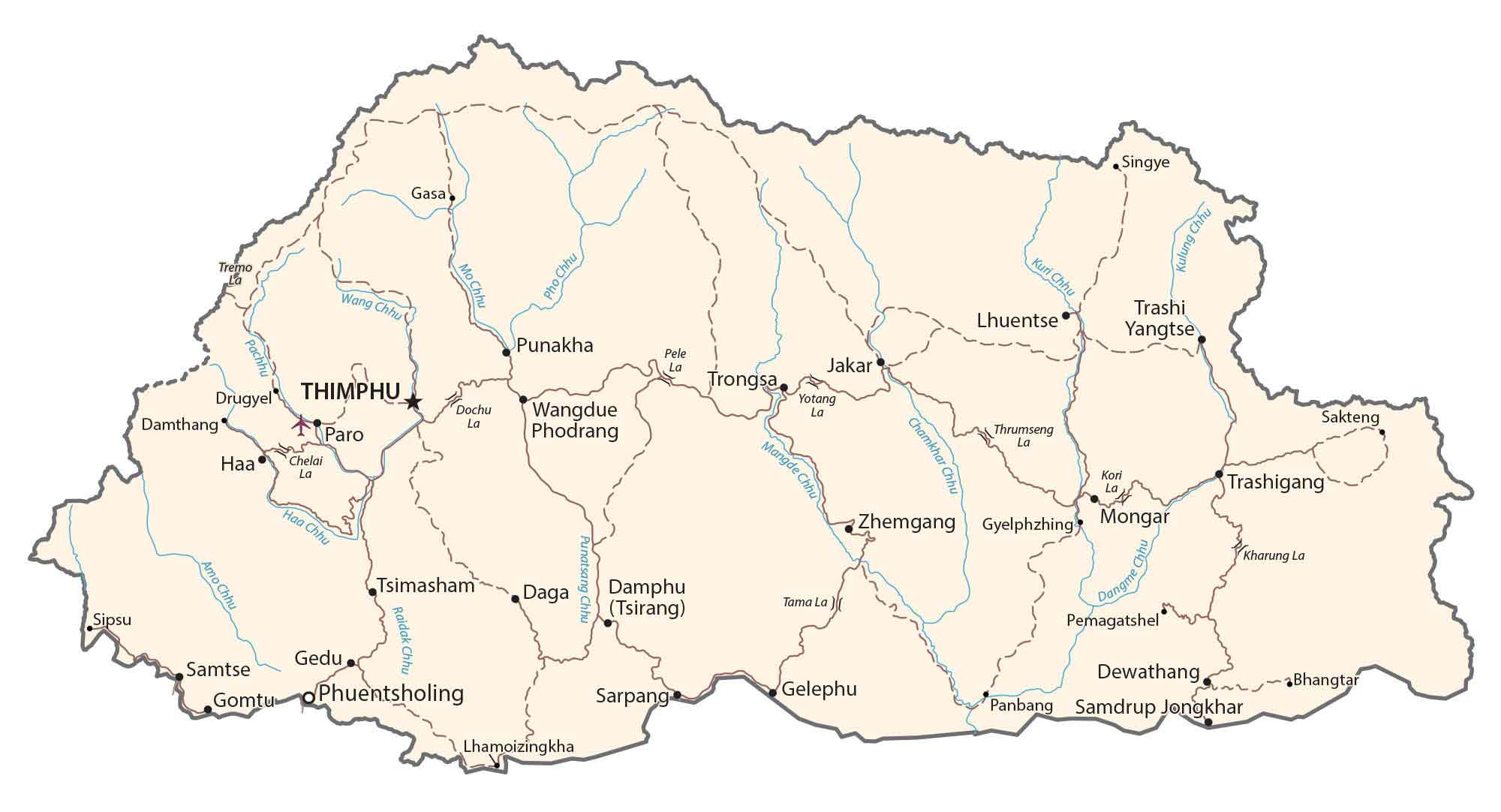
This map of Bhutan has satellite imagery, elevation, and reference information. Also, it displays major cities, towns, roads, rivers, administrative districts, and topographic features such as the Great Himalayas Range.


You are free to use our Bhutan map for educational and commercial uses. Attribution is required. How to attribute?
About the map
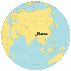
Bhutan is a landlocked country located in Southern Asia on the eastern edge of the Himalayas. It borders just 2 countries with China located to the north and India to the south. Although both Nepal and Bangladesh are near Bhutan, these countries don’t share a border.
The origin of the name “Bhutan” is “Land of the Thunder Dragon”. This is derived from the thunderous storms that occur in Bhutan due to the Great Himalayas Range. Although Bhutan is known to measure national happiness, it still ranks relatively low due to its poverty.
SATELLITE IMAGERY
Bhutan Satellite Map
Bhutan occupies an area of 38,394 square kilometers (14,824 sq mi). It’s one of the smaller countries tucked away in Southern Asia, similar in size to Taiwan. Bhutan preserves 60% of its land as a forested area.
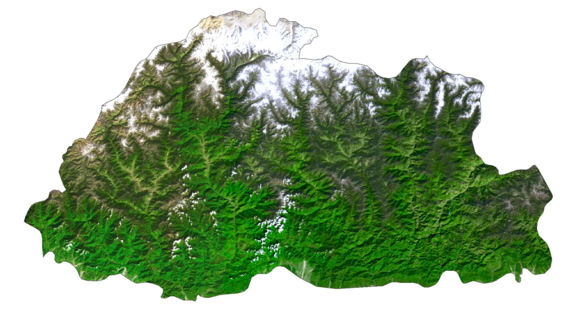
Currently, forests cover over 70% of Bhutan, which makes it one of the most heavily forested countries today. It’s the combination of its unscathed nature and mountainous terrain that helps plot out its national parks and wildlife sanctuaries. When you mix this with Bhutan’s ancient ruins and temples, the country is a hidden gem for tourism.
PHYSICAL MAP
Bhutan Physical Map
The terrain of Bhutan is mostly a dramatic landscape of mountains with some valleys and savannas. The general trend is that it’s mountainous in the northern and western regions. Then, it flattens out to the southeast.
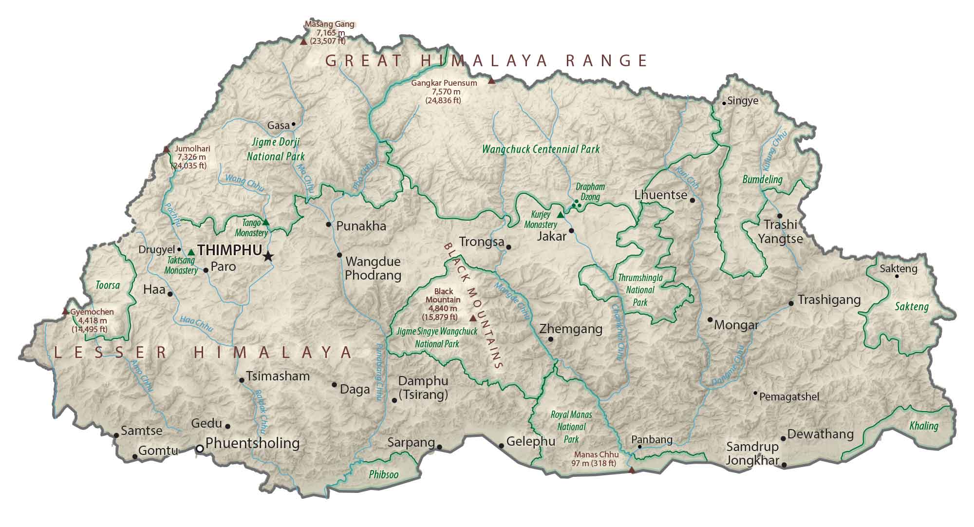
The most notable geographic feature is the Great Himalayas Range which dominates the north. Whereas, the Lesser Himalayas and the Black Mountains lie in the west and central regions. Gangkar Puensum is the highest point in Bhutan reaching 7,570 meters (24,836 ft) in height. This mountain peak straddles the border between Bhutan and China, along the northern edge of the country.
POLITICAL MAP
Bhutan Districts Map
Bhutan is divided into 20 administrative districts. Thimphu is the capital and largest city of Bhutan. It’s also an administrative building, which holds most of the political buildings in Bhutan. For example, it includes the National Assembly and Dechencholing Palace, which is the official residence of the King of Bhutan.

Capital City
Thimphu
Major cities and towns
Phuentsholing
Paro
Gelephu
Punakha
Wangdue Phodrang
Samtse
Cities and towns
Gasa
Drugyel
Damthang
Gyelphzhing
Bhangtar
Sakteng
Damphu
Dangme
Pemagatshel
Sarpang
Dewathang
Lhamoizingkha
Panbang
Samdrup
Jongkhar
Sipsu
Haa
Trongsa
Jakar
Lhuentse
Trashi Yangtse
Trashigang
Mongar
Zhemgang
Tsimasham
Daga
Gomtu
Gedu
Rivers and creeks
Wang River
Pho River
Raidak River
Amo River
Kuri River
Kulung River
Haa River
Mangde River
Mountains and passes
Great Himalaya Range
Lesser Himalaya
Black Mountains
Tremo Pass
Pele Pass
Dochu Pass
Chelai Pass
Yotang Pass
Thrumseng Pass
Kori Pass
Kharung Pass
Parks and reserves
Wangchuck Centennial Park
Jigme Dorji National Park
Thrumshingla National Park
Bumdeling Wildlife Sanctuary
Sakteng Wildlife Sanctuary
Khaling Wildlife Sanctuary
Royal Manas National Park
Toorsa Nature Reserve