What is COGO (COordinate GeOmetry)?
DEFINITION:
COGO (Coordinate Geometry) is a method surveyors use to calculate exact positions, distances, and angles using geometry and coordinates.
COGO (COordinate GeOmetry)
COGO (Coordinate Geometry) is a civil engineering tool that assists in mapping the geometry from survey plans.
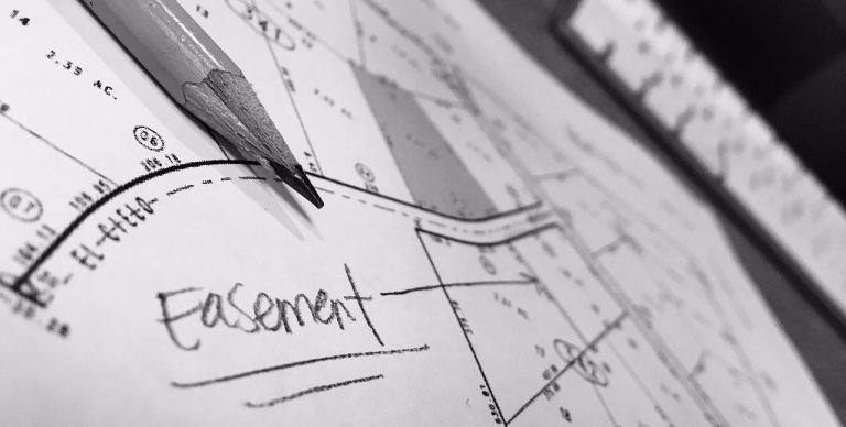
For example, survey plans include anything from land parcels, road allowances, and property easements. When surveyors record bearings, angles, and horizontal distances, these are attributes that go into COGO.
Generally, this type of geometry is from a topographic survey describing a series of consecutive lines, which can tie into existing parcel mapping.
Let’s explore how to edit with Coordinate Geometry and some of the advantages of using it.
The Geometry of COGO
COGO lines typically start at a point of beginning (POB). From there, you can incorporate simple straight or curved lines as courses.
In GIS, traverse files store courses, which is the main method for storing a detailed topographic survey. There are two types of traverses:
CLOSED TRAVERSE: A closed traverse will start and end at a known point.
OPEN TRAVERSE: An open traverse starts at a known point and does not end at a known point.
Commonly, survey plans are a closed traverse and it’s COGO that facilitates the entry of coordinates, distances, and angles.
Editing Tools with COGO
In ArcGIS Pro, you start by creating an empty feature class in a geodatabase. In the editing tab, select the feature and click “Modify” to access the COGO functionality.
The main tools for COGO are:
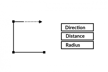
TRAVERSE: Create features by entering the direction, distance, radius, and arc length of each line segment from a survey plan.
UPDATE COGO: Updates the COGO attributes to match the geometry of line segments
CUL-DE-SAC: Builds a cul-de-sac aligning with the centerline of a road and street width.
SPLIT INTO COGO LINES: Splits a line or arc at each vertex.
Some of the other common tools related to COGO geometry include:
| Tool | Description |
|---|---|
| Extend | Extends a line from an existing feature based on a specific distance. |
| Trim | Trims a line from an existing feature based on a selected location. |
| Fillet | Reshapes a sharp angle into a circular arc based on selected locations. |
| Split | Divides features into multiple features. |
Attributes in COGO
When you digitize a traverse, some of the common COGO attributes include:
- Direction – The bearing of the line segment from start to endpoint.
- Distance – The length of the line segment with a specified unit.
- Radius – The distance between the curved line and the center point.
- Tangent – The distance at the point of tangency.
- ArcLength – The length between the start and endpoint of the curved line.
- Side – The side location of the center point.
You can describe the COGO geometry of any line segment by using the attributes above.
READ MORE: GIS Editing Tools [Cheatsheet]
COGO Editing Tools
- CoGo QGIS Plugin – A plugin to capture coordinates, bearings and distances and to use these to construct and manage land parcels.
- Coordinate Geometry in ArcGIS Pro – Learn how to delineate survey plans in ArcGIS Pro using the Traverse Tool.


great