The Ultimate List of GIS Formats and Geospatial File Extensions
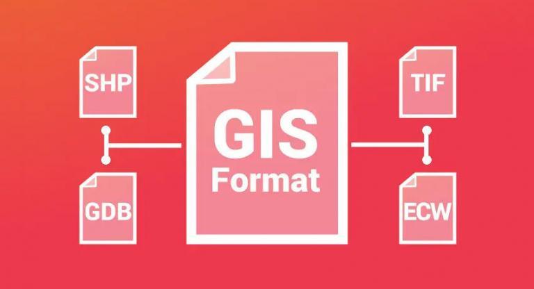
GIS formats – Pick your poison
Because an unknown GIS file format can be any GIS analyst’s worst nightmare…
We’ve got you covered with our comprehensive list of GIS formats.
Some geospatial data formats are common. But some are not so common.
First, take a look at these 63 formats in GIS (and still growing!) Then, bookmark it for future reference:
Vector GIS File Formats
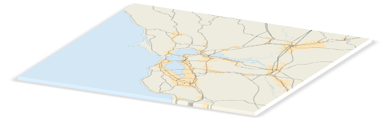
Vector data is not made up of grids of pixels. Instead, vector graphics are comprised of vertices and paths.
The three basic symbol types for vector data are points, lines, and polygons (areas). These GIS file formats house vector data.
READ MORE: GIS Spatial Data Types: Vector vs Raster
| File Type and Extension | Description |
|---|---|
| Esri Shapefile .SHP, .DBF, .SHX | The shapefile is BY FAR the most common geospatial file type you’ll encounter. All commercial and open source accept shapefile as a GIS format. It’s so ubiquitous that it’s become the industry standard. But you’ll need a complete set of three files that are mandatory to make up a shapefile. The three required files are: –SHP is the feature geometry. –SHX is the shape index position. –DBF is the attribute data. You can optionally include these files but are not completely necessary. –PRJ is the projection system metadata. –XML is the associated metadata. –SBN is the spatial index for optimizing queries. –SBX optimizes loading times. |
| Geographic JavaScript Object Notation (GeoJSON) .GEOJSON .JSON | GeoJSON is a format for encoding geographic data structures, such as points, lines, and polygons, using JavaScript Object Notation (JSON). It is one of the most common open-standard formats for online web mapping applications. |
| Geography Markup Language .GML | GML allows for the use of geographic coordinates extension of XML. And eXtensible Markup Language (XML) is both human-readable and machine-readable. GML stores geographic entities (features) in the form of text. Similar to GeoJSON, GML can be updated in any text editor. Each feature has a list of properties, geometry (points, lines, curves, surfaces, and polygons), and a spatial reference system. There is generally more overhead when comparing GML with GeoJSON. This is because GML results in more data for the same amount of information. |
| Google Keyhole Markup Language .KML .KMZ | KML stands for Keyhole Markup Language. This GIS format is XML-based and is primarily used for Google Earth. KML was developed by Keyhole Inc which was later acquired by Google. KMZ (KML-Zipped) replaced KML as being the default Google Earth geospatial format because it is a compressed version of the file. KML/KMZ became an international standard of the Open Geospatial Consortium in 2008. The longitude and latitude components (decimal degrees) are as defined by the World Geodetic System of 1984 (WGS84). The vertical component (altitude) is measured in meters from the WGS84 EGM96 Geoid vertical datum. Remember that it’s always possible to convert a KMZ to KML (and vice versa). |
| GPS eXchange Format .GPX | GPS Exchange format is an XML schema that describes waypoints, tracks, and routes captured from a GPS receiver. Because GPX is an exchange format, you can openly transfer GPS data from one program to another based on its description properties. The minimum requirements for GPX are latitude and longitude coordinates. In addition, GPX files optionally store location properties including time, elevation and geoid height as tags. |
| IDRISI Vector .VCT .VDC | The IDRISI .VCT format stores the geometry of vector data in IDRISI GIS software. The .VDC format contains metadata about the vector data. For example, it includes the coordinate system, attributes, and layer information. |
| MapInfo TAB .TAB .DAT .ID .MAP .IND | MapInfo TAB files are a proprietary format for MapInfo software. Similar to shapefiles, they require a set of files to represent geographic information and attributes. –TAB files are in ASCII format that link the associated ID, DAT, MAP, and IND files. –DAT files contain the tabular data associated as a dBase DBF file. –ID files are index files that link graphical objects to database information. –MAP files are the map objects that store geographic information. –IND files are index files for the tabular data. |
| Open Street Map OSM .XML | OSM files are the native file for OpenStreetMap which had become the largest crowdsourcing GIS data project in the world. These files are a collection of vector features from crowd-sourced contributions from the open community. The GIS format OSM is OpenStreetMap’s XML-based file format. The more efficient, smaller PBF Format (“Protocolbuffer Binary Format”) is an alternative to the XML-based format. The data interoperability in QGIS can load native OSM files. The OpenStreetMap plugin can convert PBF to OSM, which then can be used in QGIS. |
| Digital Line Graph .DLG | Digital Line Graph (DLG) files are vectors in nature that were generated on traditional paper topographic maps. For example, this includes townships & ranges, contour lines, rivers, lakes, roads, railroads and towns. Much of the U.S. Bureau of Census Topologically Integrated Geographic Encoding and Referencing (TIGER) data were generated using the standard DLG format. |
| Geographic Base File-Dual Independent Mask Encoding (GBF-DIME) | The GPF-DIME file format was developed by the US Census Bureau in the late 1960s as one of the first GIS data formats to exist. It was used to store the US road network for major urban areas, which is a key factor in census information. GPF-DIME supports choropleth mapping and also assisted in removing error for digitizing features. DIME was a key component to the current TIGER (Topologically Integrated Geographic Encoding and Referencing) system, which was produced by the US Census Bureau. |
| ArcInfo Coverage | ArcInfo Coverages are a set of folders containing points, arcs, polygons or annotations. Tics are geographic control points and help define the extent of the coverage. Attributes are stored in the ADF or INFOb tables. Each feature is identified with a unique number. These feature numbers are a way to link attribute data with each spatial feature. Coverages were the standard format during the floppy disk era. But over time, this GIS format has become obsolete and mostly unsupported in GIS software. |
Raster GIS File Formats
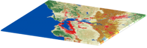
Raster data is made up of pixels (also referred to as grid cells). They are usually regularly spaced and square but they don’t have to be.
Rasters have pixels that are associated with a value (continuous) or class (discrete).
READ MORE: Raster Resampling for Discrete and Continuous Data
| File Type and Extension | Description |
|---|---|
| ERDAS Imagine .IMG | ERDAS Imagine IMG files is a proprietary file format developed by Hexagon Geospatial. IMG files are commonly used for raster data to store single and multiple bands of satellite data. IMG files use a hierarchical format (HFA) that is optional to store basic information about the file. For example, this can include file information, ground control points, and sensor type. Each raster layer as part of an IMG file contains information about its data values. For example, this includes projection, statistics, attributes, pyramids and whether or not it’s a continuous or discrete type of raster. |
| American Standard Code for Information Interchange ASCII Grid .ASC | ASCII uses a set of numbers (including floats) between 0 and 255 for information storage and processing. They also contain header information with a set of keywords. In their native form, ASCII text files store GIS data in a delimited format. This could be comma, space or tab-delimited format. Going from non-spatial to spatial data, you can run a conversion process tool like ASCII to raster. |
| GeoTIFF .TIF .TIFF .OVR | The GeoTIFF has become an industry image standard file for GIS and satellite remote sensing applications. GeoTIFFs may be accompanied by other files: –TFW is the world file that is required to give your raster geolocation. –XML optionally accompany GeoTIFFs and are your metadata. –AUX auxiliary files store projections and other information. –OVR pyramid files improves performance for raster display. |
| IDRISI Raster .RST .RDC | IDRISI assigns RST extensions to all raster layers. They consist of numeric grid cell values as integers, real numbers, bytes and RGB24. The raster documentation file (RDC) is a companion text file for RST files. They assign the number of columns and rows to RST files. Further to this, they record the file type, coordinate system, reference units and positional error. |
| Envi RAW Raster .BIL .BIP .BSQ | Band Interleaved files are a raster storage extension for single/multi-band aerial and satellite imagery. –BIL (Band Interleaved for Line) stores pixel information based on rows for all bands in an image. –BIP (Band interleaved by pixel) assigns pixel values for each band by rows. –BSQ (Band sequential format) stores separate bands by rows. BIL files consist of a header file (HDR) that describes the number of columns, rows, bands, bit depth and layout in an image. |
| PCI Geomatics Database File (PCIDSK) .PIX | PIX files are raster storage layers developed by PCI Geomatics. It’s a flexible file type that stores all image and auxiliary data called “segments” in a self-contained file. For example, segments can include image channels, training site, and histogram information. As a database file, PIX files can hold raster channels with varying bit depths. They can also store projections, attribute information, metadata and imagery/vectors. |
| Esri Grid | Grid files are a proprietary format developed by Esri. Grids have no extension and are unique because they can hold attribute data in a raster file. But the catch is that you can only add attributes to integer grids. Attributes are stored in a value attribute table (VAT) – one record for each unique value in the grid, and the count representing the number of cells. The two types of Esri Grid files are integer and floating point grids. Land cover would be an example of a discrete grid. Each class has a unique integer cell value. Elevation data is an example of a floating point grid. Each cell represents an elevation floating value. |
Compressed Raster File Formats
Lossy GIS compression reduces file size by permanently eliminating certain information, especially redundant information (even though the user may not notice it).
These lossy compression algorithms often result in greater reductions in file size. Here are examples of highly compressed GIS formats.
READ MORE: Lossless Compression vs Lossy Compression
| File Type and Extension | Description |
|---|---|
| ER Mapper Enhanced Compression Wavelet .ECW | ECW is a compressed image format typically for aerial and satellite imagery. This GIS file type is known for its high compression ratios while still maintaining quality contrast in images. ECW format was developed by ER Mapper, but it’s now owned by Hexagon Geospatial. |
| Joint Photographic Experts Group JPEG2000 .JP2 | JPEG 2000 typically have a JP2 file extension. They are a wavelet compression with the latest JPG format giving an option for lossy or lossless compression. JPEG 2000 GIS formats require a world file which gives your raster geolocation. They are an optimal choice for background imagery because of its lossy compression. JPEG 2000 can achieve a compression ratio of 20:1 which is similar to MrSID format. |
| LizardTech Multiresolution Seamless Image Database MrSID .SID .SDW | LizardTech’s proprietary MrSID format is commonly used for orthoimages in need of compression. MrSID images have an extension of SID and are accompanied with a world file with the file extension SDW. MrSIDs have impressive compression ratios. Color images can be compressed at a ratio of over 20:1. LizardTech’s GeoExpress is the software package capable of reading and writing MrSID format. |
Geographic Database File Formats
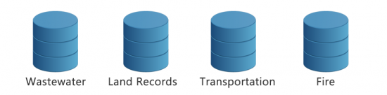
We store geographic data in various database file formats. Databases are structured sets of data/information.
But the key difference is that geographic databases allow the storage of location information.
READ MORE: Spatial Databases – Build Your Spatial Data Empire
| File Type and Extension | Description |
|---|---|
| Esri File Geodatabase .GDB | Esri created the file geodatabase to be a container for storing multiple attribute tables, vector and raster data sets. It’s the successor of the personal geodatabase (MDB) – and Esri recommends file geodatabases over personal geodatabases. File geodatabases offer structural and performance advantages. They have fast performance, versatile relationships, compatible storage for rasters, improved spatial indexes, data compression, customizable configuration, and 1 terabyte file size restrictions. Within a geodatabase, geographic datasets are referred to as feature classes. But geodatabases can store more complex data such as networks, raster mosaics, and feature data sets. READ MORE: What is a Geodatabase? Personal vs File Geodatabase |
| Esri Personal Geodatabase .MDB | Personal geodatabases use the default Microsoft Access database file extension (MDB). They used to be the most ubiquitous database type for managing geospatial data. Personal geodatabases were advantageous because you could manage multiple attribute tables, vector and raster datasets and create relationship classes. But their biggest drawback was their limited 2GB in storage capacity. Whereas file geodatabases offer 2TB of capacity. In the end, you’d quickly reach storage capacity with personal geodatabases just by adding a couple of raster and vector data sets. |
| OGC GeoPackage .GPKG | GPKG are self-contained serverless SQLite databases that can contain anything from vector, tiles, rasters, layer attributes, and even extensions. Unlike shapefile which have 3 mandatory files, this open standards geospatial container is easy to share because it’s all contained in a single file. |
| Mapbox MBTiles .MBTILES | MBTILES are for storing and packaging sets of raster or vector map tiles in a single file. The file format is based on a SQLite database. The only coordinate system MBTiles support is spherical Mercator. MBTiles file formats are designed for Mapbox and other web/mobiles applications. |
| GE Smallworld Version Managed Data Store .VMDS | Smallworld software is widely used in electrical, telecommunication, gas, water and utilities. It uses the VMDS “Version Managed Data Store” for database storage. VMDS stores multiple types of raster and vector geometries in spatial and topological utility networks. They are also capable of querying and analysis in GE Smallworld. |
| SpatiaLite .SL3, .SQLITE | SpatiaLite uses the SQLite database engine. But SpatiaLite extends SQLite by giving it spatial capabilities. SpatiaLite give similar functionality to geodatabases and are the rough equivalence to PostgreSQL + PostGIS. They are open source and lightweight with the ability to hold spatial and non-spatial files in a single file container. |
Relational Database Management System (RDBMS) Enterprise
Relational Database Management Systems (RDBMS) are commonly used for multi-user editing environments.
They also support versioned editing, backups, and recovery of an enterprise database over the same network.
| File Type and Extension | Description |
|---|---|
| PostGIS + PostgreSQL | Open source PostGIS adds spatial objects to the cross-platform PostgreSQL database. The three features that PostGIS delivers to PostgreSQL DBMS are spatial types, indexes and functions. With support for different geometry types, the PostGIS spatial database allows querying and managing information about locations and mapping. PostGIS can be leveraged in several GIS software packages including QGIS, GRASS, ArcGIS, and MapInfo. |
| ArcSDE Enterprise Geodatabase + (Oracle, Microsoft SQL Server, IBM DB2) | Relational Database Management Systems (RDBMS) and ArcSDE support versioned editing, backups, and recovery with multiple users over the same network. DBMS storage models include Oracle, Microsoft SQL Server, IBM DB2/Informix, and PostgreSQL. ArcSDE serves data in a centralized way over an entire organization using a relational database management system. End-users can access spatial data in an Esri environment and seamlessly edit and analyze data in an enterprise geodatabase. |
LiDAR File Formats
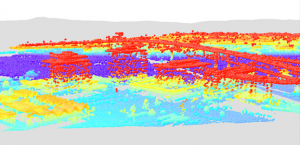
The growth of Light Detection and Ranging (LiDAR) technology has revolutionized how we view the surface of Earth.
As point cloud data, LiDAR is a dense network of coordinate points with elevation values. These GIS formats require specialized software or extensions to view or edit.
| File Type and Extension | Description |
|---|---|
| ASPRS LiDAR Data Exchange Format .LAS, .LASD, .LAZ | The LAS file format is a binary file format specifically for the interchange between vendors and customers. Overall, LAS files maintain information specific to LIDAR without the loss of information. LAS files are available for public use, unlike ASCII and other proprietary file formats. The dense networks of coordinate point measurements are so large sometimes that they often need to be split to prevent the file size from becoming too large. When you compress a LAS file, the file format specifically for this is LAZ. You can save significant storage space using the LAZ file format. Like most file compression, LAZ has no information loss. Lastly, LAS Datasets (LASD) reference a set of LAS files. The purpose of LASD is to be able to examine 3D point cloud properties from the referenced LAS files. Through LAS datasets, you can visualize triangulated surfaces and perform statistical analysis. |
| Point Cloud XYZ .XYZ | XYZ files don’t have specifications for storing point cloud data. The first 3 columns generally represent X, Y and Z coordinates. But there’s no standard specification so it may include RGB, intensity values and other LiDAR values. They are in the ASCII point cloud group of file formats which includes TXT, ASC, and PTS. Non-binary files like XYZ are advantageous because they can be opened and edited in a text editor. |
CAD File Formats
CAD (computer-assisted drafting) often goes hand-in-hand with Geographic Information System (GIS). GIS imports design models that were likely built in Autodesk or Bentley Systems MicroStation.
| File Type and Extension | Description |
|---|---|
| Autodesk Drawing .DWF, .DWG, .DXF | Autodesk CAD (computer-assisted drafting) file formats are designed for 2D and 3D designs. They generally contain elements such as edges, curves, and annotation text in layers. DWG/DXF are vector files that use Cartesian coordinates. Every element plots XY points in a grid. –DWF (Design Web Format) is more specific for view and use on the internet. –DWG (DraWinG) is the native format and working version for AutoCAD containing metadata. –DXF (Drawing Exchange Format) stores drawing information as exact representations of the data. But the purpose of DXF was for data exchange between CAD programs. It’s possible to convert DWG to SHP (and in reverse SHP to DWG). But it can be tricky to retain attributes from CAD to GIS software. |
| Bentley Microsystems DGN File Format .DGN | DGN or “Design” is the native format for Bentley Systems MicroStation. Similar to other CAD design formats, engineers and architects use it for construction design. DGN files consist of layers including annotation, points, polylines, polygons, and multipath. They also contain style information (ColorIndex) and a spatial reference system. |
Elevation File Formats
Elevation file formats are specific to digital elevation model products. For example, the USGS DEM and Canadian CDED capture regularly-spaced elevation values in a raster grid.
| File Type and Extension | Description |
|---|---|
| USGS DEM, Canadian CDED .DEM | The DEM format are raster-based ASCII files specifically developed by the USGS to capture digital elevation models. They are widely used in the industry because of the high volume of legacy elevation models produced by the USGS. The DEM format is a single file containing 3 record types. -Record A stores general characteristics of the DEM such as descriptive name, elevation minimum and maximum, extent boundaries and number of B records. -Record B contains a header and elevation profile. -Record C stores the accuracy of the data and is optional. |
| Digital Terrain Elevation Data (DTED) .DT0 .DT1 .DT2 | Digital Terrain Elevation Data (DTED) is a standard format created by the National Geospatial-Intelligence Agency. They are a raster format consisting of terrain elevation values often captured from aircraft radar. User-defined attributes are assigned through TAB files. The 3 levels of resolutions contain various cell-spacing resolution: – Level 0 spacing is 30 arc second spacing (nominally one kilometer) – Level 1 spacing is 3 arc seconds (approximately 100 meters) – Level 2 spacing is 1 arc second (approximately 30 meters) |
Web File Formats
These web file formats are built specifically to serve and display geographic features over the internet.
Although there are other web-based file formats that store geographic data (such as GeoJSON), these file formats are unique to web mapping.
READ MORE: An Introduction to Web Mapping Services (WMS)
| File Type and Extension | Description |
|---|---|
| GeoRSS URL .XML | Websites publish RSS feeds to subscribers, which are provided in a XML file. GeoRSS extends XML feeds to include geographic data. The GeoRSS specification describes how to add spatial geometries like points, lines and polygons to XML feeds. Webfeeds with location have become a tool for disaster notification. For example, the USGS publishes real-time earthquakes through GeoRSS. Now, RSS have locations. |
| Web Feature Service (WFS) URL | Web feature services allows users to share geospatial (or non-spatial) over the internet. Thus, feature services can be consumed through the internet in webmaps, desktop and web applications. Users access web features services by pointing to the REST endpoints or URL. – Web Feature Services (WFS) are for editing features – Web Mapping Services (WMS) display features without editing capabilities |
| Esri ArcGIS Online Web Services URL | ArcGIS Online is Esri’s cloud-based platform that allows users to publish content online to share collaboratively with other organizations or the general public. – Feature layers are vector layers that can be viewed and edited by users in an organization. – Tile layers are pre-drawn commonly used for basemaps. – Scene layers are specific for a collection of three-dimensional data |
Multitemporal File Formats
Temporal data has a time component attached to it. A lot of weather data uses temporal GIS data formats because of how important time is related to weather.
Other examples of temporal data are demographic trends, land use patterns, and lightning strikes.
| File Type and Extension | Description |
|---|---|
| Network Common Data Form (NetCDF) .NC | NetCDF GIS format is an interface for array-oriented data for storing multi-dimensional variables. An example of a multi-dimension NetCDF could be temperature, precipitation or wind speed over time. It’s commonly used for scientific data involved in the oceanic and atmospheric community as a GIS data storage format. The ArcGIS multidimensional toolbox and the QGIS NetCDF Browser both support NetCDF files. |
| Hierarchical Data Format .HDF | HDF (Hierarchical Data Format) was designed by the National Center for Supercomputing Applications (NCSA) to manage extremely large and complex scientific data. It’s a versatile data model with no limit on the number or size of data objects in the collection. ArcGIS is capable of reading HDF4 and HDF5 data. The free open source GDAL (command-line) tools supports the conversion of HDF files to GeoTIFF. The HDFView program allows users to view HDF files. |
| GRIdded Binary or General Regularly-distributed Information in Binary .GRIB | Similar to NetCDF, GRIB files are commonly used in meteorology to store historical and forecast weather data. It’s a multidimensional file with the advantages of self-description, flexibility and expandability. GRIB is standardized by the World Meteorological Organization’s Commission and in operation since 1985. Currently, there are three versions of GRIB files (GRIB 0, 1, and 2). There are tools to convert GRIB into rasters such as grb2grid and QGIS software. |
GIS Software Project File Formats
GIS project files are used in GIS applications. Generally, they all hierarchically store layers and then display them in a layout.
They retain symbology, queries, labeling, and other properties for building maps.
| File Type and Extension | Description |
|---|---|
| Map Exchange Document .MXD | MXD stands for Map eXplorer Document. ArcGIS uses this file format to store map layers in a table of contents. Each layer in a data frame references a data source. Map layers are displayed from the map layout in a hierarchical manner. When reopening a MXD, all symbology and labeling are retained since it was last saved. |
| QGIS 2.X Project File .QGS | The QGS extension is a project file for the GIS software program QGIS (formerly Quantum GIS). This file type can be opened similar to .TXT or .XLS file. All the map layers and composers are stored in a QGS project file. It retains the same, labeling, and map layers as they were since last saving. Map layers are referenced pointing to the physical data sources. QGIS projects generate a backup of the project file automatically with the file extension QGS~. These files are stored in the same directory as the project file. |
| ArcGIS Pro Project File .APRX | ArcGIS Pro project files (APRX) contain maps, toolboxes, databases, folders and even styles. They can also contain connections to databases, servers and folders. APRX files are the successor to MXDs, which were the equivalent to project files in Esri ArcGIS. But they are different from MXDs in that projects can have multiple maps and layouts in a single project. |
| QGIS 3 Project File .QGZ | QGZ is the default project file for QGIS 3.2 and greater. This zipped container stores the QGS XML file and is used for storing QGIS layouts, properties and layers. |
| Map Exchange Document Template .MXT | Map Exchange Document Template (MXT) are standardized layouts for Esri ArcGIS. They contain common basemaps and page layouts to be reused repeatedly in an organization. Your ArcGIS profile uses the normal.mxt. In order to fix map document issues, you can reset your application through the normal.mxt. |
| MapInfo Workspace .WOR .MWS | Map composition files (.MAP) store a set of map layers, symbology and color palettes in a file with a MAP extension. Once you reopen it, MAP files recreate the map layout as needed for printing. |
| Esri ArcGlobe Document .3DD | ArcGlobe is a global 3D visualization and analysis environment focusing on larger study areas. 3DD is the extension for ArcGlobe which houses all your feature and raster layers in a global view. |
| Esri ArcScene Document .SXD | ArcScene is a 3D feature and raster viewer specializing in smaller study area or local scenes. SXD is the extension for ArcScene that saves the scenes view, layers and properties. |
| IDRISI Map Composition File .MAP | Map composition files (.MAP) store a set of map layers, symbology and color palettes in a file with a MAP extension. Once you reopen it, MAP files recreate the map layout as needed for printing. |
Cartographic File Formats
The purpose of cartographic file formats is to standardize map creation with a set of symbols, labels, or feature displays.
Generally, they don’t hold any of the physical data. But they contain the symbology to stylize your map features.
| File Type and Extension | Description |
|---|---|
| Esri ArcGIS Layer File .LYR .LYRX | Layer files are used for displaying a set of symbology in a map. They don’t contain the geographic data itself. Instead layer files simply specify how the data will be displayed. When you share a vector or raster data set, a layer file ensures the same symbology will be displayed on another map. –LYR files are the extension for Esri ArcGIS 10.X. –LYRX files are for ArcGIS Pro. |
| QGIS Layer Definition File .QLR | Not only do QLR files contain the styling information for a layer, they also point to a referenced layer. QLR files don’t hold any of the physical data because their purpose is for storing symbology and queries. QLR files are XML based so you can freely open and edit them in a text editor. |
| Esri ArcGIS Style File .STYL .STYLX | STYL files are a set of symbols that can be assigned to symbolize features in a map layout. They often carry a list of icons specific to a theme such as forestry, petroleum or geology. Once you add a STYL file to a map document, map features can obtain any unique symbology as part of the style file. –STYLX extension are style files for ArcGIS Pro. –STYL files are style files for Esri ArcGIS 10. |
| QGIS Style File .QML | QGIS layer style files (*.QML) contain the symbology and labelling to style how features are viewed in a QGIS project. You can apply a QML file to any file without needing data. Because QML is in an XML format, you can open and edit it in a text editor. |
3D File Formats
Three-dimensional file formats not only give XY locations of features but also add depth to features.
These 3D file formats are graphic representations of objects in the real world developed in 3D modeling software.
| File Type and Extension | Description |
|---|---|
| COLLADA .DAE | COLLADA are 3D object representations stored in a XML file. This reference image file simulates textures in 3D web scenes in Esri and Google Earth. COLLADA is a format that you can transfer from 3D modelling software such as Trimble SketchUp, Autodesk Maya and 3DS Max. |
| Trimble Sketchup .SKP | Sketchup files (SKP) are 3D object representations native to the three-dimensional modelling software Trimble Sketchup. These conceptual design files (buildings, towers, trees, etc.) can be placed in Google Earth. |
Interchange File Formats
The purpose of interchange files is to transfer files between different software systems.
Generally, they are non-native formats specifically designed for interoperability and data transfer.
| File Type and Extension | Description |
|---|---|
| Esri ArcInfo Export (Interchange) .E00 .E01 .E02 | Esri ArcInfo Interchange files are no longer supported. This obsolete GIS format was used to conveniently exchange GIS coverage files. It has the extension E00 and increases incrementally (E01, E02…) with individual coverage files. Although convenient for interchange, you need to process the data before you can add it to ArcGIS. In order to convert Esri ArcInfo Interchange files, you can run the ‘Import from E00’ tool in the Conversion ArcToolbox. |
| MapInfo Interchange File .MIF .MID | MIF format are versatile files that allows the exchange of MapInfo files between different geospatial systems. This ASCII file contains two files: –MIF stores the graphics. –MID retains the attributes as delimited text. |
| Map Package .MPK | Map package (MPK) files are an Esri storage container that contains all the elements and underlying data of an MXD. The purpose of generating MPKs is to not only transfer the layers in a table of contents but the physical data that is associated with each layer in a data frame. It’s common to exchange map packages with users outside an organization who do not have access to the network data sources. Once the MPK file is transferred, they have access to editing their own source version of data. |
Indoor Mapping File Formats
This list of file extensions and formats is specific to indoor mapping, which can be incorporated in building a seamless 2D or 3D for different floor levels inherent in buildings.
| File Type and Extension | Description |
|---|---|
| Indoor Mapping Data Format .IMDF | Indoor Mapping Data Format is data model which is standard for indoor mapping and venue applications supported by Apple Maps. |
| Apple Venue Format .AVF | Apple Venue Format (AVF) is another standard format for Apple’s indoor maps. AVF stores GeoJSON files in a dataset folder. Each GeoJSON file represents a feature as part of a data collection. |
| Revit BIM .RVT .NWD .DWG | RVT are proprietary files supported in Autodesk Revit. NWD, NWC, and NWF are file types for Building Information Modelling which can be opened in Navisworks Freedom or Navisworks Manage. DWG (DraWinG) is the native format and working version for AutoCAD containing metadata. |
Other GIS File Formats
The remaining GIS formats don’t belong in any specific group. They are geographic in nature and perform a specific function related to the analysis, management, or display of geographic information.
| File Type and Extension | Description |
|---|---|
| Esri ArcGIS Toolbox .TBX | TBX extensions carry the geoprocessing tools that you can analyze geospatial data in Esri ArcGIS 10.X. When you create a custom toolbox, you can add toolsets and models. For example, you can add Python scripts (.PY) and models from ModelBuilder for specific routines and processes. |
| ArcSDE Connection File .SDE | SDE files connect to a SDE geodatabase including the username, password, version and database path. The purpose of ArcSDE connection files are to gain access to an instance of your enterprise geodatabase on a network. You authenticate the database from either operating system or database authentication |
| Adobe Geospatial | Geospatial PDFs store points, lines, polygons and raster layers all represented in geographic space. By using this file format, users can measure distance, adjust coordinate systems as well as add edit locations. Geospatial PDFs can retain tabular data associated with each graphic. |
| Esri Classifier Definition .ECD | ECD files classify a raster dataset during the segmentation and classification process. They specify the trained samples of remote sensing raster data sets for supervised classification. |
| Geoparquet | Geospatial PDFs store points, lines, polygons and raster layers all represented in geographic space. By using this file format, users can measure distance, adjust coordinate systems as well as add edit locations. Geospatial PDFs can retain tabular data associated with each graphic. |
How well do you know your GIS formats?
In your GIS career, you’re going to encounter a wide range of GIS formats.
GIS has taken different paths. For example:
From 2D to 3D, three-dimensional file formats add depth. Then from fixed to dynamic time, multi-temporal formats add the element of time.
GIS is truly one of the most diverse and expanding technologies, as shown by the plethora of GIS formats in the industry.


Very good compilation and a nice journey to good old GIS days. Thanks for your effort. Please note that the definitions of Geoparquet and Adobe Geospatial .PDF are exact duplicates.
you can add SOSI format
Thank you for compiling this list!! I’ve been searching for one. It looks like the GeoJSON description accidentally has the same description as GPX.
Yes, you’re right. I made that update. Thanks!
Extension and File Type are swapped in the table headers.
Hey, Thank you for the list. I just started out with Dutch geo data. NLExtract. This list is a good entry point for a quick overview. The comments are very useful in order to quickly grasp where to look for the next knowledge gap.
You missed WKT
Thanks for the great list!
What about layer style formats? Like SLD for instance.
Concerning the “Web File Format” section, I think it should be rewritten or a new section “Web services” should be created. OGC services (WMS, WFS, WCS, etc.) and ArcGIS geoservices are not file formats but services that can serve geospatial information in many different file formats. The definition of WFS and WMS are also not really correct (https://en.wikipedia.org/wiki/Open_Geospatial_Consortium#Standards).
Hi!
I would love it if you added the following file formats:
.ecd, which I know to be the Esri Classifier Definition file type, and .TIL, for which I can’t seem to find it’s official name…
Thanks for this compilation!
ArcInfo GRID format does have an extension: .ADF, however like shapes and filegdb there is more than one file on disk for a single raster. More info at https://gdal.org/drivers/raster/arcinfo_grid_format.html
What are .CPG and .QPJ files?
CPG describe the encoding applied to create the shapefile. If your shapefile doesn’t have a cpg file, then it has the system default encoding.
https://gisgeography.com/arcgis-shapefile-files-types-extensions/
QPJ are projection files for QGIS. QGIS applies its own Coordinate Reference System using this file type
well, thx for the list.
I think it needs a BIM-formats section starting with IFC format.
thx for keeping the list up-to-date.
gvSIG Projects: Files -GVSPROJ
This is all about ESRI formats and little else
I’m taking an Intro to GIS class right now and this was super helpful. Thank you!
I think this list should be edited to include Geo JSON at the least.
Spatial Oracle, isn’t this a GIS format??
“Joint Photographic Escort Group” should be “Joint Photographic Experts Group”
Fixed! Thanks, darn auto-corrector
GeoPackage? MBTiles?
Thanks evanvugt for your input, I’ll edit/add to this list
This is hardly the ‘ultimate’ list. Where’s GeoJSON? Where are MapInfo file formats? Since when is Postgis a file format? Why do you call TIN, which is a technique, a file format (it isn’t).
Thanks for the overview but I want to correct two points.
ASCII Grid is not limited to values between 0 and 255 – it can also contain floats.
grb2grid and grib2grid is very unhandy, alpha status for more than TEN years and QGIS cannot handle gribfiles properly.
I can recommend NASA’s Panoply, “Climate Data Operators” and Unidata’s “GRIB Java Decoder” together with the “NetCDF Library for Java” for working with Gribfiles.