10 Free GIS Data Sources: Best Global Raster and Vector Datasets

10 Free GIS Data Sources
We live in the information age. We get blasted by truckloads of information each day. In terms of free GIS data sources, it seems never-ending.
So that’s why we’ve put together this list to turbo-charge your search for reputable and free GIS data.
In other words: these 10 free GIS data sets are the best of the best.
We can ensure that all are from authoritative sources. Let’s get started.
1. Natural Earth Data
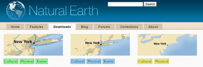
Natural Earth Data is number 1 on the list because it best suits the needs of cartographers. By and large, all the key cultural and physical vector GIS datasets are on a global scale convenient for you to use. The raster datasets also provide beautiful hillshade relief for your map.
The best part is Natural Earth Data is in the public domain. So this means that you have the right to use, modify, and disseminate the data in any manner.
Here are more details for Natural Earth data. From a cartography standpoint, it’s a no-brainer. Download Natural Earth Data now.
| Advantages | Data Types |
|---|---|
| • Download global free GIS data in the public domain. • Supported by the North American Cartographic Information Society (NACIS). | • Cultural, physical, and raster (basemap) data. • Quick start kit (MXD and QGS files) with all the essential stylized layers. |
2. USGS Earth Explorer
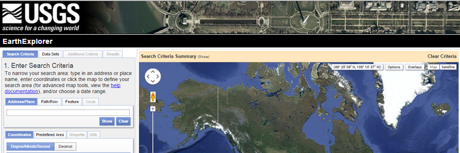
For satellite and aerial imagery, the USGS Earth Explorer is one of the largest free sources of data. The best part? You can download data outside of the United States too.
A friendly user interface makes accessing remote sensing data simple. In fact, it even has a bulk download application if you need to download more than one data set.
Registration is free. If you’re looking for other satellite data providers, check our list of 15 free satellite imagery sources.
| Advantages | Data Types |
|---|---|
| • Satellite imagery is worldwide and not just within the United States. • User interface is state-of-the-art with easy-to-use filters. | • Landsat, Sentinel-2, and land cover. • Digital Elevation Models such as NASA’s ASTER and SRTM. |
3. OpenStreetMap
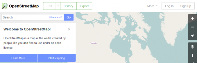
GIS users are harnessing the power of OpenStreetMap (OSM) as a means to crowdsourced data. The result of crowd-sourcing is highly detailed data. But I say detailed with cautious optimism.
While OSM is open to the public, it’s also created by the public. So this means that accuracy varies based on the creator. From my experience, accuracy is very good. And people like you and me are working on completeness every day.
For GIS analysts seeking free GIS data at a street level, OSM is exactly what you are looking for. For example, it may be the biggest inventory of buildings in the world.
How much data is being created every second into OpenStreetMap? There’s a map for that – OSM Show Me The Way.
| Advantages | Data Types |
|---|---|
| • Highly detailed free GIS data with different levels of accuracy and completeness. • Often updated by GIS users across the world. | • High spatial resolution cultural vector data such as buildings, roads, and waterways. • Format (PBF) can be difficult to convert into geospatial format |
4. Esri Open Data Hub
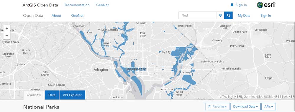
The Esri Open Data Hub is a hidden gold mine of free GIS data. For example, it now houses over 250,000+ open data sets from 5,000+ organizations worldwide. For this reason, we have it at the top of our list of free GIS data.
In some cases, you’ll have to sift through piles of data because they’re not conveniently merged into one. Despite the extra effort, this is still arguably your best chance to find exactly what you’re looking for.
In any case, the search is convenient with a map preview of the extent and table. Alternatively, you can search by topic or location and download data in multiple GIS formats. Ultimately, there is nothing more thorough for GIS data than the Esri Open Data Hub.
| Advantages | Data Types |
|---|---|
| • As of 2020, it has 250,000+ open data sets from over 5,000+ organizations worldwide. • Managed by the largest commercial GIS organization in the world. | • Download formats are in spreadsheets, KML, and shapefile. • APIs are OGC WMS, GeoJSON, and GeoService. |
5. NASA’s Socioeconomic Data and Applications Center (SEDAC)
NASA’s Socioeconomic Data and Applications Center (SEDAC) shows human interactions with the environment. SEDAC has a wide variety of coarse global free GIS data.
For example, their flagship data product is a gridded population of the world. With 800+ citations, it includes population characteristics such as age, education, and density. And the global urban and local population extents come from nighttime lights.
I like the SEDAC map viewer because you can select GIS thematic maps of the socioeconomic data. If you want to assemble the data yourself, there’s that option too.
| Advantages | Data Types |
|---|---|
| • Flagship data is its gridded population of the world. • Global socioeconomic data comes from 15 different themes. | • Socioeconomic data includes a range of topics such as agriculture, climate and health. |
6. UNEP Environmental Data Explorer
United Nations Environment Programme (UNEP) is the authoritative source for UN data. For example, it holds more than 500 variables such as freshwater, climate and health.
I must admit. I found it a bit difficult to explore the GIS data because the interface takes a while to get used to. If you click advanced, you can filter “Geospatial Data Sets”. From here, you can download free GIS data like climate, disasters, and ecosystems.
| Advantages | Data Types |
|---|---|
| • Spatial and non-spatial data on a variety of themes. • Display maps, graphs, and tables on the fly. | • Themes include population, forests, emissions, disasters, and GDP for spatial and non-spatial data. |
7. NASA Earth Observations (NEO)
Imagine seeing daily snapshots of the climate and environmental conditions of Earth. NASA’s Earth Observations (NEO) is like a real-time climate snapshot of the world.
NEO focuses on 5 themes with 50+ global datasets, mostly climate-related. For example, data ranges from aerosols, and chlorophyll to sea surface temperature. All are free GIS data sets that you can download in JPEG, GeoTIFF, and Google Earth formats.
When it comes to understanding our climate, you can’t live without NASA’s NEO. If you can’t find what you’re looking for, we have a whole list of 7 free world climate data sources.
| Advantages | Data Types |
|---|---|
| • Constant updates ensuring timely climate information of our globe. • Accessible in a variety of GIS formats. | • All raster grids are atmosphere, energy, land, life, and ocean GIS data. |
8. Sentinel Satellite Data
Sentinel-2 is the highest resolution satellite imagery available to the public for free. Its interface is the Copernicus Browser.
First, you have to register to create an account. But it’s well worth the time. Next, select your area of interest by right-clicking on the map. Finally, select the S2A or S2B product you want to download and download.
The Copernicus Browser also stores Sentinel-1 which is synthetic aperture radar. So, be careful about what you choose to download.
READ MORE: How to Download Sentinel Satellite Data for Free
| Advantages | Data Types |
|---|---|
| • 10-meter resolution satellite data readily available at your fingertips. • Sentinel 2 data has 11 spectral bands including red, green, blue, and near-infrared. | • Raster data – 11 channels from Sentinel-2. Synthetic aperture radar from Sentinel-1. |
9. Open Topography
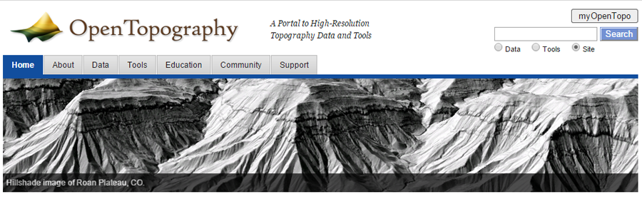
I once sang praises for OpenTopography. But now that it’s no longer free for the Average Joe, it’s sliding in our rankings. Long story, short. You now need to pay for an OT+ subscription (unless you teach K-12 or have an EDU email). Still, there are some positive takeaways here.
Currently, Open Topography has collected 465 high resolution datasets. Most are point clouds. But some are just available in raster format. Their data map shows the most available data is in the United States. But data is also available in Europe, Asia, and Australia too.
If you can’t find LiDAR data for your area of interest, the next best thing is a global DEM and drone imagery.
| Advantages | Data Types |
|---|---|
| • Select regions in the world and search available LiDAR data. • If LiDAR is unavailable, coarse global DEMs are available for download. | • LiDAR (90% in the United States, Canada, Australia, Brazil, Haiti, Mexico, and Puerto Rico). • Subscription-based with OT+ |
10. Terra Populus
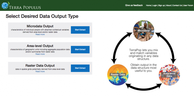
Terra Populus (TerraPop for short) integrates census data from over 160 countries around the world. In fact, it spans up to six decades for household-level and aggregate data for more than 80 countries.
The unique thing about it is how you can explore temporal and spatial changes. It’s not only for researchers. But everyone can access changes in the human-environment system for geographic space.
TerraPop also includes your basic land cover, land use, and climate data. It’s supported by the National Science Foundation and the University of Minnesota. Even now, updates keep rolling out.
| Advantages | Data Types |
|---|---|
| • User-friendly interface with customized temporal data delivery. | • Micro and environmental data describing land cover, land use, and climate. |
11. FAO GeoNetwork
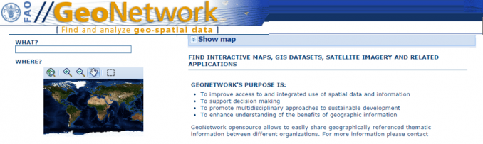
We’re going above and beyond our 10 free data sources here so this is a bit of a bonus. This one is the FAO GeoNetwork which is another portal of free GIS data from the United Nations.
The focus of GeoNetwork is to improve global sustainable development. For example, global agriculture, food security, and fisheries are some of its key free GIS data.
| Advantages | Data Types |
|---|---|
| • Search a wide range of categories and filter by country. | • Agriculture, fisheries, land resource GIS data. |
12. ISCGM Global Map
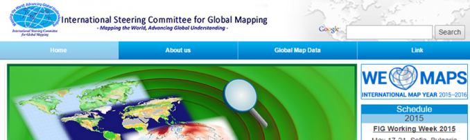
Unfortunately, the International Steering Committee for Global Mapping (ISCGM) portal no longer exists. But that doesn’t mean the data is gone forever. That’s because ISCGM archived their data to the Global Map Github.
Global Map still packs some serious punch with its free GIS data. For example, global land cover and percent tree cover are the two key datasets here. But that’s not all. It has cultural and natural vector datasets here too.
Since the move, registration is no longer required. Despite the lack of updates, ISCGM is still a source of free GIS data that many of us can use in our maps.
| Advantages | Data Types |
|---|---|
| • Download global land cover, elevation, and vegetation data. | • Boundaries, drainage, transportation, population centers, elevation, land cover, land use, and vegetation. |
Download Free GIS Data
In a perfect world, you’d be able to find all the free GIS data you need on a single website. Of course, it would have to be free and downloadable from an authoritative source.

But well, you know the drill. The world’s not perfect, life’s not fair.
That’s why we put together this list of 10 global GIS data sets that you can download for free.
Using this list, you have instantly become more knowledgeable about these 10 free GIS data sources.
More Free GIS Data
If you haven’t found what you’re looking for, here are more free GIS data sources to superpower your maps:
- 15 Free Satellite Imagery Data Sources
- Free Global DEM Data Sources – Digital Elevation Models
- Top 6 Free LiDAR Data Sources
Did we miss anything? Please let us know with a comment below.
Changelog
2024/07/11 – OpenTopography has changed its platform adding a subscription fee. As a result, we’ve moved it down to #9.


I think Overture Maps definitely needs to be added to this list, it’s a Linux Foundation project and a bunch of companies have put together their data along with gathering data from a bunch of sources. Depending on the source of the data the different “themes” have a different open license associated with them. https://overturemaps.org/ You can also just browse around the data here. https://explore.overturemaps.org/ It’s meant to be interacted with via various APIs and programming tools, not downloaded and served locally though you can do that.
Thanks, this is a great suggestion. I’ll try updating this in 2026.
Hi there, I can’t find any global oceanic pH data maps. The NOAA has the data that I require however, it is not compatible with the GIS format. Are there any other sources of up to data data that could be easily transferred to GIS?
All the best
Ints
Geofabrik has a zip shape file for all states EXCEPT CA. I need all 50 states.
However, I use QGIS and I am looking for (ideally) ONE shape file for ALL US named locations – towns, rivers, lakes, mountains (the more the better) that are queryable (is that a word?).
I want to build layers, for example, that are all places in the US with “Lincoln” in their name. Then map each point, line, polygon…
Do you know of a source where I can find such data?
Thank you!!!
You can do a search in the USGS GNIS database – https://edits.nationalmap.gov/apps/gaz-domestic/public/search/names
For example, type in “Lincoln” as you described. This will give you populated places, lakes, streams, and everything with that geographic keyword. After you hit the “Query” button, it will give you a CSV with latitude and longitude coordinates of all known places in the United States.
Thank you! I shall investigate…
Thanks
This information has been very useful my friend
I have learned a lot about water resources management which is applicable to my field of work
https://www.diva-gis.org/gdata
Download data by country
GIS vital for all evidence so very important
New free resources here: https://openlandmap.org :)
I’m doing a research on earthquakes, how can I download fault line vector data as a site, or is there a source?
I really appreciate what you’re doing. I have used this site as a springboard for building a specific country-focused geo- database. I see you’re still working on it. Ten has become twelve! Keep it up!
Thanks for this group data for free availability. I have one questions which the OSM data in my country I used it but especially the building data is overlapped with the road data what was wrong how to correct it.
I need good clear images for my engineering projects
Thank you, very helpful.
I assume most of this data is coming from satellite, and some (20% ?) from aerial mapping.
How… who pays for all this data, if it’s distributed for free? Is it the US Federal gov for the greater good? Surely ESRI does not purchase sat images and give them away for free simply on the hope that someone will buy a license.
Any insight on the procurement process for those geospatial databases would be much appreciated.
Thanks!
Most people in PA know about this one because it’s a huge source for us locally…
https://www.pasda.psu.edu/
Geospatial Data Gateway https://gdg.sc.egov.usda.gov/