25 Satellite Maps To See Earth in New Ways

List of the Top Satellite Maps
These are the top 25 satellite maps in 2024.
The best part?
You’ll get to explore Earth in new ways that you’ve never thought possible.
This is the most comprehensive list of satellite maps that you’ll find online.
Let’s get started.
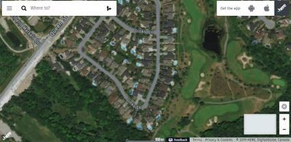
1. Google Maps
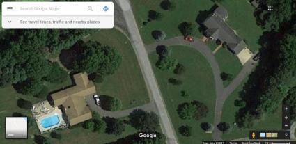
Google Maps is the ULTIMATE tool for satellite maps. It’s grown over the years. So has its features:
- Like it’s panoramic street views.
- Its 3D perspectives are mind-blowingly insane.
- And almost everyone’s favorite: finding their house with its solid addressing system.
But the best part about Google Maps is that it’s regularly updated. In fact, it’s hard to find any imagery that’s more than 3 years old.
The only downside I can think of is that you only get ONE snapshot in time. That’s where Google Earth Pro comes in…
READ MORE: 3D Maps: A Complete Guide To See Earth in 3D
2. NASA Worldview
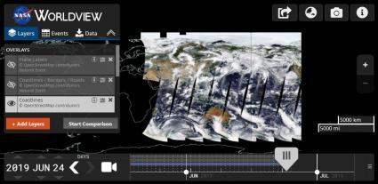
We all know what Earth looks like. But what does it look like RIGHT NOW?
NASA’s Worldview aims at real-time imagery delivery. That is… Earth how it is “right now”. But there’s more:
It shows over 800 layers of satellite imagery. And typically, most have just a 3-hour delay in time.
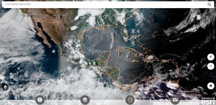
3. Esri Wayback Atlas
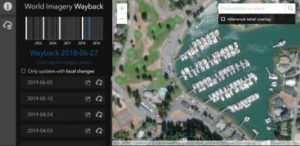
Esri’s Way Back Atlas is like going through a time machine. Similar to Google Earth Pro, you can selectively choose from satellite maps back in time.
But this atlas holds a secret wealth of information. For example, New York has 100+ satellite maps dating back to 2014.
Esri’s World Imagery layer serves as the best available of all satellite maps… But Esri’s Way Back Atlas puts you in the driver’s seat for what’s “best available”.
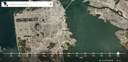
4. Google Earth Pro
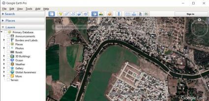
Pop quiz, hotshot! Does Google Maps and Google Earth Pro share the same imagery? The answer is that they are completely DIFFERENT from each other.
Google Earth Pro lets you hit rewind in its historical timeline. That way, you can interactively view past satellite maps from anywhere in the world.
Long ago, this used to be a paid feature. But now, it’s completely free. So if you want to see imagery like capsules of time, Google Earth Pro is a complete winner.
5. Mapbox
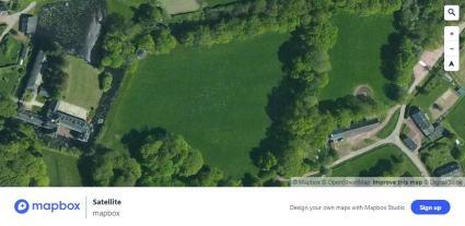
This is quickly becoming one of my go-to satellite maps. It’s because Mapbox removes the clutter and aims for clarity.
First, head over to Mapbox. Next, go to its satellite view. As you zoom in, you’ll see high-resolution satellite maps.
It includes imagery from the most iconic commercial satellites such as Maxar Technologies.
READ MORE: Mapbox Review: 5 Things We Like
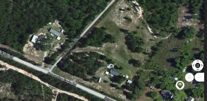
6. Esri World Imagery
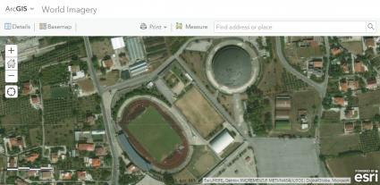
Esri stitches together imagery from 300+ contributors around the globe. The result?
A world imagery layer that is one of the most powerful, up-to-date base maps today.
Quickly and effectively, you can view satellite maps down to 3cm in pixels. That’s the size of a tiny pebble!
7. Bing Maps
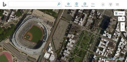
If I could give you one tip for satellite maps, it would be to not ignore Bing Maps.
Don’t get me wrong: Bing’s street views are sparse and it doesn’t have oblique views like Google Maps.
But Bing Maps still serves 10+ TB of imagery. While some imagery can be years out of date, populated areas still have frequent updates.
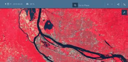
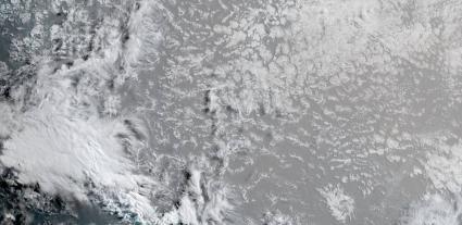
8. Landsat Explorer
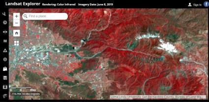
The launch of Landsat-1 in 1972 was a hinge point for space satellites. It was a milestone moment that prompted the 40+ years of archiving our planet’s history.
Hundreds of satellites have followed Landsat’s path into space. But it wasn’t just in color.
In the Landsat Explorer, you can see the world in new ways like near-infrared, a spectral index or like how our eyes see it.
9. HERE Maps
As a company, HERE focuses on navigation, traffic patterns, and self-driving cars.
But as part of its platform, it delivers satellite maps for drivers. What I’m referring to is its HERE map.
When you head over to HERE, you’ll first notice its squeaky clean interface. As you pan around, you get a range of satellite maps to explore.
10. Planet Explorer
The unfortunate about this satellite map is that you need to create an account. But when you do, Planet Explorer is like the goldmine of satellite maps. Here’s why:
It doesn’t just show satellite maps from 450+ microsatellites. But you get nearly daily updates at 2.5 m resolution
There’s only one catch: First, you’ll have to register an account. It’s free for the first 15 days. But after that, you’ll have to pay.
11. MapQuest
When you visit MapQuest, you’ll get an automatic feeling of nostalgia.
Sure, it’s a map that’s trying to sell you a hotel. But it’s not all bad: MapQuest leverages services from TomTom giving you a mixed bag of imagery.
MapQuest was once popular in the 90s. Admittedly, it’s still not much of a map. Unless it’s on a “Quest” for a better “Map”. Just waiting for that day to come.
12. Apple Maps
Let’s start with the good. If you own an iPhone, iPad, or Mac computer, you get to use the sleek interface, 3D integration of Apple Maps.
Now, for the bad… If you don’t have an Apple product (like myself), you won’t have access to any of its built-in mapping applications.
Because at the end of the day, it’s Apple Maps that delivers seamless navigation and accurate mapping, enhancing user journeys. Also, its commitment to privacy makes it a trusted companion for exploration.
13. MDA NaturalVue
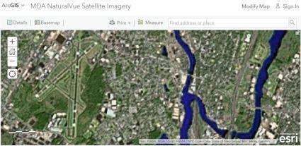
For a coarse view of the Earth, Maxar’s NaturalVue is at a 15-meter resolution. Just to give you perspective on what that means:
First, find a soccer field on the map. Then, count the number of pixels. If you count 20 or so, it’s so coarse that you won’t even be able to recognize the center field.
Sure, NaturalVue is old. It’s even a bit of a wildcard. But it’s a bonafide hit if you’re looking for consistent world imagery.
14. Sentinel Playground
The Sentinel Playground lives up to its name. Because the truth is that satellite maps aren’t just for pretty pictures.
For example, the 12 indices in the Sentinel Playground characterize Earth’s features differently.
It’s like those little Russian Dolls: You see layers upon layers. Each one is a proven way that can help you get to the bottom of distinguishing anything. Note that Sentinel Playground is deprecated and re-routed to the Copernicus Browser now.
15. USGS Earth Explorer
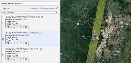
USGS Earth Explorer gives users 45+ satellite platforms to browse through. But you don’t have to download data. You can simply preview ANYTHING.
For example, it’s the only source where you can view hyperspectral imagery on the fly. Not only that, but you can unlock spy satellites like CORONA from the 1960s.
Overall, USGS Earth Explorer rewires how you see satellite maps. Because seeing is believing, give it a test drive.
16. Leaflet
Leaflet allows anyone to build lightweight web maps they can call their own.
As part of Leaflet, it has a range of free tile providers. For example, Esri, Geoportal France and CartoDB are all there.
A cool feature is that when you pan, it interactively updates each provider’s map. This means that Leaflet’s interactive maps offer a unique view of the world, not available in other satellite maps on this list.
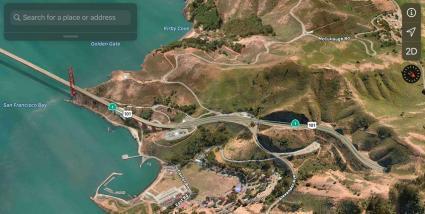
17. Cesium
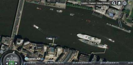
Similar to Leaflet, Cesium lets users build their own customized web maps.
But because Cesium is all in 3D, viewing is off the charts.
The Cesium Viewer is joined by satellite maps like Bing, Esri and Mapbox.
18. Tomnod/GeoHIVE
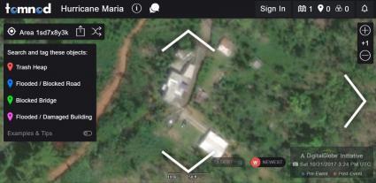
Tomnod leverages the power of crowdsourcing during times of crisis. For example, Tomnod is best known for its platform search for flight MH370.
Regardless of the campaign, Tomnod can be a treasure trove for satellite maps. Anyone who doubts it should look at its past campaigns Tomnod proves we don’t need MacGyver on the case. Instead, we need the power of crowdsourcing.
After 9 years and kilometers of satellite imagery, Maxar (previously DigitalGlobe) is shifting the Tomnod platform to GeoHIVE.
19. Maxar’s Open Data
Maxar has two flavors of open data:
First, its Open Data Program supports major global crisis events like earthquakes, hurricanes, and forest fires. That way, those who need it can get the support they need. During these humanitarian events, they release each photo into the public domain under the Creative Commons 4.0 license.
Secondly, Maxar has product samples available around the globe. For example, sample imagery products are available for Rio de Janeiro (Brazil), Stockholm (Sweden), and Washington DC (USA).
20. NOAA Weather Radar
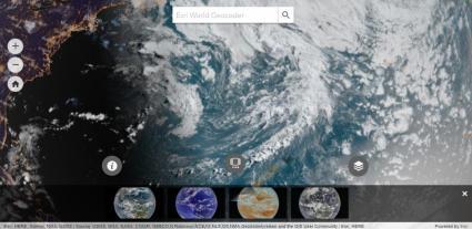
NOAA’s World in Real-Time is the first out-of-the-gate. The trick to this one is how it gives you near real-time weather.
In this global map, you can see the weather from space as it would appear from our eyes.
Alternatively, the near-infrared lets you tackle the challenge through a different lens.
21. GOES Viewer
GOES knows the weather. These geostationary satellites update our weather every 5 minutes. But how do you see it?
First, head over to the GOES Imagery Viewer. Next, select your target region.
This will lead you to satellite maps for the weather. Finally, choose your view and get an updated snapshot of satellite weather.
22. Latest 24
As NOAA satellites silently circle Earth, we get a preview of our planet from space.
Instead of a 3D perspective, NOAA has built a set of satellite maps that target weather with a top-down view.
In fact, you can interactively fast-forward and rewind the weather from the last 24 hours each day.
23. Night View
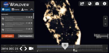
How does Earth look like at night? And what is the extent of human settlement on the landscape?
By stitching 400+ images from space, NASA had compiled the most comprehensive night view in its black marble map.
As seen in this night view map, major cities illuminate the sky the most. Overall, this gives us a ballpark figure for how much humanity has inhabited the land.
24. Global Forest Map
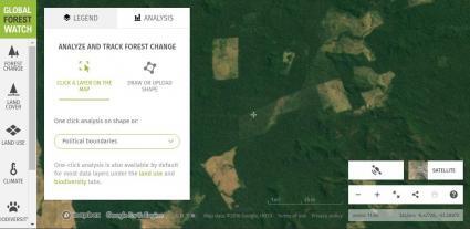
When a tree falls in the forest, satellites hear the impact. Anyone who doubts the severity of deforestation can browse it in the Global Forest Watch.
First, go to the Global Forest Watch. By default, cleared forests are on. Countries like Indonesia, Brazil, and Peru light up.
If you zoom in, it has satellite maps like Planet’s 450+ constellation – the paid one (#9) I mentioned above.
25. NASA’s Fire Information for Resource Management System (FIRMS)
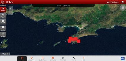
When wildfires roar, satellites track where they burn. Specifically, they capture wildfires as they happen and stream them through active fire maps like FIRMS.
Yet somehow, there’s a curious disconnect between those fighting fires on the ground.
Satellite sensors like MODIS and VIIRS make use of thermal infrared. Only then, we can detect fires as small as a hot spot… all the way up to a volcanic eruption. More on wildfire maps here.
Conclusion
We’ve put an all-out-effort equipping you with the best satellite maps.
Now, it’s your turn:
You now have a competitive edge for space imagery.
But what’s your favorite? And what did we miss?
Go to our comments section below.
Changelog
August 9, 2023 – We removed Yahoo Maps (retired) and replaced it with Apple Maps. Fixed inactive links.
October 19, 2023 – We simplified the article by removing the table of contents.


curious as to what map/app(android) or website has the most accurate and closest to real time street view. Someone broke into my Vehicle at a store which do not have a camera in that direction (blind spot) and it was within the last 45min-1hr
Hi Katie. I think you’re best bet are security cameras. Street View is just a snapshot in time of a location. There are also live came of specific areas as well that are provided as feeds. This might be an option as well.
Bing Maps has oblique imagery, likely more than Google as Bing has had this for well over a decade. Right click on the map in a city and you should see a birdseye button.
I tested it out. Yes, you’re right. For anyone wanting to do this, go to Bing Maps. Next, click on the “map style” button in the top-right. Then, click on “Bird’s Eye” view. That is actually really neat. Thanks Ricky
On a side note, I also found that they have a new “3D Flyover” mode. Sounds exactly what it is.. Kinda like you’re in a flight simulator flying around in a city.
Very useful images
For non Apple device owners, they can access Apple Maps thru DuckDuckGo.com
Can the imagery go back to January 2013? We have been stumped by the unsolved mysterious death of my brother while taking a boat ride on the Manatee River, in Florida.
You might want to take a look at our historical imagery viewers – https://gisgeography.com/free-historical-imagery-viewers/
You are mistaken when you say “But the best part about Google Maps is that it’s regularly updated. In fact, it’s hard to find any imagery that’s more than 3 years old.”
Frankly, it is increasingly difficult to find anything newer than 4 years. If google can afford to have current images, then there is no excuse for the satellite views of maps or of google earth to be so ridiculously out of date.
There is a monumental highway project on I-74 by Rockingham, NC that I have wanted to view from above for well over 4 years now but the satellite images still show pristine untouched woodland – not a single bit of the area that was clearcut from 2017 to 2018. An area that encompasses thousands of acres.
yeah l do sometime
As a golfer on the west coast, we deal with far too many golf courses in horrible shape (aka brown). I have been looking for years for a satellite image that is currently up to the day or at least the week or month guaranteed because all of us avid golfers know the pictures portrayed on the golf course’s website are inaccurate to their current real course conditions and Google Earth is not current enough.
Good its so nice
Morning, I need a current google map I can use. Mines is telling me to update but I don’t know which one.
Soon I’ll be traveling Ohio I don’t want any problems. Would you please help?!?!?!
Don’t want to be the senior lost b4 Christmas.
Holiday Blessings and Thanks
V’
I need a topography map with 6 inch elevation lines to plan drainage on an 80 acre field
Tomnod has shutdown and IIRC what’s left is part of Maxar.
Thanks, I’ll be updating this article in the next while.
To the editor: SOAR Earth is fast becoming a great platform out there for satellite imagery and probably trumps a few of the sites in the article’s list above. Soar allows users to search NASA’s Landsat-8 and the ESA’s Sentinel-2 and lets users download the imagery as high-res GeoTIFF images. I also found the platform also works great from a mobile device, which is a big win since Google Earth maps are outdated.
Very nice material sir.
Wooooow Amazing and fruitful information deep. Thanks
Wow, GISGeography, once again you have compiled an amazing resource with straightforward explanations for newbies while still managing to provide insights to a seasoned image analyst.
A resource I like is Sentinel Hub EO-Browser https://apps.sentinel-hub.com/eo-browser/. Among other neat features, you can easily make a little time lapse video of your area of interest on several different datas. Sign up for a free account.