The CubeSat: Small Satellites for Big Ideas
The CubeSat: Small Satellites for Big Ideas
CubeSats have become an inexpensive and versatile way for businesses, universities, and organizations to access space.
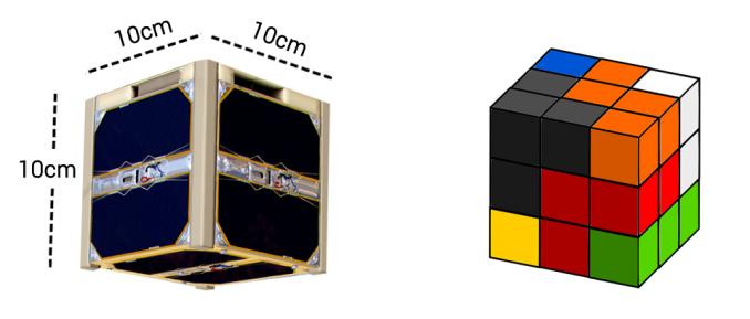
These miniaturized satellites are roughly the size of a Rubik’s cube and are small enough to hold in your hand.
But the main advantage is that they are inexpensive to build. This means their small payloads bring big opportunities to the world of remote sensing technology.
In this article, we will discuss the advantages and disadvantages of cube satellites as well as some of their use cases.
Size of a CubeSat
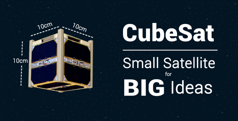
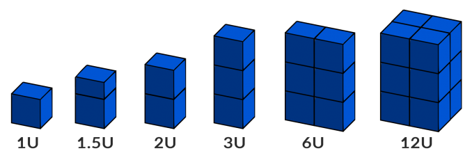
CubeSats are very small artificial satellites that orbit Earth. They’re so small that you can hold them in your hand. These satellites are made up of standardized dimensions of 10x10x10 cm, which is equal to 1U.
1 CubeSat = 1U
But if you stack other features like solar panels, communication antennas, and imagers, it adds on additional units (U). For example, if you add 6 additional units, it would equal 6U.
6 CuseSats = 6U
For example, Planet’s CubeSat (also known as doves) are 3U form factors (10cm x 10cm x 30cm) with mostly standard off-the-shelf components such as an optical camera system, solar panel, and communication antenna.
Cost and Weight
Cube satellites weigh less than 1.33 kg (3 lbs) per unit (U). This puts them in the category of nanosatellites, which is in the range of 1 kg to 10 kg. In fact, the smallest CubeSat measures 0.25U, which is only a few hundred grams.
Not only are they smaller than microsatellites (10-100 kg), but they are hundreds of times smaller than traditional satellites. Satellites like Landsat are more than 15x larger than a washing machine and have a mass of at least 1,500 kg.
Since these are designed for low mass and low volume, the materials used in their fabrication are also very lightweight. And because cube satellites have standard low-cost parts and use commercial off-the-shelf electronic components, they are very popular for those with limited budgets.
Advantages
As you already know, cube satellites are small, lightweight, and inexpensive. But here are some of its other main advantages:
Disadvantages
Although there are advantages mostly related to cost and size, cube satellites also face various challenges.
An Industry Taking Off – Literally
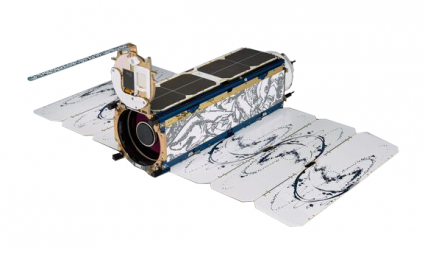
The first CubeSat launch was in 2004. But lately, the industry is taking off — pardon the pun. For companies like Planet, cube satellites are an essential element of their business model of lean and low-cost design. Without the Dove constellation, products like Planetscope would not exist.
From tracking disasters, monitoring climate change, and even delivering internet connectivity, there are hundreds of use cases for remote sensing and satellite technology in space.
Because of the advent of cube satellites, remote sensing technology is now possible for any country to leverage. Here is a shortened list of some of the CubeSat along with the country of origin.
The Orbiting Internet
Even in the internet era, there are still parts of the world that lack reliable access to digital and online information. This is not only true for developing nations, but even in parts of North America, you can struggle to get reliable service.
Remote regions, where connectivity can be expensive or difficult to acquire, and locations that are off the beaten path are some of the challenges that will continue to make the internet more difficult to access.
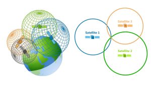
CubeSat constellations are one way to bring satellite access and connectivity to difficult-to-reach locations. Small satellites are a promising tool for delivering internet access to remote areas that suffer from a lack of connectivity.
What’s Next for CubeSats?
CubeSats are a new class of tiny satellites that are becoming common in our satellite industry.
It’s not only because of their smaller size and lighter weight, but it’s the fact that you can build them without breaking the bank.
The present and future look promising for nanosatellites that can be launched in large numbers to do tasks like data gathering.
Now, it’s become a mainstream tool for universities and companies who want to perform focused experiments that otherwise wouldn’t be possible with traditional bulky satellites.







Is imagery from Cubsats available to the public? If so, how, and what is the cost? Thank you.
Regards
I think they used to have it on USGS Earth Explorer. I just checked and couldn’t find it there anymore. Maybe I might’ve missed it? Here’s a guide how to download satellite imagery from the USGS Earth Explorer – https://gisgeography.com/usgs-earth-explorer-download-free-landsat-imagery/