Eswatini Map – Cities and Roads
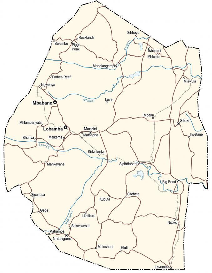
This Eswatini map (formerly Swaziland) contains major cities, roads, rivers, and lakes. Satellite imagery and an elevation map display the topography like the Drakensberg Mountains and Lebombo Valley.
Eswatini map collection
You are free to use our Eswatini map for educational and commercial uses. Attribution is required. How to attribute?
About the map
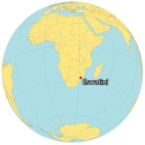
Eswatini is a tiny, landlocked country located in Southern Africa. It borders two other countries. Mozambique is to the east and South Africa wraps around Eswatini from the north to the southeast. Eswatini is a bit different because it has two capital cities.
First, Mbabane serves as the executive capital. But Lobamba, just 15 kilometers away, is the royal and legislative capital of Eswatini. It was formerly known as Swaziland. But in 2018, the official name was changed, which means “place of the Swazi” in the Swazi language.
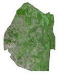
SATELLITE IMAGERY
Eswatini Satellite Map
Eswatini occupies an area of 17,364 square kilometers (6,704 sq mi). Only the Gambia is smaller than Eswatini of all the mainland African countries. If you include all the island nations, it’s the seventh smallest in Africa.
The interior of Eswatini is the Lebombo Valley with most of the savanna, forests, and farming. Half of the population works in agriculture. Despite its small area, Eswatini is a large producer of sugar in Africa. Also, it’s home to many national parks and reserves.

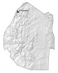
PHYSICAL MAP
Eswatini Elevation Map
The terrain consists of mostly mountains and hills. For example, the Lebombo Mountains lie in the east. Whereas the Drakensberg Mountains span most of the west with the Lebombo Valley within the interior.
But its highest peak, Emlembe, is in the north. At 1,862 m (6,109 ft), it’s part of the Drakensberg. Because of its mountains and valleys, Eswatini is filled with waterfalls. Its longest river is the Usutu River. Komati River dam fills the Maguga Reservoir.

Capital City
Mbabane
Lobamba
Major cities and towns
Manzini
Nhlangano
Siteki
Cities and towns
Big Bend
Bhunya
Forbes Reef
Gege
Hlatikulu
Hluti
Inyetane
Kubuta
Lavumisa
Luve
Mahamba
Malkerns
Mandlangempisi
Mankayane
Matsapha
Mhlosheni
Mhlume
Mhlambanyatsi
Mpaka
Ngwenya
Nsoko
Piggs Peak
Rocklands
Shiselweni II
Sidvokodvo
Sicunusa
Siphofaneni
Sitobela
Siyahelo
Siyakhweni
Tshaneni
Lakes, rivers and creeks
Mbuluzi River
Mkhondvo River
Komati River
Lusutfu River