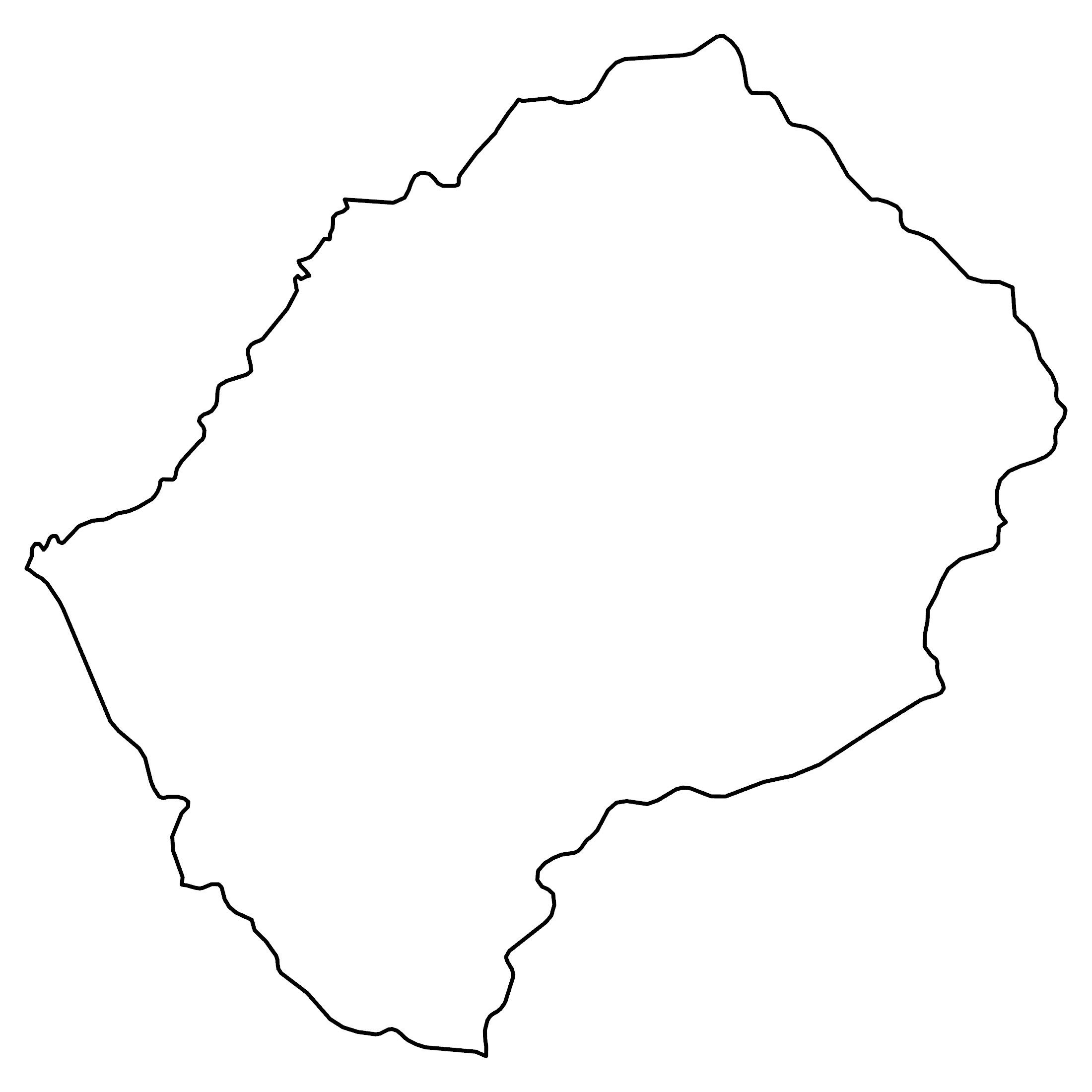
Lesotho Map – Cities and Roads
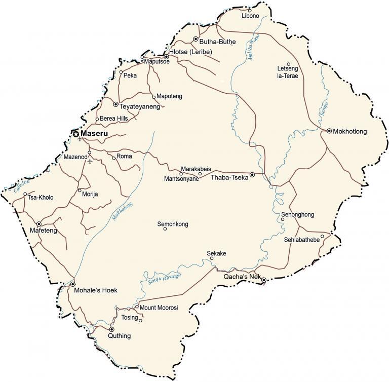
This map of Lesotho contains cities, roads, lakes, rivers, and mountains. Satellite imagery and an elevation map display its extremely rugged and mountainous terrain.
Lesotho map collection
You are free to use our Lesotho map for educational and commercial uses. Attribution is required. How to attribute?
About the map
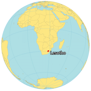
Lesotho is a small country completely surrounded by the country of South Africa. It’s the largest independent enclave state, within another country, with the other two being Vatican City and San Marino.
It’s also the southernmost landlocked country in the world. Lesotho has a population of about 2 million people. Maseru is the capital and largest city in Lesotho. Lesotho has two official languages, which are Sesotho and English.
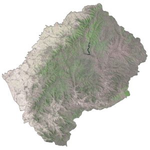
SATELLITE IMAGERY
Lesotho Satellite Map
Lesotho occupies an area of 30,355 square kilometers (11,583 sq mi). This means it’s so small that it’s just slightly larger than Hawaii. The country is highly elevated so it remains mostly cooler throughout the year compared to other regions at the same latitude.
Forests cover just 1% of the land in Lesotho. Because of its soil erosion, agriculture is often not suitable for land usage in Lesotho. This is why only about 12% of Lesotho is arable land.
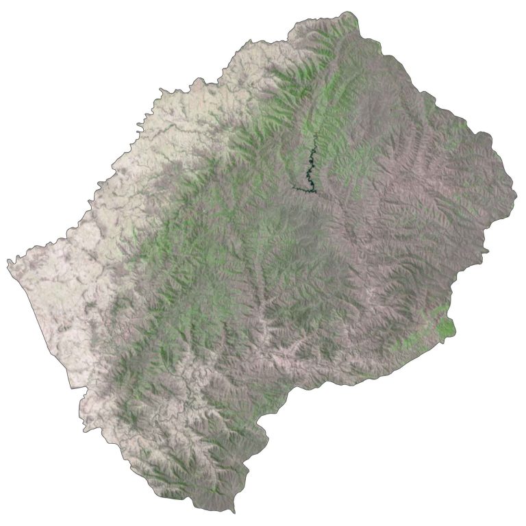
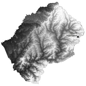
PHYSICAL MAP
Lesotho Elevation Map
Lesotho is extremely rugged with several mountain ranges. For example, its prominent mountains include the Maloti Mountains, Drakensberg, and Thaba Putsoa. No other country in the world has a higher “lowest point” than Lesotho.
This means that the country has an extremely high altitude overall. At 3,482 meters (11,424 ft) in height, Mount Ntlenyana is Lesotho’s highest peak, in the northeast region.

Capital City
Maseru
Cities and towns
Butha-Buthe
Mafeteng
Mohale’s Hoek
Mokhotlong
Qacha’s Nek
Quthing
Teyateyaneng
Thaba-Tseka
Towns and villages
Berea Hills
Hlotse (Leribe)
Letseng la-Terae
Libono
Mantsonyane
Mapoteng
Maputsoe
Marakabeis
Mazenod
Morija
Mount Moorosi
Peka
Roma
Sehlabathebe
Sehonghong
Sekake
Semonkong
Tosing
Tsa-Kholo
Major rivers
Caledon River
Makhaleng River
Sengu (Orange) River
Senqu River
Malibamatso River