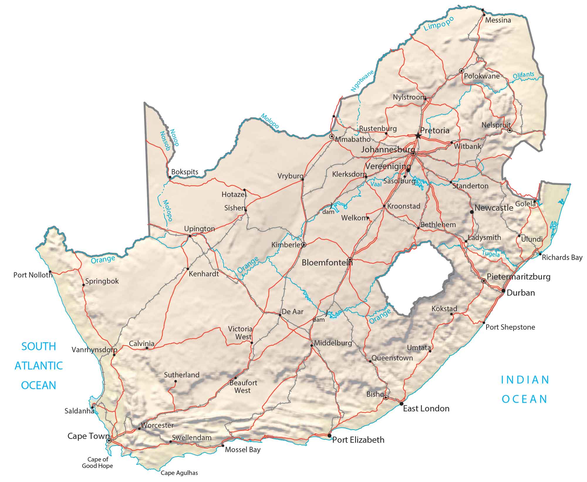
Map of South Africa – Cities and Roads
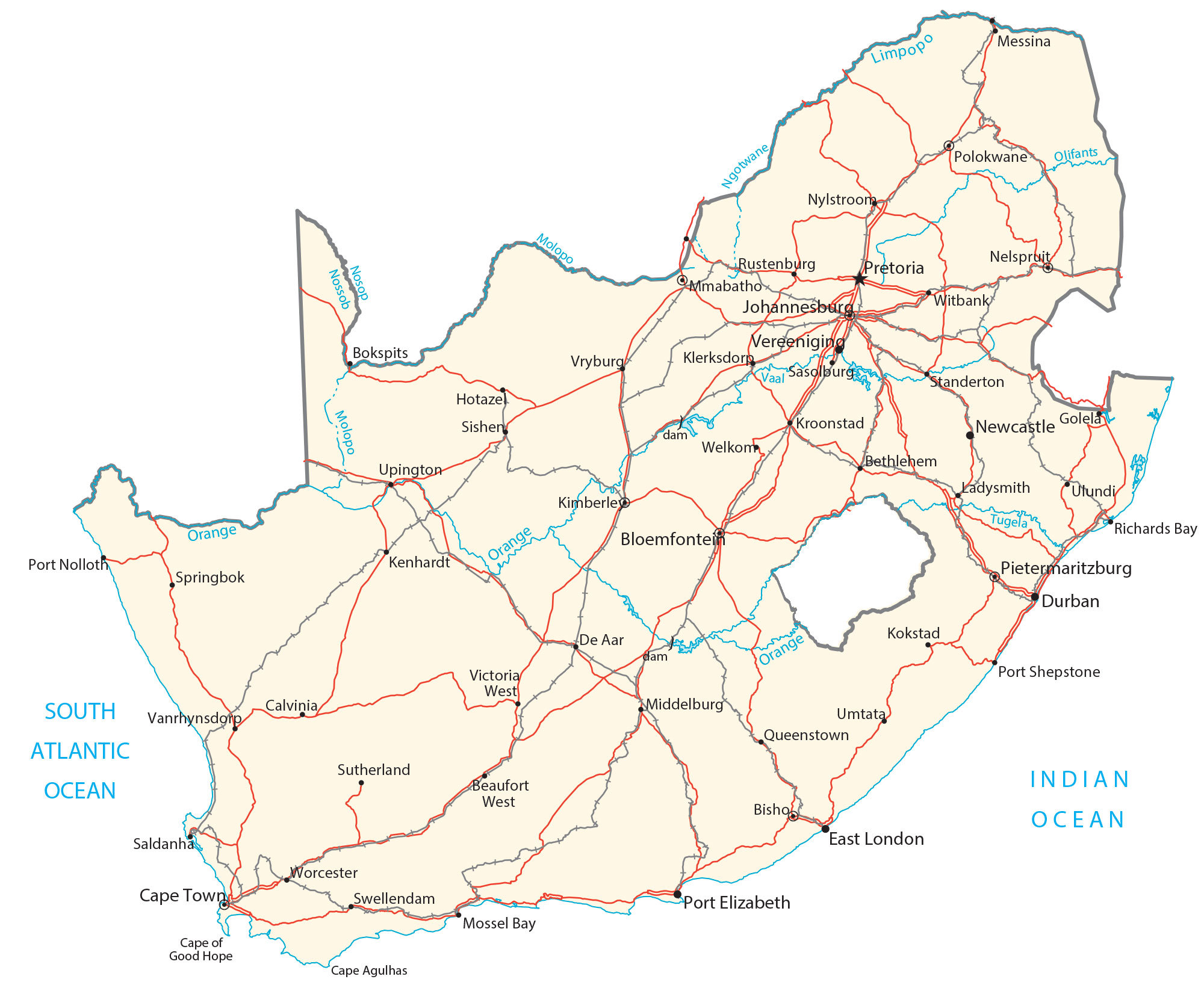
This map of South Africa displays major cities, towns, rivers, lakes, and roads. Satellite imagery and a terrain map display the Drakensberg Mountains to the Kalahari Desert.
South Africa map collection
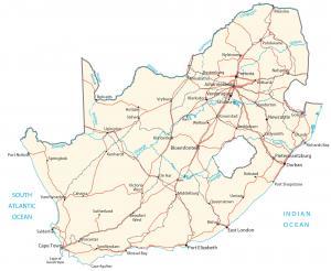

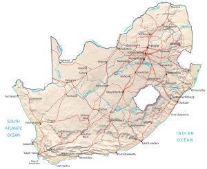
You are free to use our South Africa map for educational and commercial uses. Attribution is required. How to attribute?
About the map
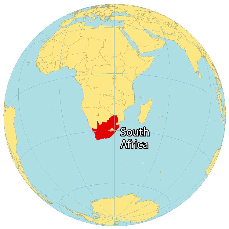
South Africa is located at the southern tip of the continent of Africa, along both the Indian Ocean and South Atlantic Ocean. It borders Namibia, Botswana, Mozambique, and Zimbabwe to the north. But South Africa also completely surrounds Lesotho, and nearly surrounds Eswatini (Swaziland) as well.
South Africa is the most populous country located entirely south of the equator with over 60 million people. Major cities are Durban, Johannesburg, and Soweto.
Additionally, South Africa is the only country in the world to have 3 capitals – Cape Town, Pretoria, and Bloemfontein. While Bloemfontein is the judicial capital, Pretoria is the executive capital. Finally, Cape Town is the legislative capital and largest city in South Africa.
SATELLITE IMAGERY
South Africa Satellite Map
South Africa occupies an area of 1,221,037 square kilometers (471,445 sq mi), which makes it the ninth-largest in Africa. In comparison, it’s smaller than Mali but larger than Ethiopia. It has one of the longest coastlines at more than 2,500 km (1,553 mi), spanning both oceans.
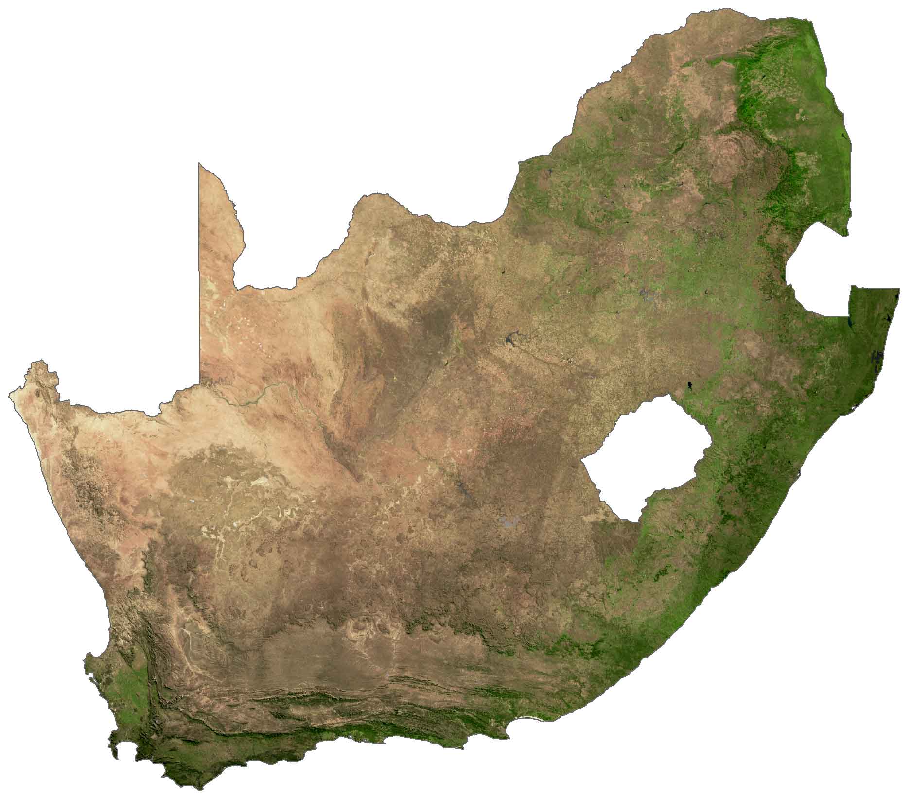
The country lies between 22°S and 35°S latitude. But because of its position near the ocean and mountains, it’s still relatively dry with less rainfall and semi-desert in the north. Specifically, the Kalahari Desert extends into the northern region of South Africa. Additionally, there is the Great Karoo region south-central region with semi-desert conditions.
PHYSICAL MAP
South Africa Physical Map
The terrain of South Africa consists of plains, rugged hills, and plateaus. But the central area of South Africa is mostly a flat plateau. The Great Escarpment is a topographic feature that surrounds southern Africa.
This geographic region has steep hills with the Drakensberg on the eastern portion of the escarpment. This mountain chain runs from the northeast through Lesotho and contains the Mafadi peak. At 3,446.1 m (11,306 ft), it’s the highest point in South Africa and is within the Drakensberg Mountains.
South Africa has one of the largest systems of rivers in Africa. For instance, the Orange River is South Africa’s longest river. But the Limpopo and Vaal Rivers are also notable rivers in South Africa. Lake Chrissie is the largest lake in South Africa.
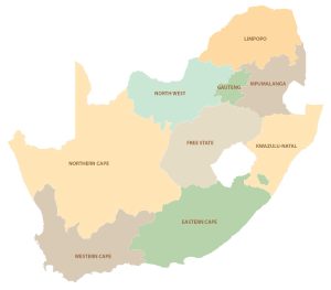
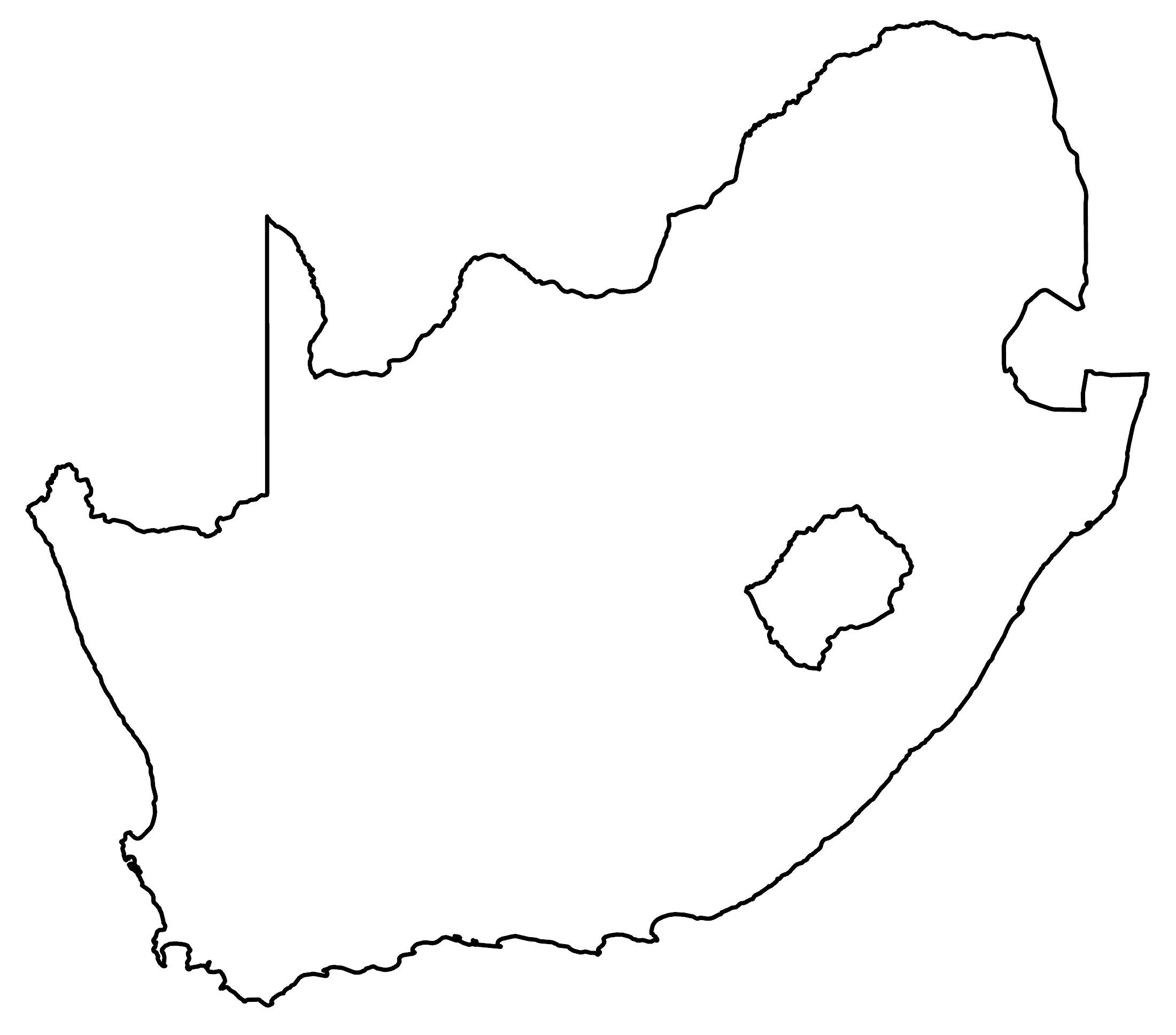
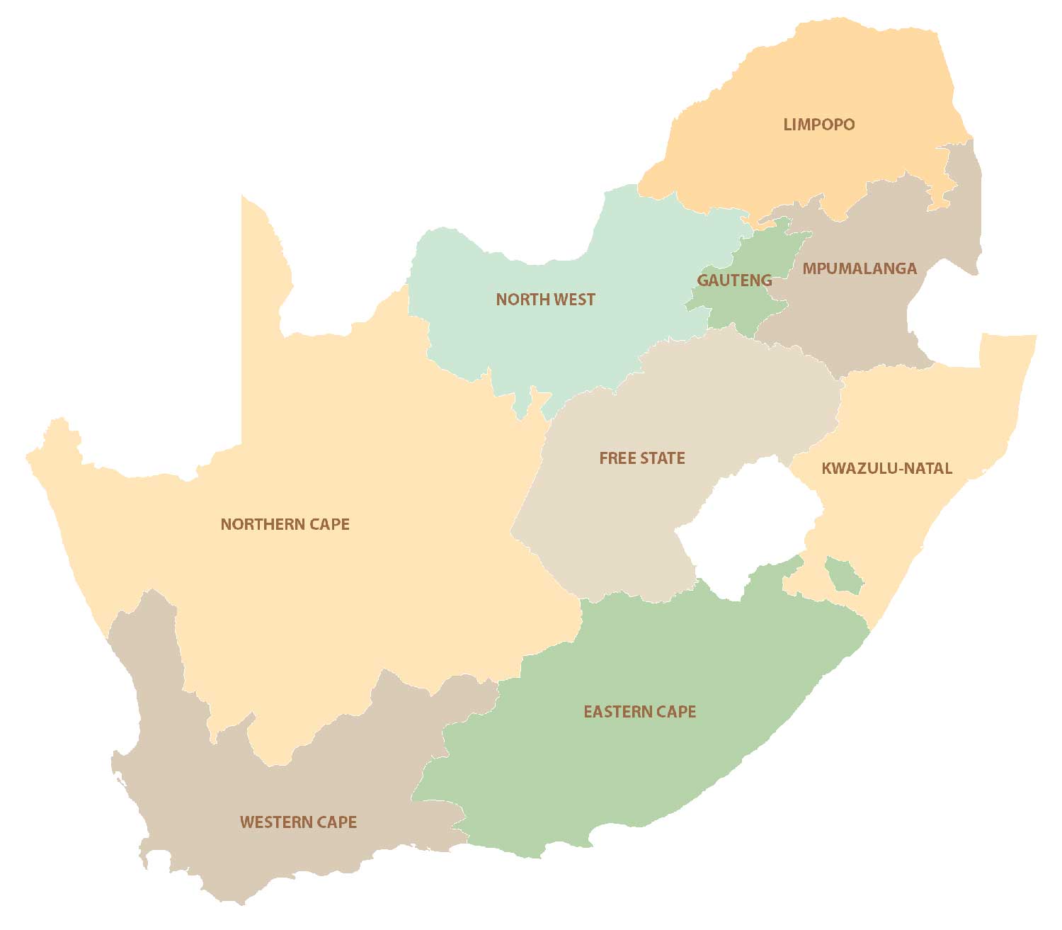
POLITICAL MAP
South Africa Provincial Map
There are 9 provinces in South Africa, which are divided administratively and geographically. Provinces are the first-level administrative unit but they can be divided further into districts.
The 9 provinces of South Africa are the Eastern Cape, Free State, Gauteng, KwaZulu-Natal, Limpopo, Mpumalanga, Northern Cape, and North West. Gauteng is the smallest in size but it’s one of the most populous with the provincial capital of Johannesburg.
Capital City
Bloemfontein
Cape Town
Pretoria
Major cities and towns
Durban
East London
Johannesburg
Pietermaritzburg
Polokwane
Port Elizabeth
Vereeniging
Cities, towns and villages
Beaufort West
Bethlehem
Bisho
Bokspits
Calvinia
De Aar
Golela
Hotaze
Kenhardt
Kimberley
Klerksdorp
Kokstad
Kroonstad
Ladysmith
Messina
Mmabatho
Middelburg
Mossel Bay
Nelspruit
Newcastle
Nylstroom
Port Nolloth
Port Shepstone
Queenstown
Richards Bay
Rustenburg
Saldanha
Sasolburg
Sishen
Springbok
Standerton
Sutherland
Swellendam
Ulundi
Upington
Vanrhynsdorp
Victoria West
Welkom
Witbank
Worcester
Lakes, rivers and water features
Atlantic Ocean
Indian Ocean
Limpopo River
Molopo River
Ngotwane River
Nossob River
Olifants River
Orange River
Tugela River
Vaal River
Capes
Cape Agulhas
Cape of Good Hope


Can’t set up the correct time CAT for South Africa