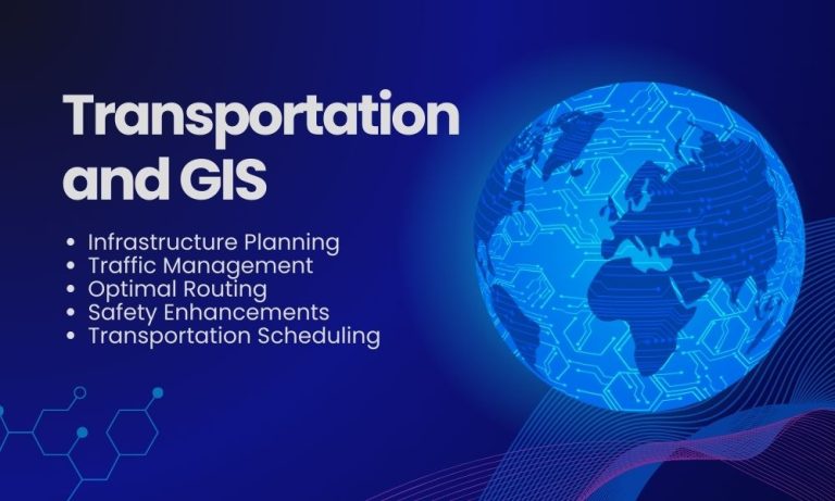
GIS in Transportation
Henry Ford once said, “If everyone is moving forward together, then success takes care of itself.” This sentiment is especially true for GIS in transportation.
By integrating geospatial data and technology, GIS propels us forward. It ensures that every journey, whether long or short, is optimized for success.
GIS in Transportation Planning
In essence, GIS in transportation is about making travel smarter, safer, and more sustainable. GIS is the technology behind the maps we use every day. It’s how we plan routes, avoid traffic, and explore new places.
By leveraging data and technology, it connects us to our destinations in the smartest way possible. These systems map our world and how we move within it.
Together with transportation, geospatial technology is changing the way we travel. By leveraging GIS in innovative ways, we can better understand the spaces and roads around us.
Use Cases of GIS in Transportation
GIS in transportation enables more efficient planning, operation, and decision-making processes.
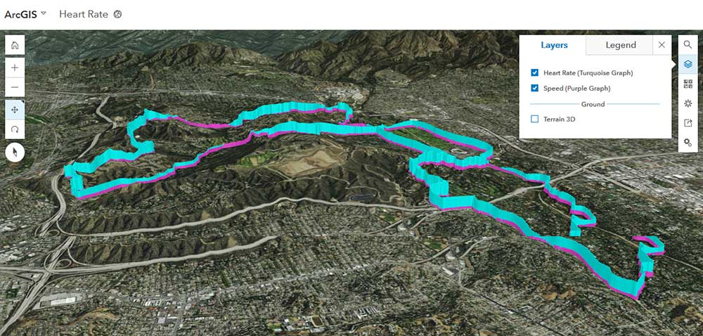
We use network analysis tools to understand how anything flows within a road network. Here are some of the ways that GIS works in transportation.
1. Routing
GIS doesn’t just find any route. Instead, it picks the best one based on the current situation. So, if you’re in a hurry, GIS finds the quickest path. But if you want to save fuel, you can also select the most efficient way.
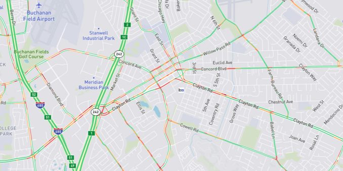
2. Traffic Management
Imagine seeing all the traffic jams on your route before you even start your journey. GIS does that, helping you steer clear of delays. As a result, this can save you time and stress.
3. Infrastructure Planning
When it comes to building new roads or improving old ones, GIS acts as the backbone for planning. It analyzes data like traffic flow and accident hotspots to make better decisions.
It also ensures roads are safer and more efficient. Plus, you can use a tool like service areas to find optimal locations for emergency services.
4. Public Transport Scheduling
For those who rely on buses or trains, GIS tracks these services in real time. This means you can get updates on arrival times. Because of this, GIS can make public transportation more reliable and convenient.
5. Safety Enhancements
By pinpointing areas with high accident rates, GIS plays a crucial role in improving road safety. Consequently, city planners can take measures to reduce risks.
For example, they can add traffic lights or speed bumps. Don’t forget that GIS and self-driving cars integrate to enhance the driving experience.
6. Disaster Response
In emergencies like floods or earthquakes, GIS identifies accessible routes for rescue and relief operations. This capability is vital for saving lives and speeding up recovery efforts.
7. Efficiency in Deliveries
For delivery services, GIS is a game-changer. It optimizes routes, considering factors like delivery windows and vehicle capacity. This means your packages arrive faster and companies save on fuel costs.
READ MORE: 10 Transportation Maps: Planes, Trains & Automobiles
Transportation Networks Datasets

GIS in transportation all starts with a network dataset. What’s different about a road network compared to a line dataset?
Geometric networks allow connectivity between lines on a map. Network analysis applies rules like one-way streets, speed limits, and height restrictions.
Looking for a network dataset? Check out our list of transportation networks. It includes datasets like OSM roads, TIGER, and Esri roads and highways.
GIS in Transportation
Behind the scenes, GIS in transportation technology works tirelessly. For example, it helps us find the best routes, avoid traffic, and save time.
Today, we’ve shown you use cases of GIS in transportation. We’ve also highlighted road datasets that are the backbone for network analysis.
Do you use road datasets and transportation networks? What are some other applications of GIS in transportation? We’d love to hear from you in the comment section.


