GOES vs POES: A Tale of Two Weather Satellites
GOES vs POES: What’s the Difference?
As the name hints, GOES and POES are both operational environmental satellites. But they actually share more in common than their title.
For example, they both share a 40+ year legacy spanning a large fleet of satellites.
They also both specialize in weather forecasting and environmental applications.
But their main difference is how they orbit the Earth. While GOES orbit is geostationary, POES has a polar orbit.
Let’s examine the similarities and differences between both satellites in a bit more detail.
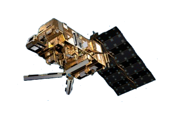
Geostationary Operational Environmental Satellite (GOES)
Ever since GOES-1 beamed down its first image from space in 1975, we know this for sure: “GOES knows weather”. Not only does this squad of satellites forecast weather, but they have also been an instrumental piece in understanding our environment and climate.
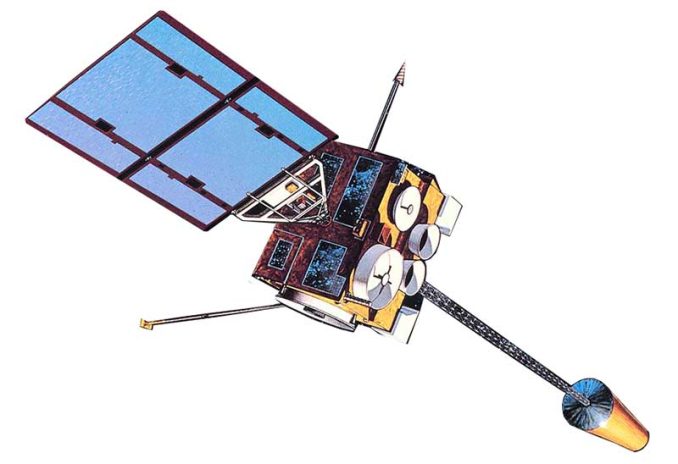
GOES-16, -17, -T, and -U are the next-generation weather satellites that are part of the GOES-R series. GOES-16 and -17 were launched in 2016 and 2018. The plan is for GOES-T and -U to launch in 2020 and 2024, respectively. Then to keep the tradition alive, they will probably be renamed GOES-18 and -19.
Compared to older GOES models, these satellites are sharper and have more defined imagery. GOES-R carries the Advanced Baseline Imager (ABI) for multispectral imaging.
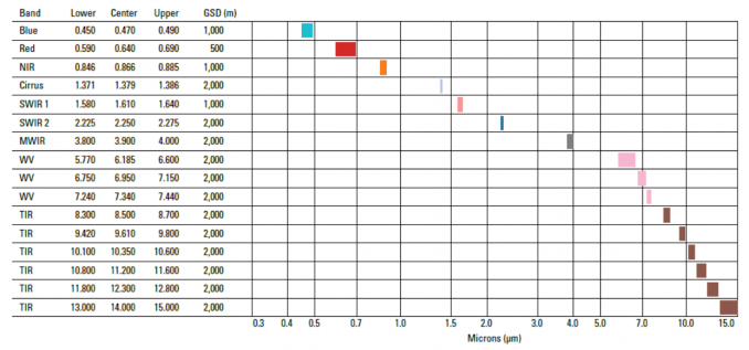
Advanced Baseline Imager (ABI)
The GOES-R series is equipped with another type of sensor called the Geostationary Lightning Mapper (GLM). Not only can GLM measure when lightning strikes the ground, but it can also detect lightning build-up in the clouds. This is useful for forecasting storm severity and tornadoes because they are closely tied together.
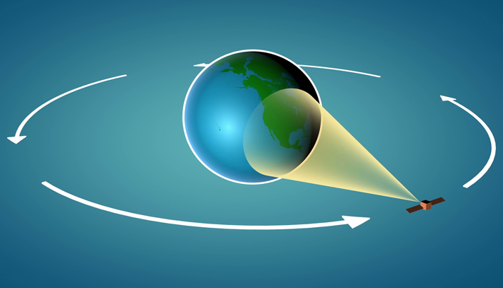
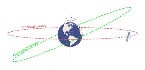
GOES satellites are in a geosynchronous orbit because they orbit at the same speed as the Earth’s rotation. They’re also in a geostationary orbit because they are directly above the equator. It’s only in this “sweet spot” where they don’t move in relation to the ground. Because GOES satellites are in this unique type of orbit, they gather weather information as often as every 30 seconds in a hemisphere.
Official Website: https://www.goes-r.gov/
Data Portal: https://www.ngdc.noaa.gov/stp/satellite/goes-r.html
GOES Uses and Applications
Here are some of the most common GOES use cases and applications:
GOES Satellites
Dating back to 1975, here’s a list of the GOES satellites:
GOES-1 (1975-1985)
GOES-2 (1977-1993)
GOES-3 (1978-1993)
GOES-4 (1980-1988)
GOES-5 (1981-1990)
GOES-6 (1983-1989)
GOES-7 (1987-1996)
GOES-8 (1994-2004)
GOES-9 (1995-2007)
GOES-10 (1997-2009)
GOES-11 (2000-2011)
GOES-12 (2001-2013)
GOES-13 (2006-Standby)
GOES-14 (2009-Standby)
GOES-15 (2010-Current)
GOES-16 (2016-Current)
GOES-17 (2018-Current)
GOES-T (Planned 2021)
GOES-U (Planned 2024)
Polar-orbiting Operational Environmental Satellites (POES)
POES consists of a 14-satellite fleet spanning a combined life of 50+ years. POES started with the launch of TIROS-1 in 1960. Then, it ended with NOAA-19 on February 6, 2009.
NOAA-19 was the final POES mission launched, as no more are planned in the near future. But make no mistake about it, POES does not fall short in terms of achievements.
- POES was the first satellite of its kind used for global search and rescue from space.
- NOAA-10 and -11 captured thousands of images from space piecing together the first cloudless photograph of Earth.
- POES was the first to pull location tracking data from buoys, balloons and sea animals primarily for conservation efforts.
POES and GOES both share a long-lasting legacy of image collection. But the main difference between them is their orbits. POES satellites orbit in the polar regions. In a single day, POES completes nearly 14 orbits at about 520 miles above Earth. Due to its large swaths, it can provide daily global coverage for weather forecasting.
The Advanced Very High Resolution Radiometer (AVHRR) is the most common instrument equipped on POES satellites. In fact, Television and Infrared Observation Satellite (TIROS) was the first carrier to use AVHRR in 1978. It started as a 4-channel radiometer. Then, it was later replaced with the 5-channel AVHRR/2.
| Band | Name | Spectral Range | Applications |
|---|---|---|---|
| Band 1 | Red | 0.58-0.68 | Urban, vegetation, snow/ice, daytime clouds |
| Band 2 | Near IR | 0.725-1.00 | Vegetation, land/water boundaries, snow/ice, flooding |
| Band 3A | Mid IR | 1.58-1.64 | Vegetation, snow/ice detection, dust monitoring |
| Band 3B | Thermal | 3.55-3.93 | Surface temperature, wildfire detection, nighttime clouds, volcanic eruptions |
| Band 4 | Thermal | 10.30-11.30 | Surface temperature, wildfire detection, nighttime clouds, volcanic eruptions |
| Band 5 | Thermal | 11.5-12.50 | Sea surface temperature, water vapor path radiance |
POES Uses and Applications
Similar to GOES, here are the most common uses and applications of POES:
POES Satellites
Here’s a list of POES satellites, starting with TIROS-1 in 1960.
TIROS-1 (1960)
TIROS-2 (1960-1961)
TIROS-N (1978-1981)
NOAA-6 (1979-1986)
NOAA-7 (1981-1985)
NOAA-8 (1983-1985)
NOAA-10 (1986-1991)
NOAA-12 (1991-2001)
NOAA-14 (1994-2004)
NOAA-15 (1998-Current)
NOAA-16 (2001-2014)
NOAA-17 (2002-2014)
NOAA-18 (2005-Current)
NOAA-19 (2009-Current)


