AVHRR: Advanced Very High Resolution Radiometer
The Very Talented AVHRR
AVHRR stands for Advanced Very High-Resolution Radiometer.
“Very high resolution” is a bit of a misnomer. This is because its spatial resolution is actually very coarse at 1.1 km.
So the “very high resolution” refers to its day temporal resolution and revisit times.
Because of its high temporal resolution, AVHRR offers services for monitoring wildfires, flooding risks, and even volcanic eruptions.
AVHRR spectral bands and specifications
The Advanced Very High Resolution Radiometer is a multispectral sensor with six spectral bands.
This includes red, thermal, mid, and near-infrared bands. But over time, their spectral ranges have varied.
For example, AVHRR/3 channel characteristics are as follows:
| Band | Name | Spectral Range | Applications |
|---|---|---|---|
| Band 1 | Red | 0.58-0.68 | Urban, vegetation, snow/ice, daytime clouds |
| Band 2 | Near IR | 0.725-1.00 | Vegetation, land/water boundaries, snow/ice, flooding |
| Band 3A | Mid IR | 1.58-1.64 | Vegetation, snow/ice detection, dust monitoring |
| Band 3B | Thermal | 3.55-3.93 | Surface temperature, wildfire detection, nighttime clouds, volcanic eruptions |
| Band 4 | Thermal | 10.30-11.30 | Surface temperature, wildfire detection, nighttime clouds, volcanic eruptions |
| Band 5 | Thermal | 11.5-12.50 | Sea surface temperature, water vapor path radiance |
AVHRR uses and applications
Because of AVHRR’s quick revisit times, it has several monitoring applications. For example, AVHRR monitors vegetation change, active wildfires, flooding risk, and even volcanic eruptions.
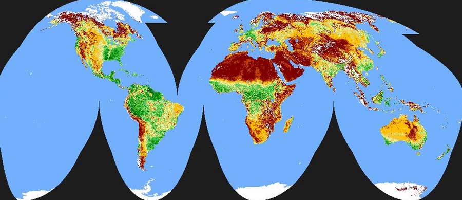
AVHRR is the backbone for the 1km global land cover product. We use global land cover to understand the human footprint on the land and its environmental impact.
The AVHRR land cover product differentiates forest types, grass, shrub, cropland, and water.
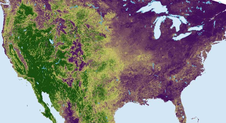
By using its red and NIR bands, AVHRR can apply the Normalized Difference Vegetation Index (NDVI) to study vegetation.
Because of its high revisit time, it’s capable of monitoring vegetation change daily. We can interpret vegetation change over time by comparing NDVI over decades of data.
Other remote sensing applications and uses from AVHRR include measuring regional soil moisture, climate change, and physiographic features.
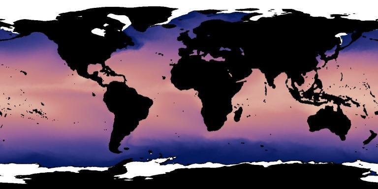
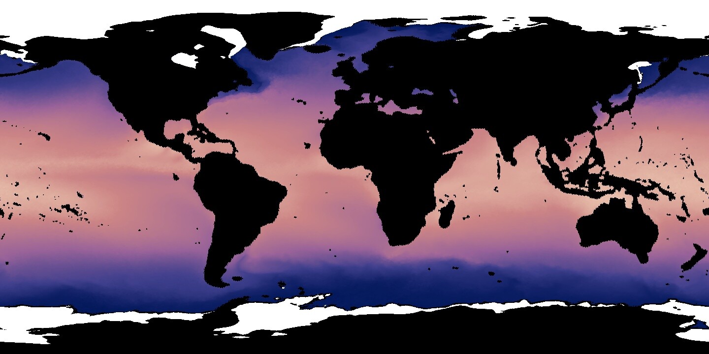
By using the thermal bands, we get a better understanding of sea surface temperatures (pictured below).
These are just a few examples of the use cases of AVHRR. There are dozens of more examples like this today.
40+ year history of AVHRR data
From NOAA-6 to NOAA-19, NOAA Polar-Orbiting Environmental Satellite (POES) satellites have been the primary carriers of AVHRR. But there have been other satellites equipped with Advanced Very High-Resolution Radiometer.
For example, Television and Infrared Observation Satellite (TIROS) was the first to use AVHRR in 1978. The 4-channel radiometer on TIROS was later replaced with the 5-channel AVHRR/2.
Finally, MetOp-A, B, and C have been launched with this sensor. To this day, AVHRR still collects satellite imagery of our changing planet. That makes it more than 40 years AVHRR has been in orbit making it one of the longest-running sensors.
Satellites equipped with AVHRR
The table below lists all of the satellites that have carried the AVHRR instrument.
| Satellite | Launch Day | End Mission |
|---|---|---|
| Television and Infrared Observation Satellite (TIROS) | October 1978 | January 1980 |
| NOAA-6 | June 1979 | November 1986 |
| NOAA-7 | June 1981 | June 1986 |
| NOAA-8 | March 1983 | October 1985 |
| NOAA-9 | December 1984 | May 1994 |
| NOAA-10 | September 1986 | September 1991 |
| NOAA-11 | September 1988 | September 1994 |
| NOAA-12 | May 1991 | December 1994 |
| NOAA-14 | December 1994 | May 2007 |
| NOAA-15 | May 1998 | Present |
| NOAA-16 | September 2000 | June 2014 |
| NOAA-17 | June 2002 | April 2013 |
| NOAA-18 | May 2005 | Present |
| NOAA-19 | February 2009 | Present |
| Metop-A | October 2006 | November 2021 |
| Metop-B | September 2012 | Present |
| Metop-C | November 2018 | Present |


