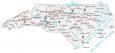
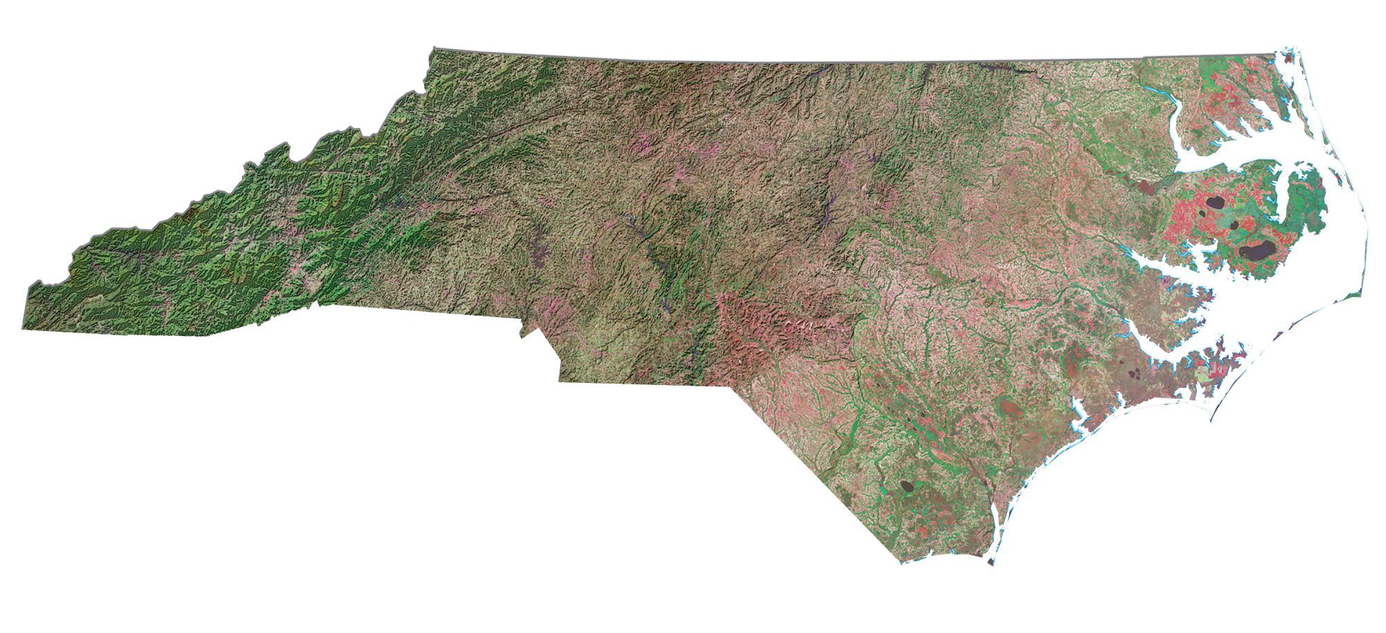
Great Smoky Mountains National Park Map
About the map
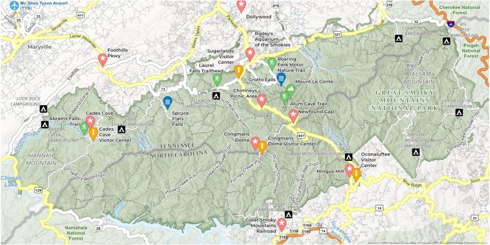
Our Great Smoky Mountains National Park Map is your go-to guide to this vast area of wilderness located on the border between North Carolina and Tennessee. This printable map showcases campgrounds, trails, and attractions you’ll find in these ancient mountains.
Looking for highlights? Our map’s got you covered. Check out Clingmans Dome, the highest point in the park, where views stretch for miles. Then, there’s the historic Cades Cove, a valley famed for its wildlife and scenic beauty.
We’ve marked out major trailheads. From easy-to-reach campgrounds to winding trails, use it to plan your day… Or let it inspire a spontaneous adventure. Remember, the Great Smoky Mountains are waiting for you, and this map is your first step into the wild.
You are free to use our Great Smoky Mountains National Park map for educational and commercial uses. Attribution is required. How to attribute?
Top Things to Do
Looking for the best things to do at Big Bend? Try these out.
- Clingmans Dome: Highest peak in the park, offering panoramic views and an iconic observation tower.
- Dollywood: Renowned amusement park in Pigeon Forge, celebrating Appalachian culture with rides and entertainment.
- Cades Cove: Scenic valley with historic buildings, wildlife viewing, and picturesque mountain backdrops.
- Newfound Gap: Mountain pass offering stunning views, straddling the border between North Carolina and Tennessee.
- Ripley’s Aquarium of the Smokies: Interactive aquarium in Gatlinburg, showcasing a wide variety of marine life.
- Grotto Falls: Unique waterfall allowing visitors to walk behind the cascade, located along the Trillium Gap Trail.
- Great Smoky Mountains Railroad: Scenic heritage railroad offering train rides through the beautiful North Carolina countryside.
- Mingus Mill: Historic grist mill in the park, demonstrating traditional milling techniques in a serene setting.
- Mount Le Conte: Third highest mountain in the park, known for its challenging hikes and spectacular views.
- Spruce Flats Falls: Relatively hidden waterfall, offering a peaceful hike and scenery.
Discovery and Visitor Centers
Oconaluftee Visitor Center
Sugarlands Visitor Center
Cades Cove Visitor Center
Clingmans Dome Visitor Center
Campgrounds
Abrams Creek Campground
Balsam Mountain Campground
Cosby Campground
Big Creek Campground
Deep Creek Campground
Cades Cove Campground
Look Rock Campground
Elkmont Campground
Cataloochee Campground
Smokemont Campground
Trails
Laurel Falls Trail
Alum Cave Trail
Roaring Fork Motor Nature Trail
Abrams Falls Trail
Little River Trail
Forney Creek Trail
Hazel Creek Trail
Big Creek Trail
Welch Ridge Trail
Gregory Bald Trail
Beard Cane Trail
Loop Trail
Sunkota Ridge Trail
Cataloochee Divide Trail
Beard Cane Trail
Lakes, Rivers and Creeks
Abrams Creek
Cheoah Lake
Anthony Creek
Little Pigeon River
Oconaluftee River
Tuckasegee River
Landforms/Physical Regions
Hannah Mountain
Balsam Mountain
Nantahala National Forest
Pisgah National Forest
Cherokee National Forest
Highways and Roads
Foothills Pkwy
Highway 321 (US-321)
Newfound Gap Road (US-441)
Interstate 40 (I-40)
State Route 73 Scenic
Little River Road
Hooper Hwy
Other Features
Chimneys Picnic Area
References
- Great Smoky Mountains National Park (National Park Service)
- USGS Great Smoky Mountains National Park Map
- Topographic Maps of Great Smoky Mountains NP (USGS)