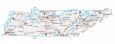
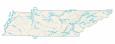
Map of Tennessee – Cities and Roads

About the map
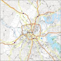
This Tennessee map contains cities, roads, rivers, and lakes. For example, the major cities in this map of Tennessee are Nashville, Memphis, Knoxville, and Chattanooga.
Tennessee has a country music vibe going for it. The Country music record industry is big in Tennessee and produces a ton of record deals. But it’s also known for its bluegrass music too. If you’re into music, it’s also known for the world-renowned Grand Ole Opry, which has weekly concerts for country music lovers.
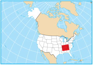
The state of Tennessee is located in the southeast of the United States with a shape that’s long in the east-west direction. Tennessee borders 8 other states including Kentucky, Missouri, Arkansas, Mississippi, Alabama, Georgia, North Carolina, and Virginia. No other state borders this many, with the exception of Missouri, which also borders 8 other states. The state is also located in the Appalachian Mountains, making it a great place for outdoor enthusiasts.
Tennessee map collection

You are free to use our map of Tennessee for educational and commercial uses. Attribution is required. How to attribute?
State capital
Nashville
Major cities and towns
Nashville
Memphis
Knoxville
Clarksville
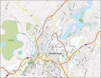
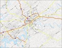
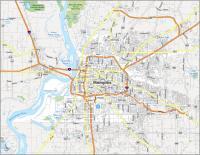
Chattanooga
Cleveland
Columbia
Franklin
Germantown
Hendersonville
Jackson
Johnson City
Kingsport
Murfreesboro
Oak Ridge
Smyrna
Athens
Brownsville
Dickson
Dyersburg
Fayetteville
Gallatin
Gatlinburg
Greeneville
Lawrenceburg
Lebanon
Lexington
Linden
Livingston
Martin
Maryville
McMinnville
Milan
Millington
Morristown
Newport
Oneida
Paris
Pulaski
Savannah
Selmer
Shelbyville
Tullahoma
Union City
Waverly
Bristol
Cookeville
Bolivar
Portland
Interstate highways
Interstate-24 (I-24)
Interstate-40 (I-40)
Interstate-65 (I-65)
Interstate-75 (I-75)
Interstate-81 (I-81)
Interstate-155 (I-255)
Lakes, rivers and creeks
Kentucky Lake
Lake Barkley
Duck River
Dale Hollow Lake
Norris Lake
Holston River
Center Hill Lake
Pickwick Lake
Mississippi River
Cumberland River
Tennessee River
Landmarks in Tennessee
Cumberland Plateau
Great Smoky Mountains
Clingmans Dome
How many miles is Memphis TN from Knoxville TN
How can I get a paper map of Tennessee?
Please feel free to print this one out
This was extremely interesting