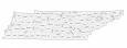
Tennessee County Map
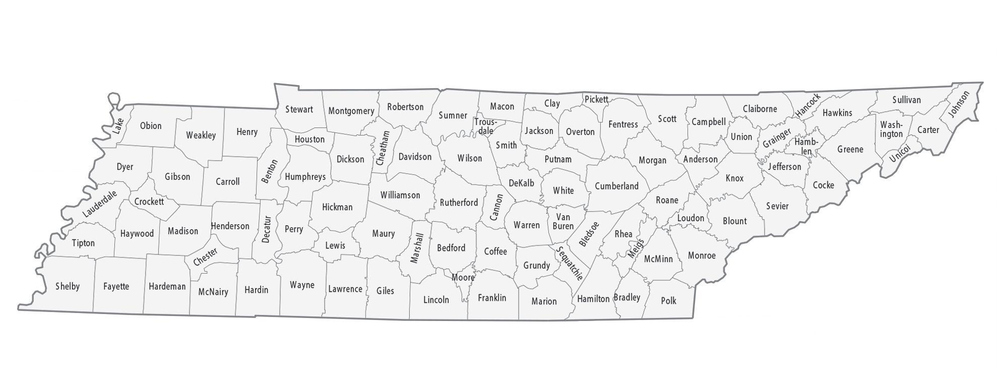
About the map
This Tennessee county map displays its 95 counties. Out of all states in the US, Tennessee has the 10th highest tally of counties. Only Texas, Georgia, Virginia, Kentucky, Missouri, Kansas, Illinois, North Carolina, and Iowa have more counties than Tennessee.
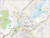
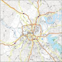
Shelby County has the highest population with close to 1 million people and is home to the city of Memphis. Next, Davidson County is the second highest with nearly 700,000 people, and the city of Nashville. On the other hand, Pickett County is the least populated with just over 5,000 people.
Not only is Shelby County the most populated county, but it’s also the largest in size. For size, Shelby County occupies an area of about 783 square miles and is located in the southwest corner of the state of Tennessee. But the smallest county is Trousdale County, occupying an area of just 116.7 square miles in size.

You are free to use our county map of Tennessee for educational and commercial uses. Attribution is required. How to attribute?
Tennessee County List
| FIPS Code | Name | Land (sq mi) | Water (sq mi) | Population (2024) |
|---|---|---|---|---|
| 47-001 | Anderson County | 337.2 | 7.6 | 81,449 |
| 47-003 | Bedford County | 473.6 | 1.2 | 54,228 |
| 47-005 | Benton County | 394.3 | 41.9 | 16,173 |
| 47-007 | Bledsoe County | 406.4 | 0.3 | 15,591 |
| 47-009 | Blount County | 558.8 | 7.8 | 142,211 |
| 47-011 | Bradley County | 328.8 | 2.7 | 113,782 |
| 47-013 | Campbell County | 480.2 | 18.0 | 40,238 |
| 47-015 | Cannon County | 265.6 | 0.1 | 15,142 |
| 47-017 | Carroll County | 597.7 | 2.4 | 29,107 |
| 47-019 | Carter County | 341.3 | 6.4 | 57,434 |
| 47-021 | Cheatham County | 302.5 | 4.6 | 42,604 |
| 47-023 | Chester County | 285.7 | 0.2 | 17,876 |
| 47-025 | Claiborne County | 434.6 | 7.0 | 33,070 |
| 47-027 | Clay County | 236.5 | 22.8 | 7,857 |
| 47-029 | Cocke County | 435.8 | 7.2 | 37,596 |
| 47-031 | Coffee County | 429.0 | 5.6 | 61,285 |
| 47-033 | Crockett County | 265.5 | 0.2 | 13,973 |
| 47-035 | Cumberland County | 681.0 | 3.8 | 65,618 |
| 47-037 | Davidson County | 503.5 | 21.8 | 729,505 |
| 47-039 | Decatur County | 333.9 | 11.0 | 11,800 |
| 47-041 | DeKalb County | 304.4 | 24.6 | 21,747 |
| 47-043 | Dickson County | 489.9 | 1.4 | 57,641 |
| 47-045 | Dyer County | 512.3 | 14.2 | 36,403 |
| 47-047 | Fayette County | 704.8 | 1.5 | 44,476 |
| 47-049 | Fentress County | 498.6 | 0.3 | 20,129 |
| 47-051 | Franklin County | 554.5 | 21.3 | 45,137 |
| 47-053 | Gibson County | 602.7 | 0.9 | 51,422 |
| 47-055 | Giles County | 610.9 | 0.2 | 30,971 |
| 47-057 | Grainger County | 280.6 | 21.9 | 25,073 |
| 47-059 | Greene County | 622.2 | 2.0 | 73,398 |
| 47-061 | Grundy County | 360.4 | 0.7 | 14,148 |
| 47-063 | Hamblen County | 161.2 | 14.6 | 67,715 |
| 47-065 | Hamilton County | 542.3 | 33.5 | 386,256 |
| 47-067 | Hancock County | 222.3 | 1.2 | 7,038 |
| 47-069 | Hardeman County | 667.7 | 2.6 | 25,434 |
| 47-071 | Hardin County | 577.3 | 19.0 | 27,617 |
| 47-073 | Hawkins County | 487.1 | 12.6 | 59,371 |
| 47-075 | Haywood County | 533.1 | 1.0 | 17,097 |
| 47-077 | Henderson County | 520.0 | 5.9 | 28,183 |
| 47-079 | Henry County | 561.8 | 31.6 | 32,883 |
| 47-081 | Hickman County | 612.5 | 0.1 | 25,859 |
| 47-083 | Houston County | 200.3 | 6.7 | 8,538 |
| 47-085 | Humphreys County | 530.8 | 25.9 | 19,554 |
| 47-087 | Jackson County | 308.6 | 10.9 | 12,376 |
| 47-089 | Jefferson County | 274.9 | 39.4 | 59,217 |
| 47-091 | Johnson County | 298.4 | 4.3 | 18,506 |
| 47-093 | Knox County | 508.3 | 17.6 | 506,748 |
| 47-095 | Lake County | 165.8 | 28.1 | 6,422 |
| 47-097 | Lauderdale County | 472.0 | 35.6 | 24,630 |
| 47-099 | Lawrence County | 617.1 | 0.9 | 46,467 |
| 47-101 | Lewis County | 282.1 | 0.4 | 13,418 |
| 47-103 | Lincoln County | 570.3 | 0.4 | 36,751 |
| 47-105 | Loudon County | 229.3 | 18.1 | 62,129 |
| 47-107 | McMinn County | 430.1 | 2.1 | 56,754 |
| 47-109 | McNairy County | 562.8 | 0.8 | 26,103 |
| 47-111 | Macon County | 307.1 | 0.1 | 27,189 |
| 47-113 | Madison County | 557.1 | 1.5 | 100,409 |
| 47-115 | Marion County | 498.3 | 14.1 | 29,826 |
| 47-117 | Marshall County | 375.5 | 0.7 | 37,847 |
| 47-119 | Maury County | 613.1 | 2.4 | 113,411 |
| 47-121 | Meigs County | 195.1 | 21.6 | 13,937 |
| 47-123 | Monroe County | 635.7 | 16.9 | 49,154 |
| 47-125 | Montgomery County | 539.2 | 4.7 | 246,025 |
| 47-127 | Moore County | 129.2 | 1.2 | 6,773 |
| 47-129 | Morgan County | 522.2 | 0.3 | 21,954 |
| 47-131 | Obion County | 544.8 | 10.6 | 30,261 |
| 47-133 | Overton County | 433.5 | 1.3 | 23,551 |
| 47-135 | Perry County | 414.7 | 8.1 | 8,987 |
| 47-137 | Pickett County | 163.0 | 11.5 | 5,108 |
| 47-139 | Polk County | 434.6 | 7.7 | 18,338 |
| 47-141 | Putnam County | 401.1 | 1.5 | 84,894 |
| 47-143 | Rhea County | 315.4 | 21.0 | 34,759 |
| 47-145 | Roane County | 360.7 | 34.2 | 56,742 |
| 47-147 | Robertson County | 476.3 | 0.2 | 78,459 |
| 47-149 | Rutherford County | 619.2 | 4.8 | 376,996 |
| 47-151 | Scott County | 532.3 | 0.9 | 22,517 |
| 47-153 | Sequatchie County | 265.8 | 0.2 | 17,620 |
| 47-155 | Sevier County | 592.5 | 5.2 | 100,184 |
| 47-157 | Shelby County | 763.6 | 21.5 | 910,530 |
| 47-159 | Smith County | 314.3 | 11.1 | 20,783 |
| 47-161 | Stewart County | 459.8 | 33.2 | 14,365 |
| 47-163 | Sullivan County | 413.4 | 16.3 | 162,703 |
| 47-165 | Sumner County | 529.4 | 13.8 | 211,721 |
| 47-167 | Tipton County | 458.4 | 14.9 | 62,187 |
| 47-169 | Trousdale County | 114.3 | 2.3 | 12,159 |
| 47-171 | Unicoi County | 186.1 | 0.3 | 17,872 |
| 47-173 | Union County | 223.6 | 23.6 | 21,064 |
| 47-175 | Van Buren County | 273.4 | 1.1 | 6,686 |
| 47-177 | Warren County | 432.7 | 1.4 | 43,619 |
| 47-179 | Washington County | 326.5 | 3.3 | 139,642 |
| 47-181 | Wayne County | 734.1 | 1.6 | 15,974 |
| 47-183 | Weakley County | 580.4 | 1.4 | 33,162 |
| 47-185 | White County | 376.7 | 2.7 | 29,108 |
| 47-187 | Williamson County | 582.9 | 1.2 | 269,136 |
| 47-189 | Wilson County | 571.1 | 12.4 | 169,948 |