Map of Guatemala
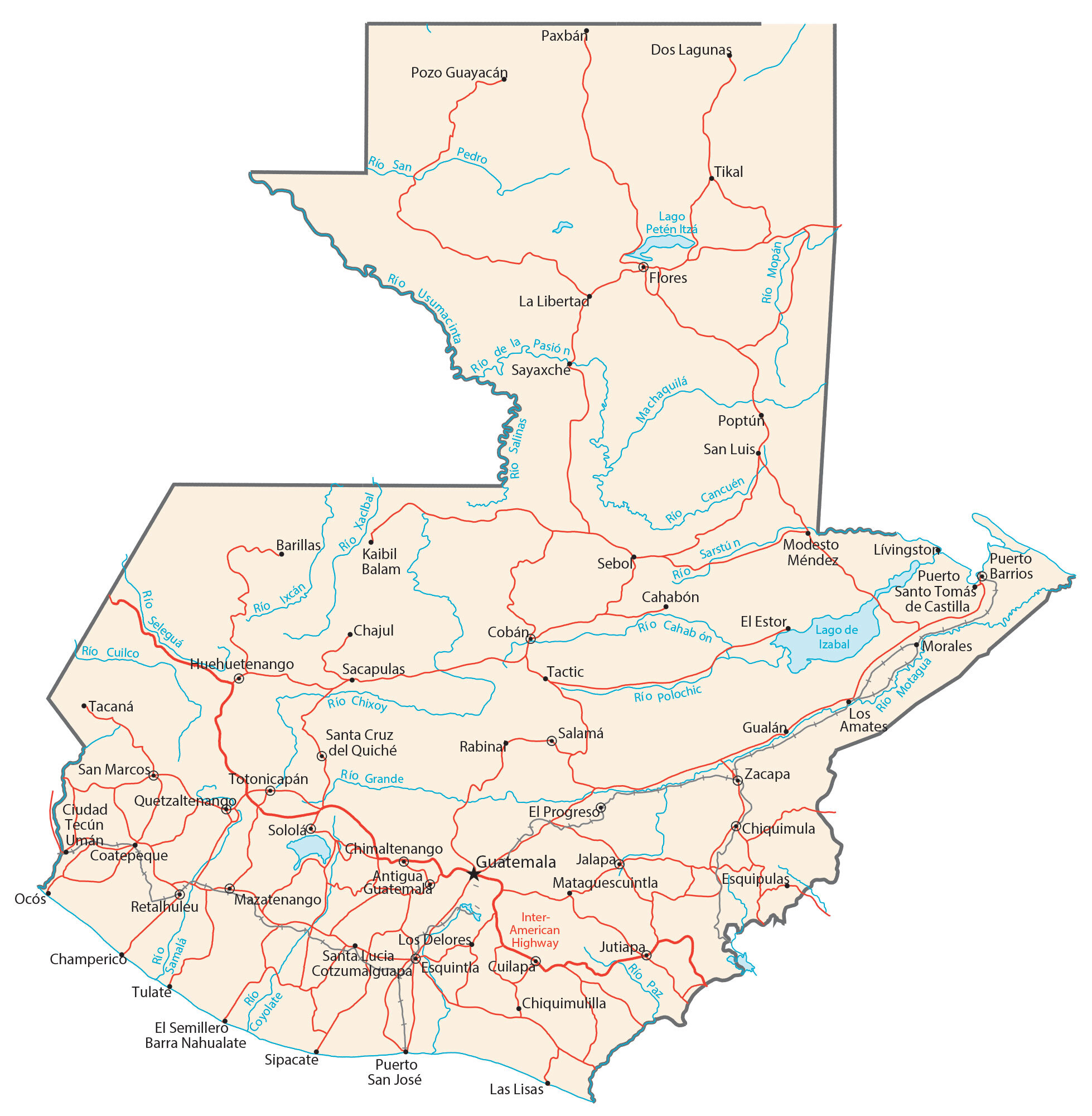
This map of Guatemala features cities, lakes, rivers, railroads, and highways. It includes satellite imagery and an elevation map to view the topography of Guatemala.
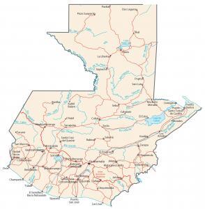
Guatemala map collection
You are free to use our Guatemala map for educational and commercial uses. Attribution is required. How to attribute?
About the map
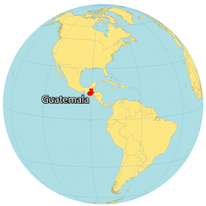
Guatemala is located in Central America along the Gulf of Honduras and the North Pacific Ocean. Guatemala is home to ancient Mayan ruins, numerous volcanoes, and dense rainforests. In comparison to other Central American nations, it has a strong indigenous culture, especially of Mayan descent.
It borders 4 other countries including Mexico to the northwest, Belize to the north, as well as El Salvador and Honduras to the southeast. Guatemala City is the capital and largest city. It’s not only the most populous urban area in Guatemala but also in all of Central America.
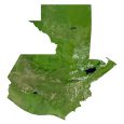
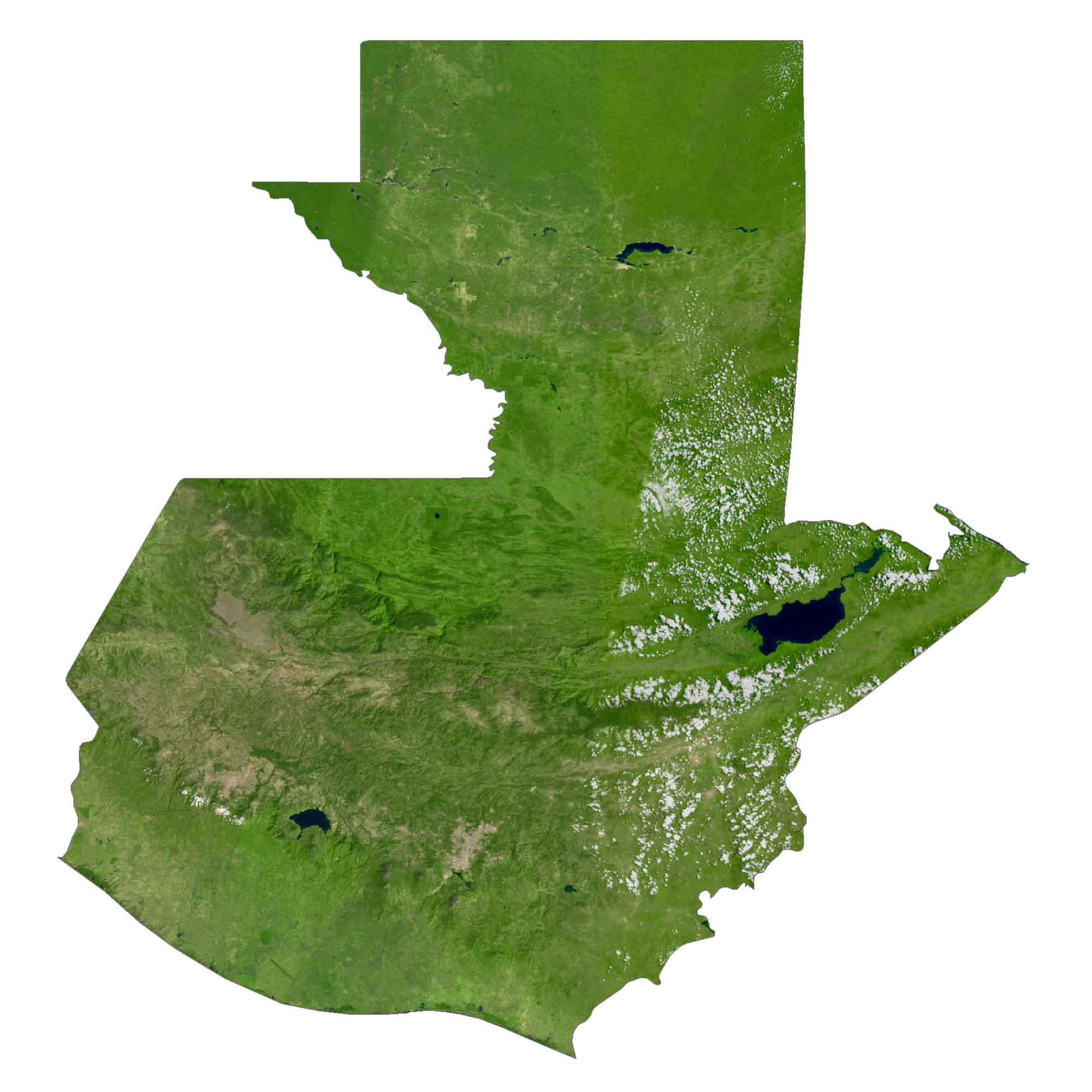
SATELLITE IMAGERY
Guatemala Satellite Map
Guatemala is a mix of heavy rainforests, two major mountain chains, and a low-lying coastal region. Also, it has small patches of desert and sand dunes with hills and valleys. In total, Guatemala occupies an area of 108,889 square kilometers (42,042 sq mi).
This makes it slightly smaller than Honduras. While Lake Izabal is the largest lake in Guatemala, Motagua is its longest river. According to the FAO, forests cover about 34% of Guatemala. Its rainforests are characterized as high in biodiversity and high in rainfall.
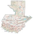
PHYSICAL MAP
Guatemala Physical Map
The country can be divided into three separate regions because of its two east-west mountain chains. First, the Pacific coast is south of the mountains. Secondly, the Petén region consists of limestone plateaus north of the mountainous section. Finally, the highlands are the physical mountainous regions, where most major cities are located.
Specifically, the Sierra Madre Mountains are situated in the central-south region. Whereas, the Cuchumatanes Mountains stretch east-west within the interior. At 4,203 m (13,789 ft), its highest peak is a large stratovolcano, Volcán Tajumulco.
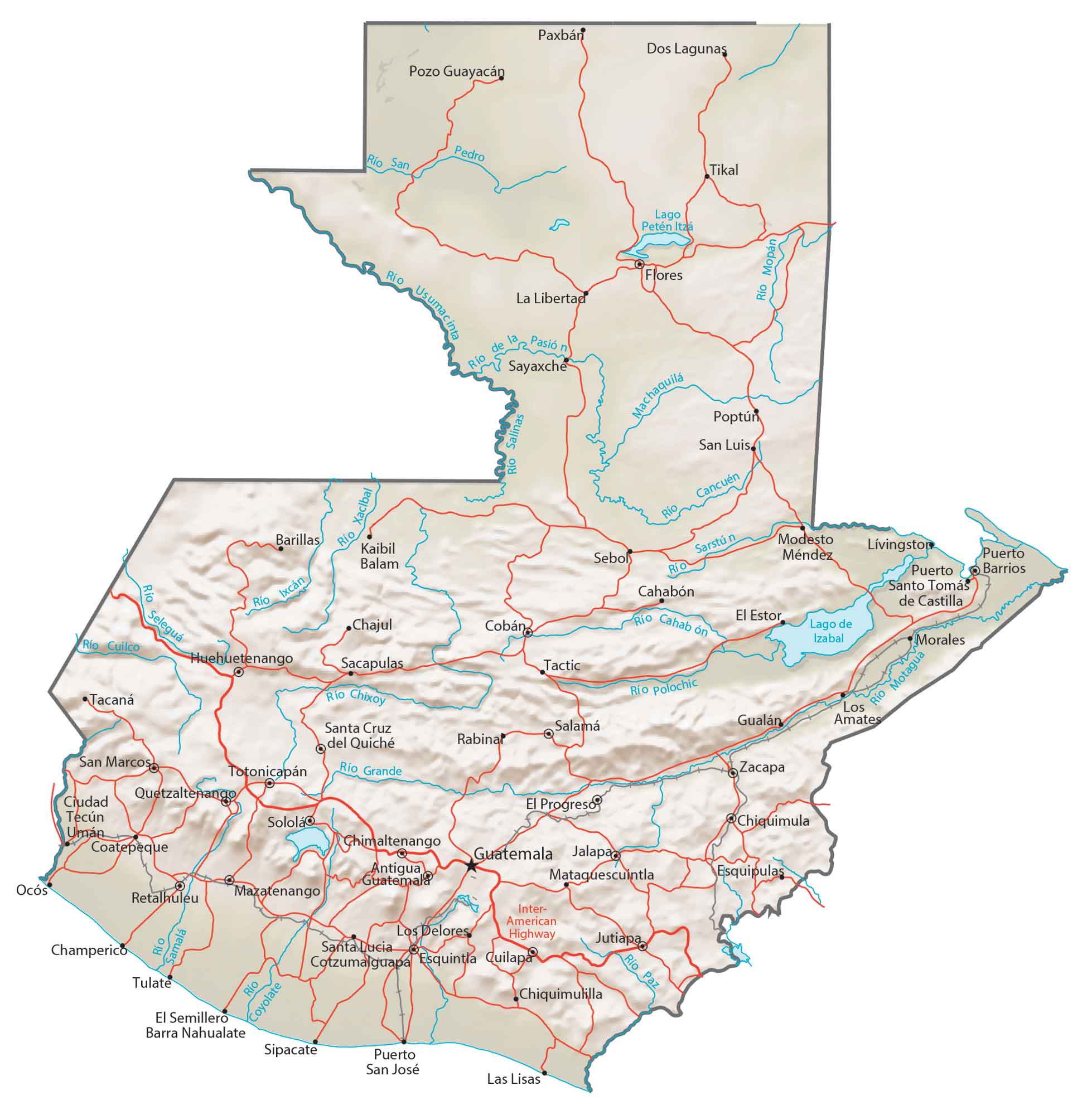
Capital City
Guatemala
Major cities and towns
Cobán
Esquintla
Jalapa
Jutiapa
Mixico
Quetzaltenango
Villa Nueva
Cities, towns and villages
Antigua Guatemala
Barillas
Cahabón
Chajul
Champerico
Chimaltenango
Chiquimula
Chiquimulilla
Ciudad Tecún Umán
Coatepeque
Dos Lagunas
El Estor
El Progreso
El Semillero Barra Nahualate
Esquipulas
Flores
Gualán
Huehuetenango
Kaibil Balam
La Libertad
Las Lisas
Livingston
Los Amates
Los Delores
Mataquescuintla
Mazatenango
Modesto Méndez
Morales
Ocós
Paxbán
Poptún
Pozo Guayacán
Puerto Barrios
Puerto San José
Puerto Santo Tomás de Castilla
Quilapa
Rabinar
Retalhuleu
Sacapulas
Salamá
San Luis
San Marcos
Santa Cruz del Quiché
Santa Lucia Cotzumalguapa
Sayaxche
Sebol
Sipacate
Sololá
Tacaná
Tactic
Tikal
Totonicapán
Tulate
Zacapa
Lakes, rivers and creeks
Lake Izabal
Lake Petén Itzá
Cahabón River
Cancuén River
Chixoy River
Coyolate River
Cuilco River
Río de la Pasión
Río Grande
Ixcán River
Machaquila River
Mopán River
Motagua River
Paz River
Polochic River
Samalá River
San Pedro River
Sarstún River
Seleguá River
Usumacinta River
Xacıbal River
Other features
Inter-American Highway


This really help me thx for the map