What Is a Map Legend?
What do symbols represent on your map?
A map legend defines features in a map. It simply displays the symbol followed by a text description of what that symbol represents.
You find map legends everywhere. For example, subway maps, road maps, and even video game maps have map legends. And there’s no better way than to illustrate this with a couple of examples.
For example, some maps can have fifteen to twenty different symbols in them. And it’s hard for the reader to really understand each one. That’s why they need to reference a chart containing each symbol. That’s what map legends do.
Let’s take a look at map legend examples in cartography.
Let’s start with some map legend examples
Whether you’re defining elements in a simple road map… map legends are one of those essential map elements that you absolutely need.
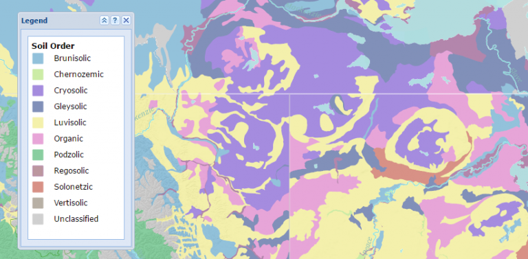
For example, if you are classifying soil orders like in the map below, how would you know what each color meant without a map legend? You can’t label each polygon as it would be cluttered in text.
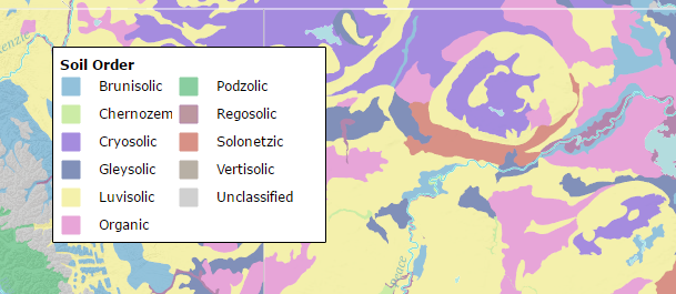
This is an appropriate case for using one. Actually, map legends are the driving force to understanding what is on a map.
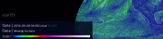
They are found everywhere from wind speeds like the Earth Null School map. In this case, it is a color ramp for wind speeds going from slow to fast.
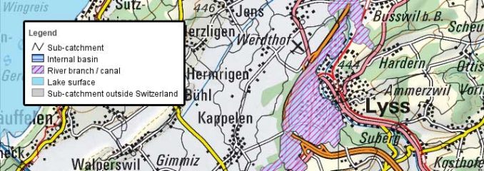
Finally, the SwissTopo has a variety of different symbols for the reader to understand.
Now, you understand what is where on the map. Let’s take a closer look at how to read a map legend.
How to read a map legend
Imagine you’re lost in the woods. You’re in desperate need of food and water… and all you have is a road map and compass.
Your survival instincts begin to kick in.
You know where you are on the map, but it’s time to make some sense of it.
So you pull out your map and it looks like this:

You begin to look at the features and line them up with the map legend.
Aha!
Blue means water. Green is a forested area. Red and black lines define the types of roads.
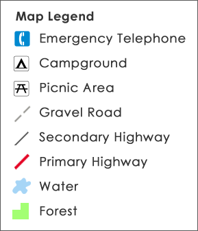
At this moment, you’re reading the map legend. The map legend contains all the symbols (symbology) used in the map to help the reader understand what the polygons, lines, points, or grid cells represent.
So where should you go?
Your best bet is to march your way to the primary and secondary highways because natural features like water and forest are not a sure path to finding people. Certainly, gravel roads and abandoned roads are no guarantee either.
Certainly, the telephone in the south would be handy too!
You pull out your compass and head south.
It’s only because you could make sense out of a map legend that you could make that decision.
What’s Next?
Cartographers simplify features in a map using symbols to represent real-world entities.
Sort of like a restaurant menu, these features in a map are defined in the map legend.
From simple topographic maps to complex geologic surveys, map keys (or map legends) are found in almost every single modern map.
We have a complete guide on how to tackle legends in ArcGIS Pro, which includes a step-by-step video.
Anything else you need to know? Drop a comment below.


Can I use your images of a map and map legend in a slide I am using with students? I might share or sell the slides as part of my education non-profit. Would that still be acceptable use? If I cite your website as the source?
Yes, that works
5 stars
What do you mean Kayden
So helpful! Thank you
Why do people use a lot of maps what if they know where they are going?
what is a map legend
Yes, that’s what this article explains.