North Korea Map and Satellite Imagery
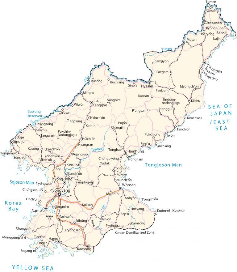
This map of North Korea (the Democratic People’s Republic of Korea or DPRK) contains cities, towns, highways, roads, lakes, and rivers. It also displays satellite imagery and an elevation map.
North Korea map collection

You are free to use our North Korea map for educational and commercial uses. Attribution is required. How to attribute?
About the map
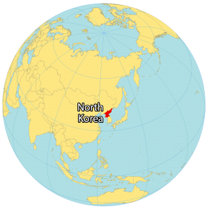
North Korea, also known as the Democratic People’s Republic of Korea (DPRK), is a country in Eastern Asia located along the East Sea (Sea of Japan). It is an isolated country and is tightly controlled by its totalitarian leaders. It borders both China and Russia to the north.
The 250-kilometer-long Demilitarized Zone (DMZ) splits the Korean Peninsula in half, crossing the 38th parallel, with South Korea to the south. Pyongyang is the capital and largest city of North Korea. Other major cities include Hamhung, Namp’o, and Sunch’ŏn.
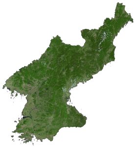
SATELLITE IMAGERY
North Korea Satellite Map
North Korea occupies an area of 120,540 square kilometers (46,540 sq mi) which is larger than South Korea but smaller than Nepal. The types of land use are mixed in North Korea including alpine, forest, farmland, and freshwater.

The country lies between 38°N and 43°N so its climate is mostly continental and oceanic with four distinct seasons. While forests cover an estimated 41% of North Korea’s area, 20% is arable land. Its longest rivers are the Yalu, Tumen, and Taedong Rivers. The Kwangpo Salt Lagoon is North Korea’s largest natural inland body.
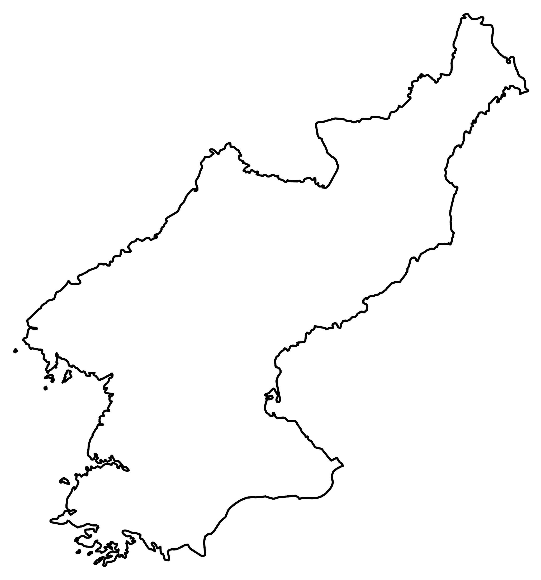
PHYSICAL MAP
North Korea Elevation Map
The country is extremely rugged with an estimated 80% mountain cover. Deep, narrow valleys separate its major mountain chains. But most major cities in North Korea are within the plains and lowlands to the west.
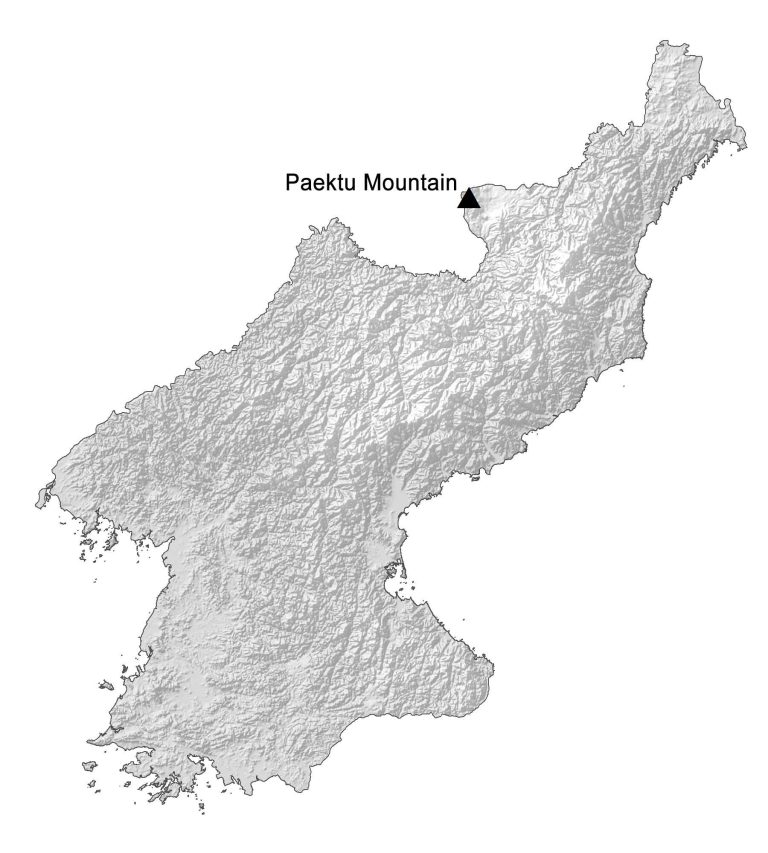
One of its major mountain chains is the Hamgyong Range to the northeast. Also, the Rangrim Mountains are in the north-central region. Finally, the Kangnam Range lies along its border with China to the north. At 2,743 m (9,003 ft), Paektu Mountain, the highest peak in North Korea, is a mountain of volcanic origin.
Capital City
Pyongyang
Major cities
Hamhung
Hyesan
Kaesong
Nampo
Sariwon
Sinpo
Sinuiju
Wonsan
Cities, towns and villages
Anbyon
Anak
Anju
Chasong
Chongjin
Chongju
Chongsong
Chosan
Chongjin
Chongpyong
Chongsong
Chungsan-up
Haeju
Hoeryong
Hoeyang
Honggul-li
Huichon
Hungnam
Hyangsan
Ichon
Iwon
Kaechon
Kanggye
Kapsan
Kilchu
Kimchaek
Koin-ni
Koksan
Kopung
Kowon
Kujang-up
Kusong
Kyonghung
Kyongsong
Manpo
Majon-ni
Monggŭmpo-ri
Munchon
Musan
Myongch’on
Najin
Nangnim
Onsong
Ongjin
Pakch’on
Paegam
Pungsan
Pukchong
Pukchin
Pyongsan
Pyonggang
Pyongwon
Pyongsong
Sariwon
Sepo
Sinpa
Sinchang
Songnim
Sogang-ni
Sohung
Sonchon
Sunchon
Supung
Taegwam
Tanchon
Taetan
Taechon
Tongchon
Tonghae
Unggi
Uiju
Wiwon
Yodok
Yongampo
Yongbyon
Yonghung
Yongdog-up
Lakes, rivers and water features
Imjin River
Korea Bay
Sea of Japan/East Sea
Supung Reservoir
Taedong River
Tongjoson Bay
Tumen River
Yalu River
Yellow Sea
Places of interest
Korean Demilitarized Zone