Mongolia Map and Satellite Image
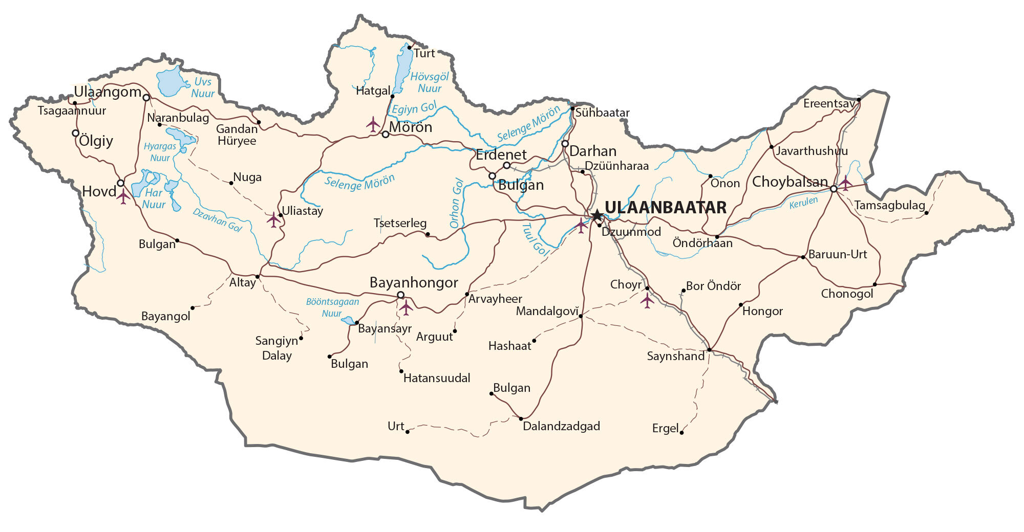
This map of Mongolia displays major cities, towns, highways, roads, lakes, and rivers. It contains satellite imagery, an elevation map, and a provincial map of Mongolia.
Mongolia map collection
You are free to use our Mongolia map for educational and commercial uses. Attribution is required. How to attribute?
About the map
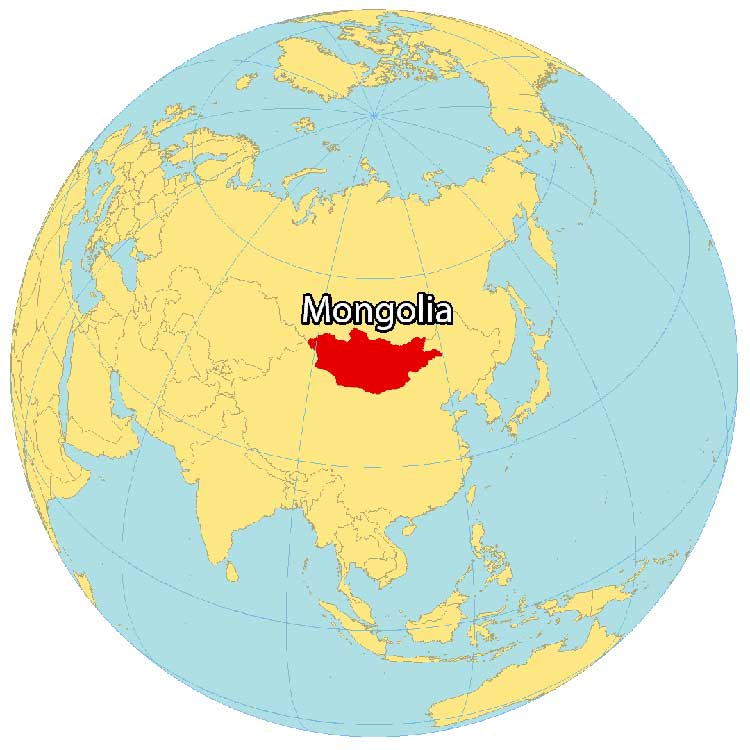
Mongolia is a landlocked country located in Northern Asia and is the world’s 18th-largest in terms of area. It’s situated between China to the south and Russia to the north.
Most of the country is covered by steppe, with forests in the north and the Gobi Desert in the south. The Gobi is one of the world’s driest deserts, with annual precipitation of fewer than 50 millimeters (1 inch).
Mongolia is the least densely populated country in the world with just 5 people per square mile. Mongolia’s capital and largest city is Ulaanbaatar, also the world’s coldest capital. Other major cities are Erdenet, Darkhan, and Choibalsan.
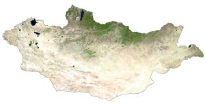
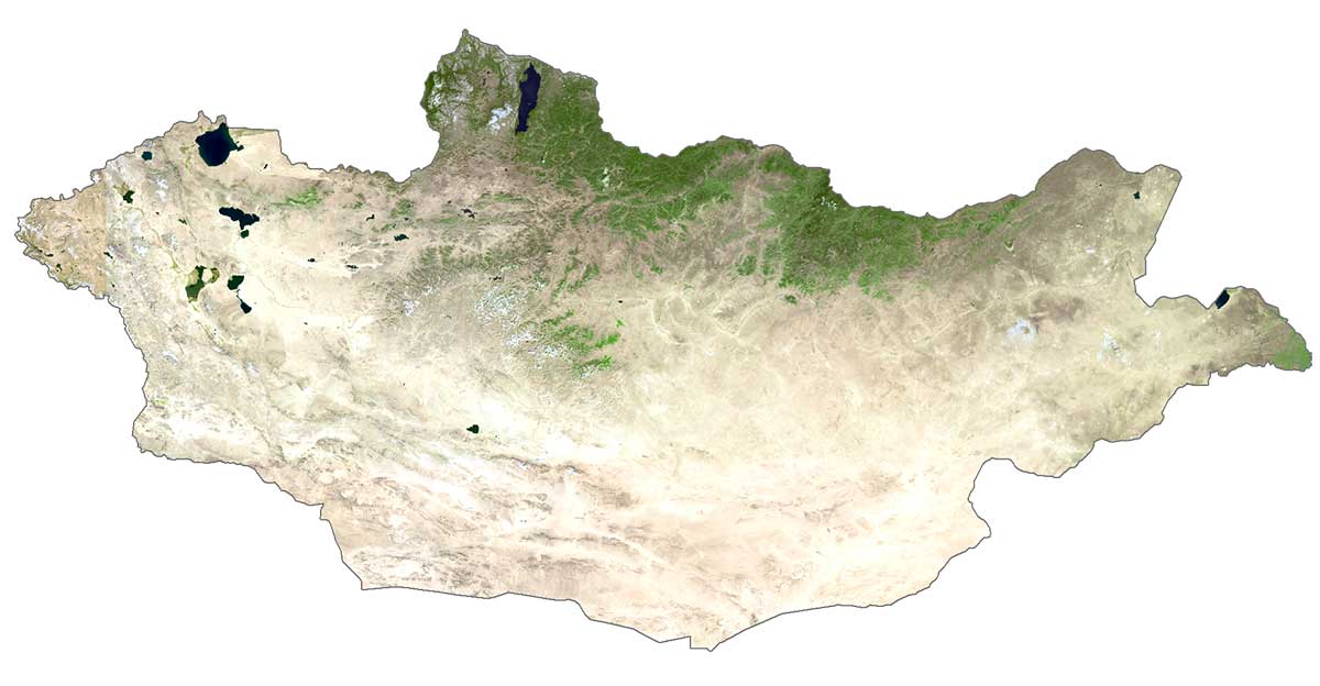
SATELLITE IMAGERY
Mongolia Satellite Map
Mongolia occupies an area of 1,564,116 square kilometers (603,909 sq mi), which is similar in size to Alaska. It’s the largest landlocked country in the world and one of the largest land areas in Asia. Mongolia is mostly desert or semi-desert plains with grassy steppe.
Specifically, the Gobi Desert occupies most of the southeast part of the country. While its longest river is the Orkhon River at 1,124 kilometers (698 mi), its largest lake by surface area is Uvs Lake. Mongolia lies between 42°N and 52°N latitude with a desert, continental climate.
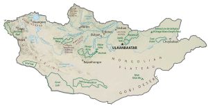
PHYSICAL MAP
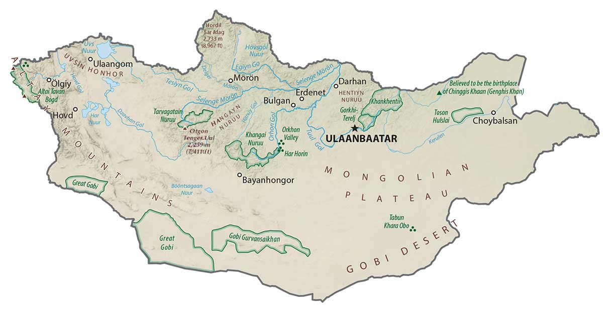
Mongolia Physical Map
Mongolia is one of the highest-lying countries with an average elevation of 1,580 meters (5,180 ft). It consists of a vast central plateau with the Altay Mountains situated in the west. At 4,356 m (14,291 ft) in height, this is the location of Mongolia’s highest point, the Khuiten Peak. Whereas its lowest point is at 560 m (1,840 ft) at Lake Huh. Another mountain range is the Hentiyn, along its border with Russia. Also, Hangayn is in west-central Mongolia.
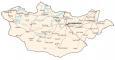
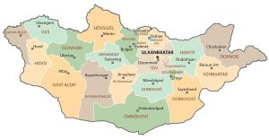
POLITICAL MAP
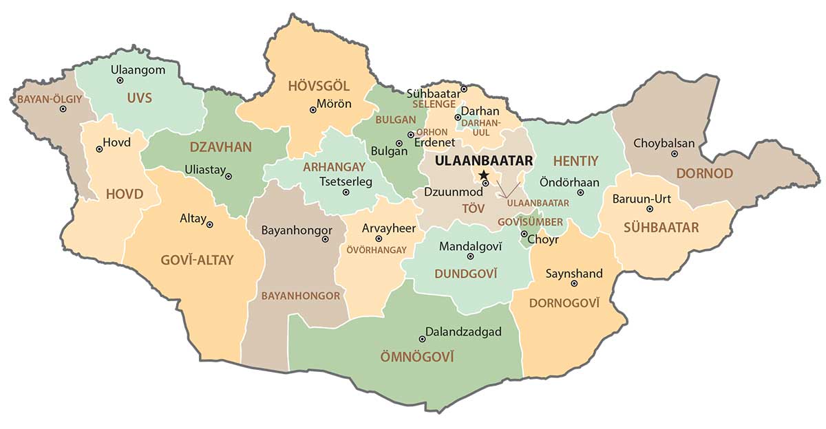
Mongolia Provincial Map
Provinces are the first-level unit in Mongolia that are divided geographically and administratively. Altogether, there are 21 provinces within Mongolia. But the capital of Ulaanbaatar acts as an independent provincial municipality. After provinces, the second-level unit is districts.
Capital City
Ulaanbaatar
Major cities
Arvayheer
Bayanhongor
Darhan
Erdenet
Hovd
Mörön
Ölgiy
Sühbaatar
Ulaangom
Cities, towns and villages
Altay
Arguut
Baruun-Urt
Bayangol
Bayansayr
Bor Öndör
Bulgan
Choyr
Dalandzadgad
Dzüünharaa
Dzuunmod
Ereentsav
Ergel
Gandan Hüryee
Hatgal
Hatansuudal
Hongor
Javarthushuu
Mandalgovi
Naranbulag
Nuga
Onon (Choybalsan)
Öndörhaan
Sangiyn Dalay
Saynshand
Tamsagbulag
Tsagaannuur
Tsetserleg
Turt
Uliastay
Lakes, rivers and creeks
Bööntsagaan Nuur Lake
Dzavhan River
Egiyn River
Har Nuur Lake
Khövsgöl Lake
Khyargas Lake
Kerulen River
Selenge Mörön River