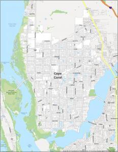
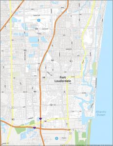
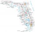
Florida County Map

About the map
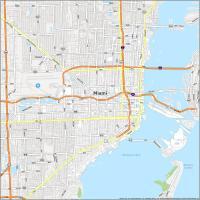
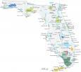
This Florida county map displays its 67 counties, which rank 21st highest for the number of counties. Some of the most populated counties in Florida are Miami-Dade, Broward, and Pinellas.
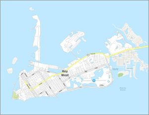
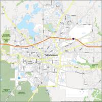
The state capital of Tallahassee is located in Leon County. But it’s nowhere close to being one of the most populated cities in Florida. That would be Jacksonville in Duval County, part of northeast Florida.
For size, Palm Beach County on the east coast is the largest with an area of about 2,034 square miles. But the smallest is Union County occupying an area of just 240 square miles. For population, Miami-Dade County is the largest with over 2.7 million people. But Liberty County and Lafayette County have the lowest population with less than 10,000 residents.
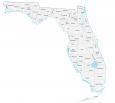

You are free to use our county map of Florida for educational and commercial uses. Attribution is required. How to attribute?
Florida county list
| FIPS Code | Name | Land (sq mi) | Water (sq mi) | Population (2024) |
|---|---|---|---|---|
| 12-001 | Alachua County | 875.0 | 93.8 | 291,782 |
| 12-003 | Baker County | 585.2 | 3.7 | 29,325 |
| 12-005 | Bay County | 758.5 | 274.6 | 199,718 |
| 12-007 | Bradford County | 294.0 | 6.5 | 28,075 |
| 12-009 | Brevard County | 1015.2 | 541.8 | 658,447 |
| 12-011 | Broward County | 1203.1 | 119.7 | 2,037,472 |
| 12-013 | Calhoun County | 567.3 | 7.0 | 13,278 |
| 12-015 | Charlotte County | 681.1 | 177.1 | 212,122 |
| 12-017 | Citrus County | 581.9 | 191.3 | 170,174 |
| 12-019 | Clay County | 604.8 | 38.8 | 236,760 |
| 12-021 | Collier County | 1996.3 | 308.7 | 416,233 |
| 12-023 | Columbia County | 797.5 | 3.8 | 73,977 |
| 12-027 | DeSoto County | 636.7 | 2.4 | 36,744 |
| 12-029 | Dixie County | 705.1 | 158.5 | 17,614 |
| 12-031 | Duval County | 762.9 | 155.5 | 1,055,159 |
| 12-033 | Escambia County | 657.0 | 217.7 | 331,275 |
| 12-035 | Flagler County | 485.1 | 85.7 | 136,744 |
| 12-037 | Franklin County | 545.1 | 492.5 | 12,979 |
| 12-039 | Gadsden County | 516.3 | 12.2 | 44,151 |
| 12-041 | Gilchrist County | 349.7 | 5.5 | 20,233 |
| 12-043 | Glades County | 806.6 | 180.2 | 13,132 |
| 12-045 | Gulf County | 553.4 | 191.0 | 15,876 |
| 12-047 | Hamilton County | 513.8 | 5.3 | 14,334 |
| 12-049 | Hardee County | 637.6 | 0.6 | 26,068 |
| 12-051 | Hendry County | 1156.2 | 33.6 | 46,130 |
| 12-053 | Hernando County | 472.8 | 116.2 | 218,150 |
| 12-055 | Highlands County | 1017.3 | 89.4 | 109,778 |
| 12-057 | Hillsborough County | 1021.8 | 243.9 | 1,581,426 |
| 12-059 | Holmes County | 478.9 | 10.2 | 19,876 |
| 12-061 | Indian River County | 502.8 | 114.1 | 172,139 |
| 12-063 | Jackson County | 918.2 | 36.4 | 49,980 |
| 12-065 | Jefferson County | 598.1 | 38.5 | 15,921 |
| 12-067 | Lafayette County | 543.4 | 4.5 | 8,640 |
| 12-069 | Lake County | 950.7 | 206.2 | 444,204 |
| 12-071 | Lee County | 782.0 | 430.4 | 860,959 |
| 12-073 | Leon County | 666.8 | 35.0 | 300,488 |
| 12-075 | Levy County | 1118.2 | 294.6 | 47,765 |
| 12-077 | Liberty County | 835.6 | 7.6 | 7,955 |
| 12-079 | Madison County | 696.5 | 19.2 | 18,364 |
| 12-081 | Manatee County | 743.1 | 149.6 | 458,352 |
| 12-083 | Marion County | 1588.4 | 74.3 | 428,905 |
| 12-085 | Martin County | 543.8 | 209.3 | 165,666 |
| 12-086 | Miami-Dade County | 1898.7 | 532.4 | 2,838,461 |
| 12-087 | Monroe County | 983.0 | 2754.2 | 80,908 |
| 12-089 | Nassau County | 648.7 | 77.2 | 104,376 |
| 12-091 | Okaloosa County | 930.2 | 151.8 | 220,483 |
| 12-093 | Okeechobee County | 768.9 | 123.1 | 42,369 |
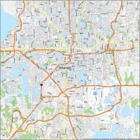
| 12-095 | Orange County | 902.5 | 100.7 | 1,533,646 |
| 12-097 | Osceola County | 1327.7 | 178.3 | 468,058 |
| 12-099 | Palm Beach County | 1965.6 | 417.5 | 1,582,055 |
| 12-101 | Pasco County | 746.7 | 121.8 | 659,114 |
| 12-103 | Pinellas County | 273.7 | 334.4 | 965,870 |
| 12-105 | Polk County | 1797.2 | 213.3 | 852,878 |
| 12-107 | Putnam County | 727.9 | 99.1 | 77,301 |
| 12-113 | Santa Rosa County | 1012.4 | 161.4 | 207,653 |
| 12-115 | Sarasota County | 556.9 | 168.4 | 476,604 |
| 12-117 | Seminole County | 309.4 | 35.9 | 494,605 |
| 12-109 | St. Johns County | 600.7 | 220.8 | 334,928 |
| 12-111 | St. Lucie County | 571.7 | 116.2 | 390,670 |
| 12-119 | Sumter County | 557.1 | 22.7 | 154,693 |
| 12-121 | Suwannee County | 688.5 | 3.7 | 47,536 |
| 12-123 | Taylor County | 1043.3 | 188.9 | 21,843 |
| 12-125 | Union County | 243.6 | 6.2 | 15,738 |
| 12-127 | Volusia County | 1101.2 | 331.2 | 602,772 |
| 12-129 | Wakulla County | 606.4 | 129.3 | 37,115 |
| 12-131 | Walton County | 1037.7 | 201.9 | 89,666 |
| 12-133 | Washington County | 584.7 | 31.3 | 26,503 |