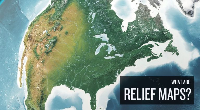
What Are Relief Maps?
DEFINITION:
A relief map is a type of map that shows the shape and elevation of the land, highlighting features like mountains, valleys, and plains.
What Is a Relief Map?
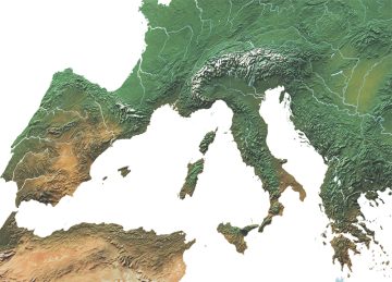
Relief maps are ways to visualize the Earth’s terrain. It highlights the differences in height, like mountains and valleys, using colors and shadows. While mountains appear raised, valleys and plains seem lower.
This type of map is great for understanding how high or flat an area is. For example, darker colors often mean higher elevations, making mountains stand out. Some relief maps are even 3D, which adds to the realism.
Now that you have some background on what a relief map is, let’s tour through all of the different types of relief maps.
Types of Relief Maps
Through relief maps, we can learn about the shape and texture of our world. The base layer is a digital elevation model. They help us understand the complexity of where we live.
Let’s dive into the various types of relief maps. Although there is overlap between their types, there are still subtle nuances between each one.
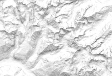
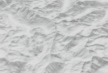
1. Shaded Relief Map
This is the most common type of relief map. Imagine the sun casting shadows over mountains and valleys. This map uses shading to make the terrain look 3D. It’s like the sun is shining on paper with real mountains and valleys.
2. Raised Relief Map
This one almost feels like you can touch the mountains. Raised relief maps pop out of the paper. Feel the bumps of mountains and dips of valleys. With exaggerated terrain, raised relief maps make an awesome wall poster.
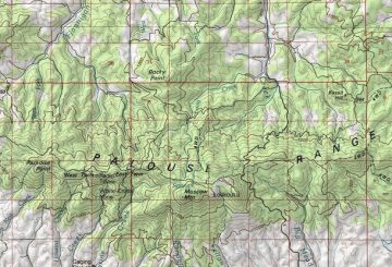
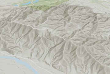
3. Topographic Relief Map
Topographic relief maps use contour lines to detail elevation changes. Every line represents an elevation value. For hikers, it shows how steep or flat an area is. Here is how to download a topographic map.
4. 3D Relief Map
It’s the modern twist on mapping. Using GIS software, these maps feel almost like you’re flying over the landscape. They’re interactive. This means you can zoom in on the landscape as if you’re on a virtual tour.
5. Embossed Map
An embossed map has raised parts that show mountains and valleys. It’s designed with raised features that stand out. These types of relief maps show the bumps and dips to figure out where hills and valleys are.
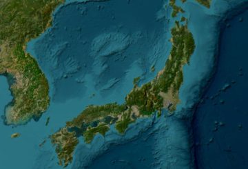
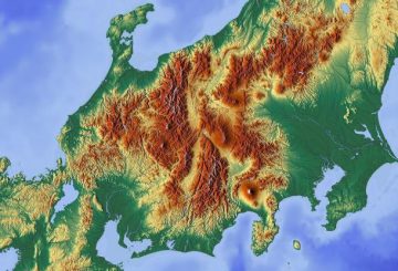
6. Hypsometric Map
Colors show height. By assigning colors to different elevations, these maps create a visual spectrum of height. From the green of lowlands to the white of snowy peaks, they show elevation in an easily understood way.
7. Exaggerated Relief Map
Sometimes, to see the small details, you need to make them bigger. These maps amplify the Earth’s features. Gentle slopes look steep and small hills appear large. Imagine mountains twice as tall. In this case, bigger is better.
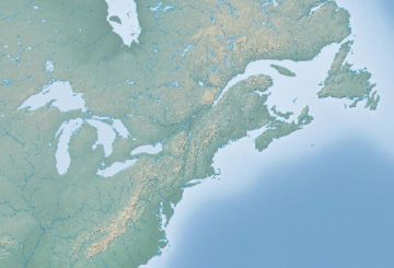
8. Physical Map
A physical map shows natural features. The colors and symbols help us see how high or low the terrain is. It relates to relief by showing how high or flat places are. Physical maps often have different colors for elevations. But not always.
Relief Maps in Geography
Relief maps show us the Earth’s ups and downs. With these maps, mountains and valleys jump out at us. It’s almost as if we can see, touch, and explore places without physically being there.
We’ve listed all the different types of relief maps. What’s your favorite? How often do you use relief maps in GIS? Please let us know in the comment section below.


