How to Download USGS Topo Maps for Free
What Are USGS Topo Maps?
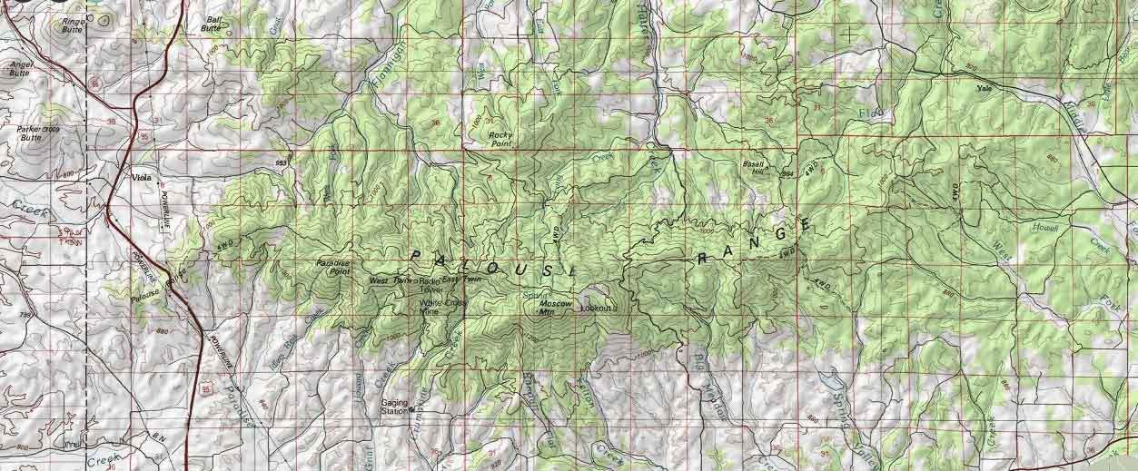
If you’re looking for topographic maps for the United States, the first place to look is the USGS topo maps series.
Since 1884, the purpose of these general-use maps has been to display the complex, changing geography of the United States.
This includes hydrography, place names, contour lines, and cultural features of the nation.
So how do you get your hands on USGS Topo Maps? We show you 2 quick ways to download USGS Topo Maps.
How to Download Free USGS Topo Maps with the National Map Viewer
Currently, the most recent version is published as “US Topo” and stored in digital format on the TNM Viewer V2.
Depending on your needs, you can choose “US Topo” or “Historical Topographic Maps” in the TNM Viewer. Otherwise, you can download the raw vector and raster GIS datasets in the bottom option.
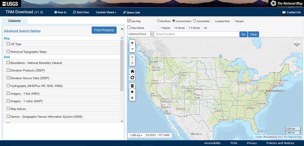
By default, your current extent is the search area. However, you can enter latitude and longitude coordinates or draw a polygon extent to change it. Also, you can filter by date period in the advanced option.
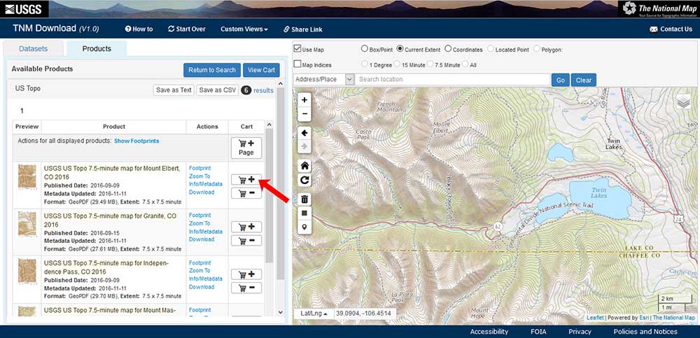
Finally, you can click “Find Products” if you want the current “Topo Maps” or the “Historical Topographic Maps” version. From here, it’s a matter of adding your items to your cart and downloading it as a PDF.
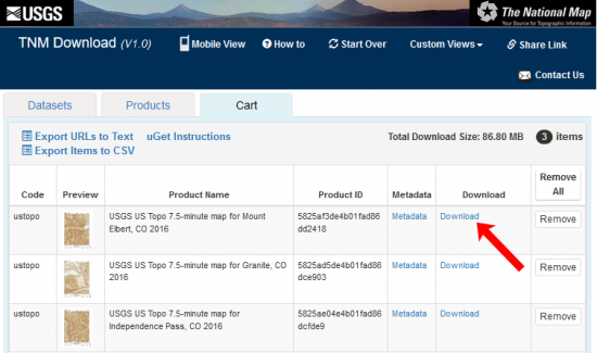
For the US Topo maps that you want to download, simply click the “Download” button under the “Cart” tab.
Of course, the advantage of the TNM viewer is that you can preview the USGS Topo Map before you download it. Unless you want topo maps in Alaska, they are based on 1:100,000 and 1:24,000 scales.
How to Download Historical USGS Topographic Maps with TopoView
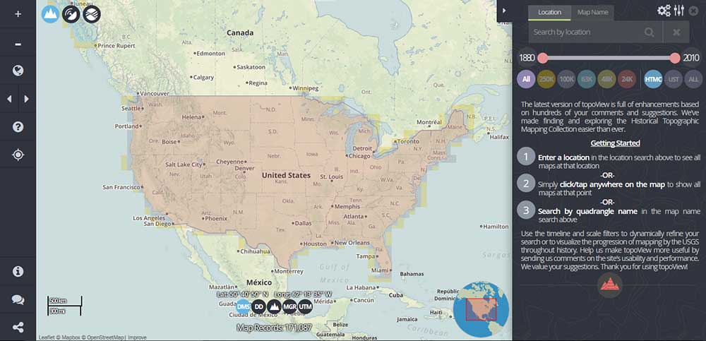
One of the neatest things about USGS topographic maps is how some of them date back to 1884. Like a time capsule, you can really explore these historical maps in the USGS TopoView application
As part of the Historic Topographic Map Collection (HTMC), you can filter USGS historical topographic by time period. Simply, move the time slider and it will filter and preview the Topo maps.
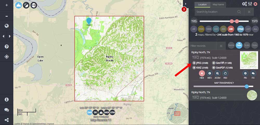
Similar to the TNM Viewer, add items to your cart that you want to download. To do that, you have to click anywhere on the map. Also, you can preview the topo map in the viewer which is a neat function.
From here, you can download the JPEG, KMZ, GeoTIFF, or GeoPDF by clicking the option on the right.
The USGS TopoView was specifically designed for time. Because you can preview images and filter with a time slider, these qualities make TopoView extremely intuitive for the end-user.
USGS Historical Topographic Map Explorer
The USGS Historical Topographic Map Explorer is an Esri web application that is part of the Living Atlas of the World. Not only can you compare maps using transparency sliders, but you can also download them.
First, type in a city name in the search and click enter. Secondly, this will zoom you into your area of interest. Once you click on the map, it will display all the options you have to download topographic maps.
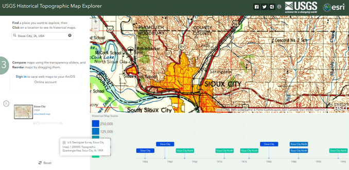
You don’t need an ArcGIS Online account to download any of the topographic maps. Simply, click the “Download” button in the left panel and you will be able to obtain a copy of the topographic map.
Here’s the latest version of the Topo Map Explorer courtesy of Esri’s Living Atlas of the World.
Web Services (WMS) or Physical Prints
PDFs and raw data aren’t the only two ways to view USGS topographic maps.
If you have any GIS software installed on your machine, you can consume web mapping services like these National Map Service Endpoints. All you have to do is add these URLs to your map.
When you just want physical prints, you can visit the USGS store to get them delivered at a cost.
Overall, the natural and physical landscapes in the USGS topo maps have become an extremely valuable base map source of data. Check out these sources and see for yourself.


When I download the maps for use in ArcMap, the borders of the paper map are included. How can I get them without the borders?
If it’s a raster, I don’t think you can.
I want to download large number of maps and be able to do it without have to download each one individually. Is there a was to do that?
I’m looking for a digital map of Lake Lanier with contours. I have found printed maps, but need it digital. I am looking for a downloadable vector file, not a PDF. Is this possible to get from your site?
I am a Realtor, specializing in Land. I deal with unknown addresses. I surely do not possess, or even know where to obtain the longitude/latitude of the parcels. I am given APNs (Assessor Parcel Numbers) from the title company, along with the owner’s name. I didn’t see where I can type the state, county, and assessor’s parcel number in the search line of your website that will give me the satellite or topo view of a property, no matter the size.
I have looked all over the place on the Internet to find a way I can locate a satellite or topo view of these parcels, i.e. Google earth, google maps, landopia, etc.
Do you have any ideas of a website, if not on your USGS website for the information I desire from the information I have to give?
Thank you.
In order to run a search, you will need the parcel fabric with these IDs in them. Which state are you in? You can first take a look in the link I’ve provided below. It will only be available if your state geospatial authority has added it as open data. https://hub.arcgis.com/search
If not, you can try to ask them for the Accessor Parcel Numbers. Sorry, I couldn’t be too much help.
I am working for an oil company. I am trying to download a hi-res top map shapefile for Lubbock-Crosby-Garza Counties in Texas, but could not find the map covering the area of interest. Some only has pdf in stead of shapefile. Please help!
How can I download, free LIDAR image?
Here’s our list of free LiDAR sources: https://gisgeography.com/top-6-free-lidar-data-sources/
We’ve been trying to use USGS topo map layer with Open Street Maps, but the contour interval appears to be bigger than on the downloadable 7.5 minute USGS topo maps, e.g. while the downloadable maps have 20′ contour interval, the digital USGS map tile at the same scale shows 100′ contour interval which is too big for our purposes. Can that be changed?
Could you please lead me to the download site?
The link is in the article – TNM Viewer and USGS TopoView Application. Either one will work
Good references and info. New users or inexperienced users will be able to use these!