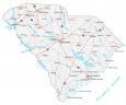
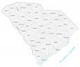
South Carolina County Map

About the map
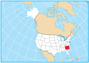
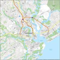
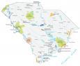
This South Carolina county map displays its 46 counties. Greenville, Richland, and Charleston counties are the most populated counties in South Carolina. South Carolina borders North Carolina, Georgia, and the Atlantic Ocean.
For size, Berkeley County is the largest county in South Carolina. It occupies an area of over 1200 square miles in the southeastern portion of the state. Conversely, the smallest county in South Carolina is Calhoun County, which is just under 400 square miles.
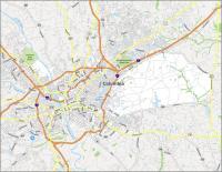
Greenville County is the most populated county in South Carolina with over 500,000 people. Richland County is the next most populated county and is home to Columbia, the capital and second-largest city of South Carolina.
You are free to use our county map of South Carolina for educational and commercial uses. Attribution is required. How to attribute?
South Carolina County List
| FIPS Code | Name | Land (sq mi) | Water (sq mi) | Population (2024) |
|---|---|---|---|---|
| 45-001 | Abbeville County | 491.4 | 20.6 | 24,607 |
| 45-003 | Aiken County | 1070.6 | 9.5 | 179,245 |
| 45-005 | Allendale County | 408.1 | 4.3 | 7,551 |
| 45-007 | Anderson County | 713.8 | 41.9 | 217,183 |
| 45-009 | Bamberg County | 393.4 | 2.2 | 12,870 |
| 45-011 | Barnwell County | 548.4 | 8.9 | 20,495 |
| 45-013 | Beaufort County | 576.2 | 347.3 | 201,775 |
| 45-015 | Berkeley County | 1103.6 | 130.3 | 264,276 |
| 45-017 | Calhoun County | 381.2 | 11.3 | 14,249 |
| 45-019 | Charleston County | 917.9 | 440.1 | 431,001 |
| 45-021 | Cherokee County | 393.3 | 4.5 | 57,770 |
| 45-023 | Chester County | 580.7 | 5.5 | 32,323 |
| 45-025 | Chesterfield County | 799.0 | 6.7 | 44,488 |
| 45-027 | Clarendon County | 607.0 | 88.7 | 31,030 |
| 45-029 | Colleton County | 1056.5 | 76.8 | 39,259 |
| 45-031 | Darlington County | 560.6 | 5.7 | 62,425 |
| 45-033 | Dillon County | 405.1 | 1.8 | 27,577 |
| 45-035 | Dorchester County | 568.6 | 2.6 | 174,663 |
| 45-037 | Edgefield County | 500.8 | 6.3 | 29,455 |
| 45-039 | Fairfield County | 686.3 | 23.6 | 20,369 |
| 45-041 | Florence County | 800.5 | 3.8 | 138,049 |
| 45-043 | Georgetown County | 813.9 | 221.3 | 66,035 |
| 45-045 | Greenville County | 785.1 | 9.7 | 570,745 |
| 45-047 | Greenwood County | 454.7 | 8.2 | 70,041 |
| 45-049 | Hampton County | 560.0 | 2.7 | 18,172 |
| 45-051 | Horry County | 1133.7 | 120.7 | 413,391 |
| 45-053 | Jasper County | 655.2 | 46.4 | 35,618 |
| 45-055 | Kershaw County | 726.5 | 13.8 | 71,698 |
| 45-057 | Lancaster County | 549.1 | 6.0 | 111,652 |
| 45-059 | Laurens County | 713.8 | 10.1 | 70,545 |
| 45-061 | Lee County | 410.2 | 1.0 | 15,958 |
| 45-063 | Lexington County | 699.0 | 58.7 | 313,774 |
| 45-065 | McCormick County | 359.1 | 34.7 | 9,983 |
| 45-067 | Marion County | 489.3 | 4.9 | 28,368 |
| 45-069 | Marlboro County | 479.9 | 5.6 | 25,498 |
| 45-071 | Newberry County | 630.0 | 17.2 | 39,203 |
| 45-073 | Oconee County | 626.4 | 47.2 | 82,475 |
| 45-075 | Orangeburg County | 1106.3 | 21.5 | 83,129 |
| 45-077 | Pickens County | 496.9 | 15.7 | 138,207 |
| 45-079 | Richland County | 757.3 | 14.6 | 430,651 |
| 45-081 | Saluda County | 452.9 | 9.0 | 19,452 |
| 45-083 | Spartanburg County | 807.7 | 11.3 | 369,256 |
| 45-085 | Sumter County | 665.1 | 17.0 | 104,776 |
| 45-087 | Union County | 514.2 | 1.9 | 26,678 |
| 45-089 | Williamsburg County | 934.2 | 2.9 | 29,865 |
| 45-091 | York County | 680.7 | 15.2 | 303,001 |