Whatever Happened to Yahoo Maps?
Does Yahoo Maps still exist? There was a time when Yahoo Maps was a force to be reckoned with. But since June 2015, that time is now gone.

Does Yahoo Maps still exist? There was a time when Yahoo Maps was a force to be reckoned with. But since June 2015, that time is now gone.
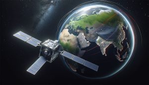
We compare the commercial satellite companies – BlackSky, Planet, and Maxar. Each company has carved out its niche in satellite technology.
From near real-time satellite views to live feeds, this article aims at showing you how to view a live satellite map of the world.

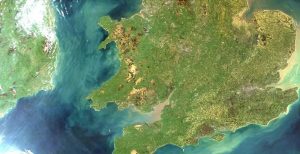
These are the top 25 satellite maps in the world. The best part? You’ll get to explore Earth in new ways that you’ve never thought possible.

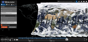
When you want historical imagery, the best web viewers are Google Earth, Esri’s Wayback Living Atlas, USGS LandLook, NASA Worldview and Planet’s Stories.
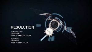
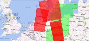
Planet Labs (or simply Planet) started with one main idea: To capture our dynamic Earth… Every day. using an ultra-compact, inexpensive CubeSAT satellite.

If you’re searching for free satellite imagery, we rank the best sources of free satellite data from authoritative sources like NASA, USGS and Maxar.
If you want to download Sentinel satellite data, then you’ve come to the right place. We show you how to obtain free Sentinel satellite data.
The USGS Earth Explorer is quick and easy to download free Landsat imagery & other remote sensing data. Enter ROI, define timeline and download for free.