BlackSky vs Planet vs Maxar – 10 Differences in Technology
Today, we’ll compare the top commercial satellite companies – BlackSky, Planet, and Maxar. Each company has carved out its niche in the satellite technology sector. We’ll look at each company’s strengths and give you a winner in each category. Plus, we’ll explore where each one is heading in the future. Let’s get started.
1. Company Background
Before we get into the finer details, we’ll give a quick summary of each satellite company. Who is the largest company out of BlackSky, Planet, and Maxar?
BlackSky
BlackSky’s work primarily revolves around satellite imagery and data analytics. They also offer services to observe, analyze, and interpret events across the globe in near-real time. BlackSky is based in Seattle, Washington, and Herndon, Virginia. According to BlackSky’s LinkedIn profile, it has anywhere from 200 to 500 employees.
Planet
Planet Labs specializes in satellite data analytics. They provide services such as monitoring, base maps, and tasking. Founded in 2010 and headquartered in San Francisco, California, the company’s mission is to image all of Earth’s landmass every day. The company employs 600 full-time employees and was founded by 3 former NASA scientists.
Maxar
Maxar Technologies Inc. has a wide focus on satellite technology and geospatial intelligence. Their flagship satellites are WorldView with 30 cm resolution imagery. Based in Westminster, Colorado, Maxar employs around 4,400 people.
Verdict
Maxar is the largest company, while BlackSky is the smallest in size. Planet takes the middle ground for company size in our comparison.
Winner – Maxar
2. Satellite Coverage
Imagine a flashlight shining down from the sky. The lit area on the ground is the satellite’s coverage. Who is shining the most light toward Earth? Let’s examine this below.
Planet
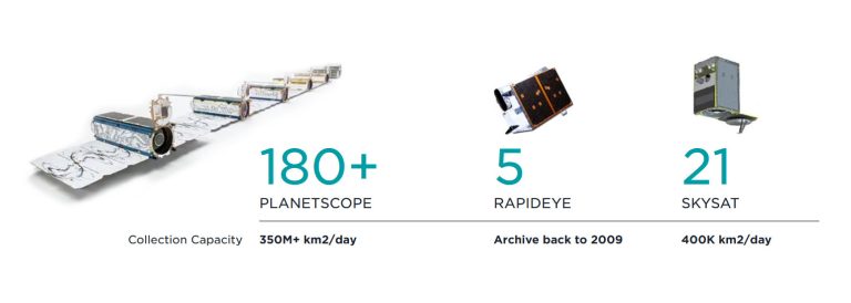
Quantity over quality? Planet’s secret is its “nanosatellites”, which they call “doves”. Because “doves” are the size of a Rubik’s cube, Planet can launch more at a fraction of the cost. In fact, Planet has deployed over 450 satellites to this date. But they currently operate over 200 satellites in orbit. Each day, they collect over 350 million square kilometers. That’s a lot of imagery.
Maxar
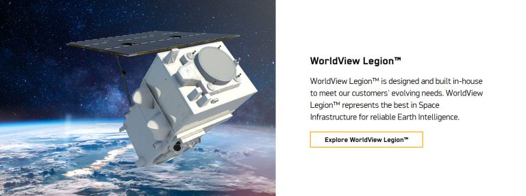
Maxar operates more traditional, larger satellites such as the WorldView and GeoEye series. The problem with doing this is that they have much less coverage compared to Planet. But the future looks different for Maxar. The launch of WorldView Legion will increase its coverage. It won’t be as much as Planet though.
BlackSky
Oddly enough, it’s hard to find information about BlackSky’s satellite constellation. This should be front and center on their page. From what I can tell, BlackSky operates 19 microsatellites. Each one carries an identical SV-24 (Spaceview-24™) sensor. However, they plan to launch a constellation of 60 satellites with revisit times of a few hours or less. Rapid tasking is a strong point with delivery under 90 minutes.
Verdict
Planet excels with its daily global coverage, while BlackSky offers rapid tasking and high revisit rates. Maxar focuses more on high-resolution, detailed imagery.
Winner – Planet
3. Spatial Resolution
Spatial resolution is the sharpness of an image. It tells you how small the details are that you can see in a satellite image. Let’s compare each satellite company’s spatial resolution.
Maxar
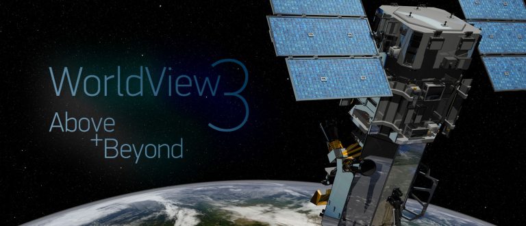
Maxar is known for its extremely high-resolution imagery. WorldView-3 provides imagery at a resolution of up to 30 centimeters. It’s not too far-fetched to say their images are almost detailed enough to capture license plates. This level of clarity makes Maxar’s imagery useful for any detailed analysis.
BlackSky
Again, it’s difficult to find the specs of BlackSky. Why? According to ESA’s EO portal, BlackSky’s SV-24 sensor has a spatial resolution of 1 m. This isn’t too impressive, but a 1-meter resolution is still quite useful for a range of applications, where finer details are less critical.
Planet
Planet’s “dove” constellation typically offers a spatial resolution of about 3 to 5 meters. This resolution is suitable for large-scale monitoring, such as agricultural or environmental observations. On the other hand, its SkySat Constellation provides a spatial resolution of about 50 centimeters with a lower revisit time.
Verdict
Maxar stands out for its high-resolution imagery. Whereas BlackSky and Planet offer relatively lower resolutions. However, their advantages include rapid imaging and large coverage areas.
Winner – Maxar
4. Spectral Bands
“Spectral resolution” is about capturing images in various wavelengths of light, beyond just the basic colors that our eyes can see. Here’s more information on spectral resolution. Let’s compare the differences between BlackSky, Planet, and Maxar.
Maxar
Worldview-3 has 29 spectral bands. This includes a panchromatic band, eight multispectral bands, and eight shortwave infrared bands. It also has 12 CAVIS (Cloud, Aerosol, Vapor, Ice, and Snow) bands. These advanced spectral bands allow Worldview-3 to capture some of the most detailed images of the Earth’s surface.
Planet
The earliest “dove” satellites had simply red, green, blue, and near-infrared. But the newest PlanetScope imagery adds four extra bands. They include coastal blue, green I, yellow, and red edge. Coming soon though is Planet Hyperspectral. I am super excited about this hyperspectral mission. Is it going to happen though?
BlackSky
I’m still amazed that there is no information on the BlackSky webpage. According to this USGS report on BlackSky Multispectral Sensor. BlackSky’s SV-24 imager operates in 4 channels, with 3 visible (RGB), and one panchromatic. On the other hand, SV-80 contains an 8-band multispectral sensor. The big difference is that it contains visible panchromatic/color and SWIR/MWIR.
Verdict
Everything in the world has a spectral signature. When you have 29 spectral bands like you do for Worldview-3, this gives greater potential to more accurately Earth’s features. At this point, nothing beats Maxar’s Worldview-3 and it’s one of the most advanced sensors in the world today. Planet Hyperspectral might make things interesting though.
Winner – Maxar
5. Basemaps
Does the satellite company provide any basemaps for easy access? We examine the web services that the geospatial industry can consume from Planet, Maxar, and BlackSky.
Planet
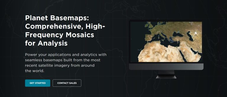
Current, complete, and analysis-ready mosaics. Planet Basemaps are regularly updated with their fleet of “dove” satellites. These basemaps are created by stitching together multiple satellite images. If you’re looking for near real-time satellite imagery, this high-resolution basemap is as close as you’re going to get.
Maxar
When you watch the news and see any satellite imagery, it’s likely Maxar that they use. In fact, Esri’s ArcGIS Online Living Atlas of the World contains mostly Worldview imagery. They also plan to integrate their Precision3D data. Finally, don’t forget about the Maxar Discovery Platform, which is an archive for the search and discovery of Maxar imagery.
BlackSky
BlackSky focuses on delivering near-real-time satellite imagery, rather than basemap services. They specialize in frequent imaging for dynamic monitoring and analysis. The focus is not on creating traditional, static basemaps. At least from what I can tell.
Verdict
Planet’s platform processes and distributes a global, near-daily stream of satellite data. Customers incorporate this into their daily workflows and operations.
Winner – Planet
6. Analytics Platforms
Full disclosure. All the above, I am most confident in. For the category of “Analytics”, I am less confident. But I’ll give my best-educated guess.
BlackSky
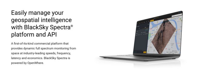
Maybe, BlackSky is better at advertising for their analytics? But it’s clear that their geospatial intelligence platform, BlackSky Spectra, leverages artificial intelligence. BlackSky uses machine learning to detect everything from moving objects to buildings and vessels. This focus on advanced analytics is what sets BlackSky apart for strategic decisions.
Planet
Planet’s analytical capabilities include change detection, machine learning, object identification, and more. Custom analytics solutions are tailored to meet the specific needs of different industries, ranging from agriculture to government sectors. As satellite technology evolves, Planet’s capabilities are expected to expand in this area too.
Maxar
Maxar offers a range of analytics capabilities focused on high-resolution satellite imagery. These analytical capabilities include urban expansion, deforestation, and disaster response. Maxar’s advanced analytics also integrate AI and machine learning for better decision-making.
Verdict
BlackSky, Maxar, and Planet each offer unique strengths in satellite data analytics. BlackSky focuses on real-time geospatial intelligence and rapid revisit rates. Whereas Maxar excels in high-resolution imagery and sophisticated analytics. Finally, Planet is ideal for environmental monitoring and change detection over time.
Winner – BlackSky
7. Applications and Use Cases
Take this one with a grain of salt because you can use satellite imagery for almost any use case! But I’ll explain why each satellite company is ideal for any situation.
BlackSky
BlackSky is one of the best services for speed of delivery. This means they’re likely best for monitoring disaster response, defense, and intelligence applications. Anything that you need to be delivered quickly might be best suited for BlackSky. But BlackSky imagery can also be useful for environmental monitoring, urban planning, and infrastructure applications.
Planet
Planet is helpful for anything that needs a high revisit time. For example, this includes environmental monitoring, agricultural planning, and short-term change detection. With their basemaps, Planet integrates 1.5+ million scenes daily. That means a fresh image of Earth every day.
Maxar
I’ve seen companies use WorldView imagery in a range of applications. Once they obtain it, they use it for critical tasks. For example, they use it for detailed mapping in sectors ranging from real estate development to environmental management. Images are sharp. But the only downside is that it can take months to get that perfect, cloudless image.
Verdict
While BlackSky is best for quick delivery, Planet is ideal for continuous monitoring. Finally, Maxar is an ideal solution for detailed image analysis.
Winner: All
8. Speed of Delivery
Why does speed of delivery matter? It matters because it can be critical for timely decision-making and response in critical situations. Who is best at speed of delivery?

BlackSky
With BlackSky’s rapid tasking capability, delivering is typically under 90 minutes. This is one of the fastest deliveries for imagery in the market today. It stands out as a game-changer for time-sensitive missions.
Planet
Planet’s delivery process includes several stages. In general, it includes order time, scheduled time, and collection time. It also consists of different types of delivery including standard and fast track. Fast-track delivery offers expedited service with less latency time.
Maxar
Maxar Technologies has recently introduced the Maxar Geospatial Platform (MGP). They developed this platform to streamline and expedite access to satellite imagery. Additionally, their Rapid Access Program (RAP) provides online access for time-sensitive missions. But they don’t specify the duration for how fast delivery will be.
Verdict
Both BlackSky and Planet use smaller satellites. This enables quicker deployment and updates to their constellations. Maxar uses larger, more traditional satellites. Although it has advanced imaging capabilities, the speed of delivery is typically slower.
Winner – BlackSky
9. Convenience and Extras
What does each satellite provider give you for convenience? Let’s take a look at what each company offers for extra services.
Maxar
I work in the geospatial industry. A decade ago, everyone wanted a self-service platform for downloading satellite imagery. Now, Maxar offers access to 125+ petabytes with a 20+ year image library, through their Maxar Geospatial Platform (MGP). This includes imagery archives like Ikonos and GeoEye. I also like the humanitarian efforts from Maxar with their Open Data Program during periods of disaster.
Planet
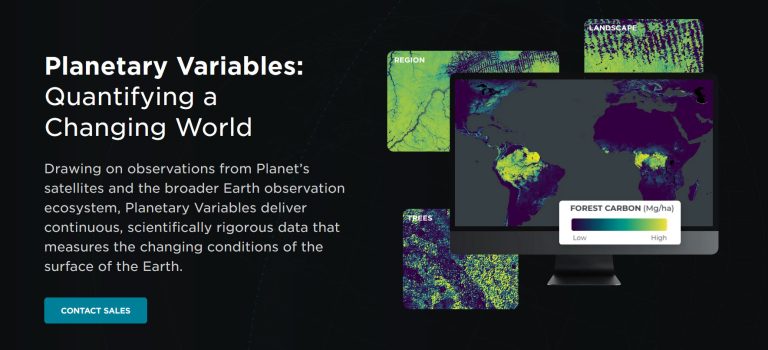
One of the neatest features is Planetary Variables. These are analytics-ready data derived from their satellite imagery. You’ll find metrics like crop health, forest carbon, temperature, and soil water content. Planet also makes imagery of disaster areas publicly through their free and open resources.
BlackSky
You can task satellites to capture data in a variety of formats. For instance, nighttime, stereo, and burst imagery (analyzing motion) also exist. Detecting moving objects can help you understand speed, heading, and more.
Verdict
Maxar and Planet distinguish themselves with an extensive imagery archive and a commitment to humanitarian efforts. Satellite imagery is helpful for humanitarian efforts because it allows us to see what’s happening in places that are hard to reach. Similar to our free satellite imagery, this can provide crucial information for planning rescue operations and delivering aid in disaster-stricken areas.
Winner – Maxar & Planet
10. Future Technology
What is the future of satellite technology? This section examines which satellite company is heading in the right direction.
Planet
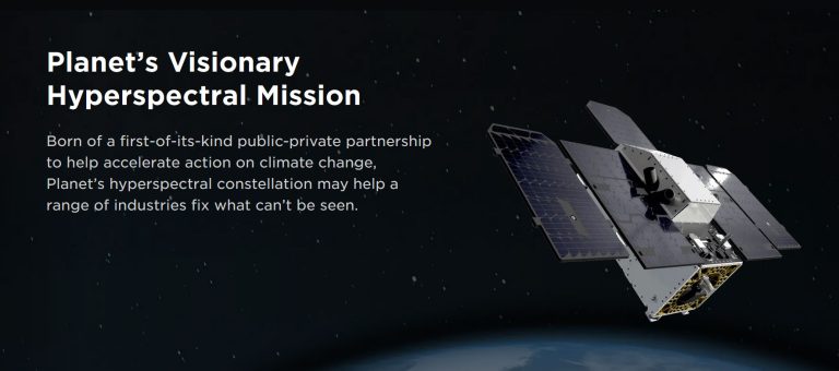
Coming soon to a theater near you. Tanager is Planet’s hyperspectral imaging mission. Imagine splitting light into hundreds of bands for detailed analysis. Hyperspectral imaging is Planet’s vision for the future. But is the geospatial industry at a stage where they can read and analyze this type of data yet?
Maxar
There are lots of exciting developments at Maxar. First, they plan to launch WorldView Legion which has a much larger swath compared to its predecessors. Next, Maxar plans to offer 3D elevation to Esri’s Living Atlas of the World. Finally, Maxar has the capacity for SAR imagery through Umbra. Synthetic aperture radar allows for night and day radar imagery through clouds and smoke.
BlackSky
The emphasis for BlackSky Technology is on AI/ML mapping automation. Namely, Spectra AI is its real-time geospatial intelligence platform. But in terms of satellite innovations, it’s hard to know what they have planned because they don’t document it very well.
Verdict
The future looks bright for both Planet and Maxar. But it’s hard to say what BlackSky has in their plans and we’re left a bit in the dark.
Winner – Planet and Maxar
Summary: BlackSky vs Planet vs Maxar
BlackSky, Maxar, and Planet are key players in the satellite remote sensing industry. Each has its own unique strengths and strategic focuses. In summary, Maxar and Planet are diversifying their satellite imaging capabilities. This will help them cater to a broader range of intelligence and data needs. Whereas BlackSky has positioned itself as a key player in space-based remote sensing analytics.


