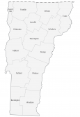
Vermont County Map
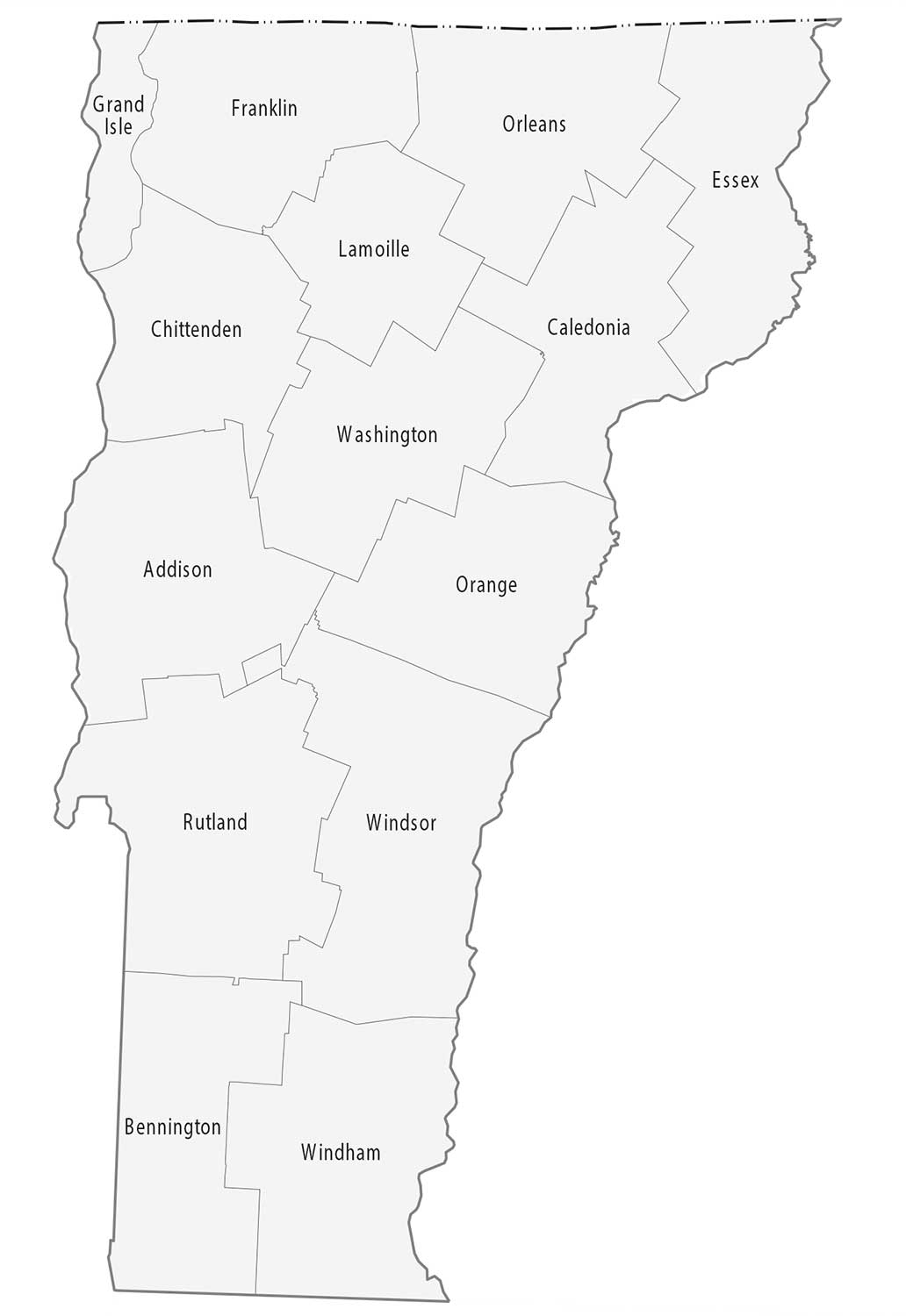
About the map
This Vermont county map displays its 14 counties. Vermont’s tally of 14 counties gives it the 6th least in all of America. Only New Hampshire, Connecticut, Hawaii, Rhode Island, and Delaware have fewer counties than Vermont.
For area, the largest county in Vermont is Windsor County. It occupies close to 1000 square miles on the east side of Vermont. The smallest county in Vermont is Grand Isle County in the northwest of Vermont. Grand Isle County is just under 200 square miles in area.
The most populated county in Vermont is Chittenden County. As of 2019, it has an estimated population of over 163,000 residents. The least populous county in Vermont is Essex County with just over 6,000 people.

You are free to use our county map of Vermont for educational and commercial uses. Attribution is required. How to attribute?
Vermont County List
| FIPS Code | Name | Land (sq mi) | Water (sq mi) | Population (2024) |
|---|---|---|---|---|
| 50-001 | Addison County | 766.3 | 41.4 | 38,047 |
| 50-003 | Bennington County | 675.0 | 2.7 | 37,039 |
| 50-005 | Caledonia County | 649.0 | 8.6 | 30,535 |
| 50-007 | Chittenden County | 536.6 | 82.7 | 170,851 |
| 50-009 | Essex County | 663.6 | 11.1 | 6,037 |
| 50-011 | Franklin County | 634.1 | 58.0 | 51,066 |
| 50-013 | Grand Isle County | 81.8 | 112.9 | 7,528 |
| 50-015 | Lamoille County | 458.9 | 4.9 | 26,248 |
| 50-017 | Orange County | 687.0 | 4.6 | 30,050 |
| 50-019 | Orleans County | 693.6 | 27.6 | 27,726 |
| 50-021 | Rutland County | 929.8 | 15.0 | 60,198 |
| 50-023 | Washington County | 687.0 | 8.2 | 59,844 |
| 50-025 | Windham County | 785.5 | 12.7 | 45,627 |
| 50-027 | Windsor County | 969.6 | 7.5 | 57,697 |