Oregon County Map

About the map
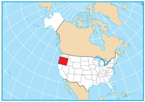
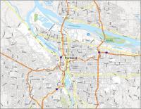
This Oregon county map displays its 36 counties. Oregon shares a border with Washington, Idaho, Nevada, and California and a maritime border with the North Pacific Ocean.

For size, Harney County is the largest and is over 10,000 square miles in area. But its next-door neighbor, Malheur County, is similar in size and is about 9925 square miles in size. Overall, the smallest county in Oregon is Multnomah County which is also under 500 square miles.
The most populous county in Oregon is Multnomah County with over 800,000 people. Conversely, the county with the lowest population is Wheeler County with just under 1,500 residents.
You are free to use our county map of Oregon for educational and commercial uses. Attribution is required. How to attribute?
Oregon County List
| FIPS Code | Name | Land (sq mi) | Water (sq mi) | Population (2024) |
|---|---|---|---|---|
| 41-001 | Baker County | 3068.0 | 20.0 | 16,750 |
| 41-003 | Benton County | 675.2 | 3.0 | 98,899 |
| 41-005 | Clackamas County | 1870.7 | 12.3 | 425,857 |
| 41-007 | Clatsop County | 828.1 | 255.5 | 41,043 |
| 41-009 | Columbia County | 658.1 | 30.9 | 54,063 |
| 41-011 | Coos County | 1596.0 | 210.3 | 64,326 |
| 41-013 | Crook County | 2978.9 | 8.1 | 27,336 |
| 41-015 | Curry County | 1628.4 | 360.9 | 22,774 |
| 41-017 | Deschutes County | 3017.6 | 36.6 | 211,535 |
| 41-019 | Douglas County | 5035.6 | 97.3 | 112,255 |
| 41-021 | Gilliam County | 1204.7 | 18.1 | 1,971 |
| 41-023 | Grant County | 4527.8 | 0.7 | 7,093 |
| 41-025 | Harney County | 10134.4 | 93.3 | 7,402 |
| 41-027 | Hood River County | 522.1 | 11.2 | 23,764 |
| 41-029 | Jackson County | 2783.2 | 18.1 | 221,331 |
| 41-031 | Jefferson County | 1782.2 | 10.1 | 25,536 |
| 41-033 | Josephine County | 1638.6 | 2.2 | 88,276 |
| 41-035 | Klamath County | 5942.7 | 194.5 | 70,438 |
| 41-037 | Lake County | 8138.6 | 219.5 | 8,194 |
| 41-039 | Lane County | 4556.6 | 167.9 | 382,396 |
| 41-041 | Lincoln County | 980.4 | 214.2 | 51,212 |
| 41-043 | Linn County | 2287.1 | 19.4 | 132,474 |
| 41-045 | Malheur County | 9887.7 | 42.1 | 32,315 |
| 41-047 | Marion County | 1180.5 | 10.3 | 352,867 |
| 41-049 | Morrow County | 2030.5 | 17.1 | 12,360 |
| 41-051 | Multnomah County | 431.1 | 34.1 | 795,897 |
| 41-053 | Polk County | 740.9 | 3.1 | 90,549 |
| 41-055 | Sherman County | 823.6 | 7.6 | 2,002 |
| 41-057 | Tillamook County | 1102.4 | 230.0 | 27,264 |
| 41-059 | Umatilla County | 3215.4 | 16.1 | 80,491 |
| 41-061 | Union County | 2036.9 | 1.9 | 26,058 |
| 41-063 | Wallowa County | 3145.9 | 5.5 | 7,522 |
| 41-065 | Wasco County | 2381.1 | 13.8 | 26,507 |
| 41-067 | Washington County | 724.3 | 2.4 | 611,272 |
| 41-069 | Wheeler County | 1716.0 | 0.5 | 1,456 |
| 41-071 | Yamhill County | 715.9 | 2.5 | 110,886 |


“The most populous county in Oregon is Umatilla County with over 800,000 people. Conversely, the county with the lowest population is Lincoln County with just over 1300 residents.”
False. Multnomah County is most populous. Please check your data source.
https://sos.oregon.gov/blue-book/Pages/local/county-population.aspx
Thanks, I fixed it