Map of Tajikistan
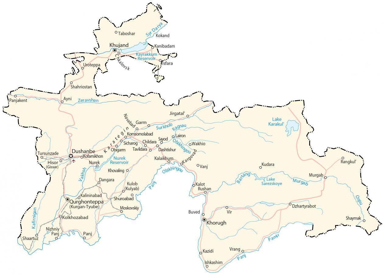
This Tajikistan map collection contains a reference map, satellite imagery, and an elevation. It includes cities, towns, roads, highways, lakes, rivers, and the Alay and the Pamir Mountains.
Tajikistan map collection

You are free to use our Tajikistan map for educational and commercial uses. Attribution is required. How to attribute?
About the map
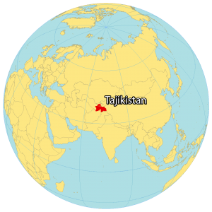
Tajikistan is a landlocked country located in Central Asia within the Alay and Pamir Mountains. It borders Uzbekistan to the west, Kyrgyzstan to the north, China to the east, and Afghanistan to the south. Tajikistan is known for its electrical power, ancient cultural roots, and high mountains.
In fact, the country is nicknamed the “Roof of the World” because of the Pamir Mountains. The capital and largest city of Tajikistan is Dushanbe. Other major cities in the country of Tajikistan are Khujand, Kulob, and Bokhtar.
SATELLITE IMAGERY
Tajikistan Satellite Map
Tajikistan occupies an area of 143,100 square kilometers (55,300 sq mi). Its small size makes it the smallest country in Central Asia. In comparison, it’s close to the same size as Nepal.
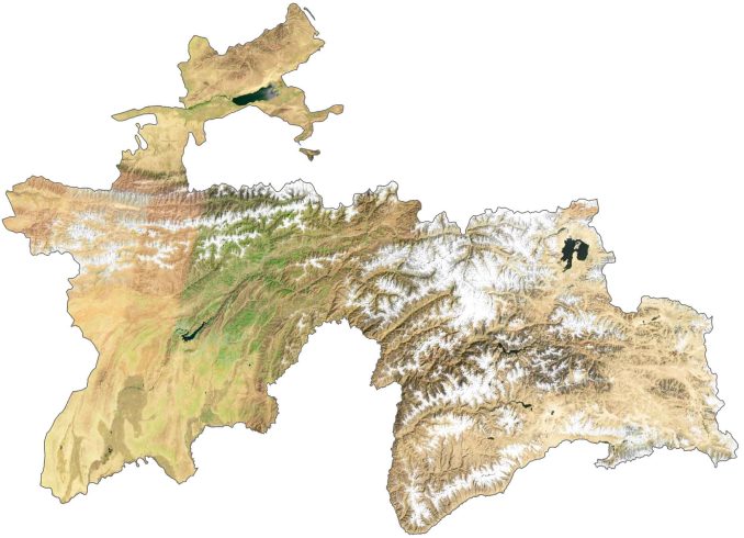
The country lies mostly between latitudes 36° and 41° N so the climate is continental with variations in altitude. Tajikistan has a dense system of rivers with its two largest, the Syr Darya and the Amu Darya. Its largest body of water is Karakul lake, from an impact crater in Tajik National Park.
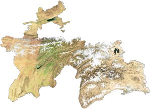
PHYSICAL MAP
Tajikistan Elevation Map
The terrain is mostly mountainous with lowlands in the north. Mountains cover 93% of the country with its two major mountain ranges, the Pamir and Alay. The Alay Mountains run east-west in the northwest of Tajikistan.
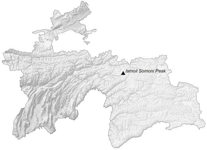
The Pamir Mountains are among the world’s highest and lie in the southeast of Tajikistan. It contains the Ismoil Somoni Peak, which formerly used to be the highest peak of the Soviet Union before Tajikistan claimed its independence. At 7,495 meters (24,590 ft), Ismoil Somoni Peak is the highest peak in Tajikistan.
Capital City
Dushanbe
Major cities
Istaravshan
Khujand
Kulob (Kulyab)
Qurghonteppa (Kurgan-Tyube)
Tursunzoda
Cities, towns and villages
Ayni
Buved
Childara
Chkalovsk
Dangara
Dashtishur
Garm
Hisor
Ishkashim
Jirgatal
Kalaikhum
Kalininabad
Kargovad
Khovaling
Kofarnikhon
Kokand
Komsomolabad
Moskovskiy
Murgab
Navabad
Obigarm
Panjakent
Rangkul
Shaartuz
Shahriostan
Shuroabad
Sicharog
Tavildara
Tursunzade
Uroteppa
Vir
Wakhio
Zafarabad
Lakes, rivers and water features
Bartang River
Kafirnigan River
Kayrakkum Reservoir
Lake Karakul
Lake Sarezkoye
Murgab River
Nurek Reservoir
Obikhingou River
Oqsu River
Pamir River
Panj River
Ragnau River
Surkhob River
Syr Darya River
Vakhsh River
Zeravshan River